The Copse & Hill 70
Beneath the Loos battlefield
A place beneath the battlefield
The workings known as the Copse lie within the Loos battlefield, near Hill 70. Roads, development and the filling of a former quarry have changed the landscape above them. Underground, passages, shafts and mining galleries preserve evidence of underground warfare and the later adaptation of mining passages for infantry use.
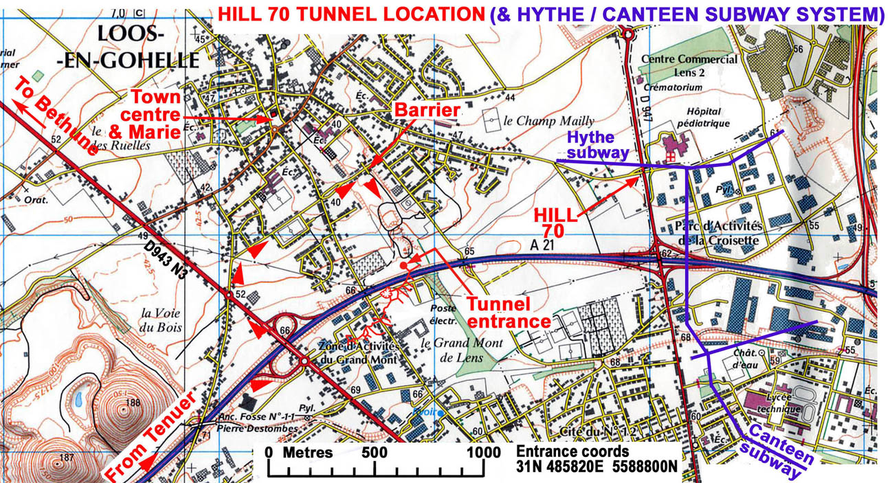
The investigation centred on passages reached through the former quarry area: upper workings adapted for infantry, low mining galleries and shafts descending to a deeper system. The name “Hill 70 tunnels” was also used locally for these passages. The captured German workings discussed below lay farther north-east, while the Group’s explored deep lateral extended west towards the Double Crassier, the twin spoil heaps of the coal-mining landscape. These locations give the project its geographical scope.
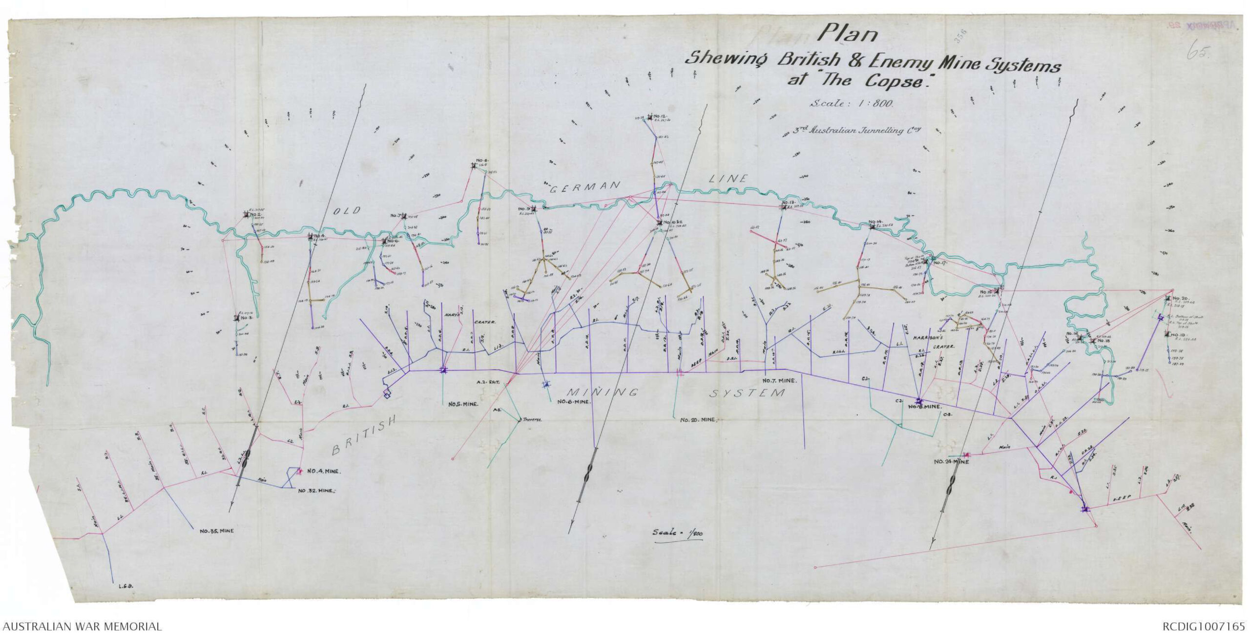
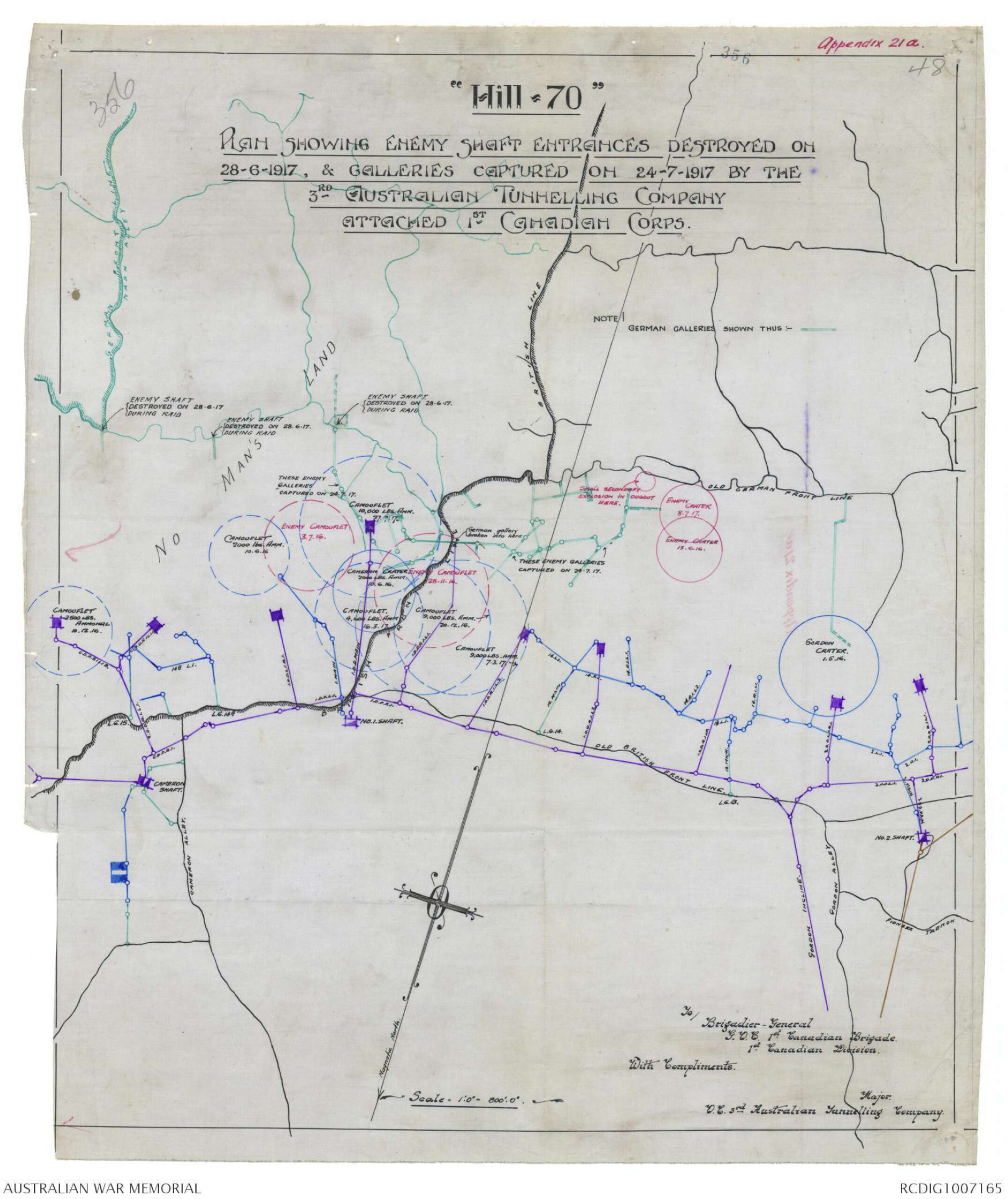
The July 1917 Australian war diary maps the British and German mine systems at the Copse. The Durand Group’s later investigation followed surviving passages, opened access to the deep workings and tested an eastward route towards Hill 70. Rails, ventilation pipes, shafts and inscriptions made it possible to examine how this underground position had been built and used.
From trench fighting to underground warfare
The Battle of Loos in September–October 1915 placed the surrounding ground within a major British offensive. The subsequent struggle produced a close and heavily contested front. At the Copse, the underground remains reflect the needs of mining warfare as well as the movement and accommodation of infantry.
A mining gallery was a passage driven towards an enemy position, often to place an explosive charge beneath it. A subway provided a protected route for troops or supplies. A listening gallery allowed miners to detect enemy digging, while a camouflet was an underground explosion intended to damage opposing workings without necessarily making a surface crater. These purposes could overlap as the front moved and existing passages were adapted.
The 173rd Tunnelling Company, Royal Engineers, was developing the Copse mines in January 1916. Its original diary describes starting No. XI Mine from the end of an old French gallery on 15 January, with No. XII also driven from that gallery. French workings therefore preceded this British development, although their construction date, builders and full extent remain unidentified.
Responsibility changed at different times in the two sectors. The 3rd Australian Tunnelling Company’s November 1916 diary records completion of its relief of the 258th Tunnelling Company at Hill 70 on 12 November 1916. The Copse handover followed on 4 April 1917: the 173rd Company states that the Australians took over its mines there, while the Australian April diary names the 170th Tunnelling Company as the outgoing unit. The date is supported by both accounts; the conflicting unit attribution remains unresolved.
Hill 70 and the changing front
The Australians’ first weeks at Hill 70 involved active mine fighting. On 27 November 1916, a German camouflet destroyed their gallery at No. 21, where an explosive charge had already been installed, killing twenty men. The company’s November diary records rescue work and the recovery of bodies following the enemy explosions. This episode belongs to the Hill 70 mining front, before the Australians took over the Copse; it illustrates the danger of preparing charges while enemy miners worked nearby.
The German withdrawal in April 1917 moved the front away from the Copse and changed the use of its workings. At Hill 70, mining continued alongside operations to enter and destroy enemy galleries. The Australian official history’s account of the 3rd Tunnelling Company at Hill 70 describes the destruction of German shaft entrances on 28 June, penetration of German galleries on 24 July, and a subsequent large camouflet intended to destroy underground connections.
A contemporary plan preserved with the July 1917 war diary distinguishes the shaft entrances destroyed on 28 June from the galleries captured on 24 July. The distinction helps explain why mapped wartime connections need not have survived intact.
Preparation for the Canadian Corps’ attack on Hill 70 on 15 August 1917 also required underground headquarters and accommodation. Under a 1st Canadian Division order of 17 July, the Australian tunnellers worked on several positions with labour supplied by Canadian infantry brigades. Their July diary records completion of the Quarry brigade headquarters on 31 July. This was part of the wider Hill 70 preparations; no connection to the passages explored by the Durand Group has been established.
Underground operations also depended on machinery and a maintained power supply. The Australian Electrical and Mechanical Mining and Boring Company, commonly called the “Alphabet Company”, provided specialist services to tunnelling units. Damien Finlayson’s The Lightning Keepers identifies Loos, Hill 70 and Hythe among its working locations, and places the Loos–Hill 70 engine room beneath the wreckage of Tower Bridge, the prominent pithead structure at Loos. This establishes support within the sector, but does not identify who installed each surviving fitting in the Copse.
Reading the surviving workings
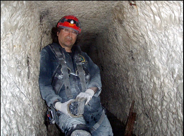
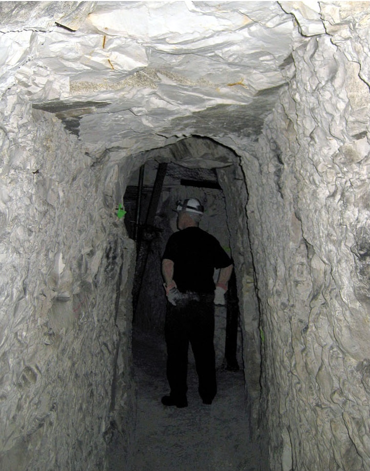
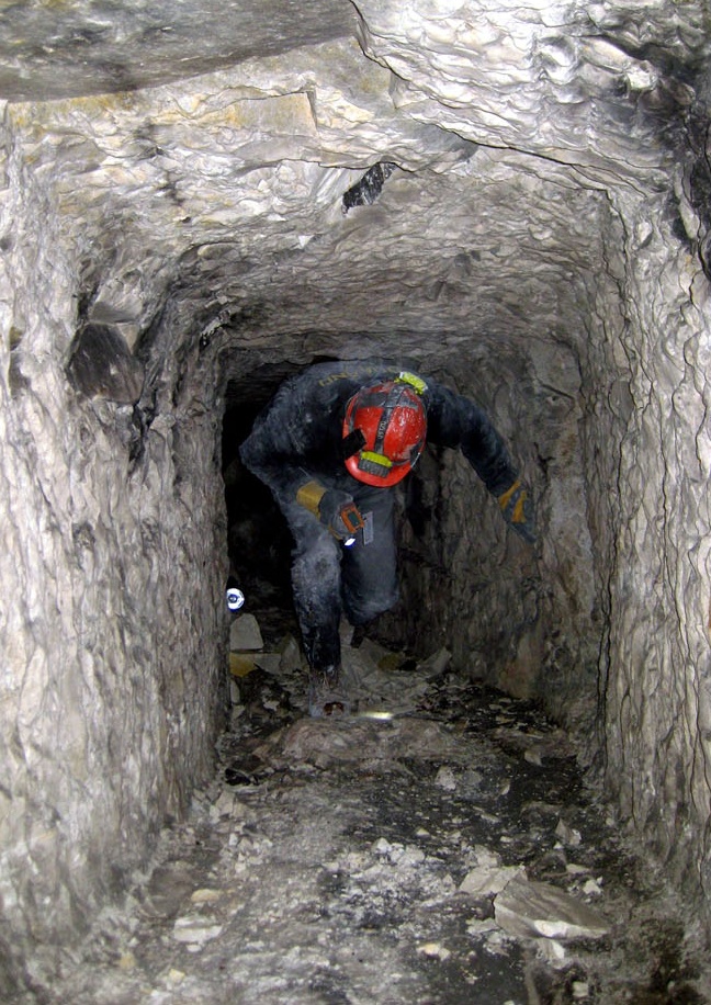
The upper Copse passages show repeated alteration. In the northern section, pick marks, soot and former support positions indicated that the original roof had been raised by approximately 0.5 metres. The Durand Group interpreted this enlargement as adaptation for infantry use. In contrast, much of the southern section retained low passages only about 0.9–1.5 metres high, requiring visitors to crouch or crawl.
Recesses cut for bunks provided accommodation, while a surviving gas-door frame, with concrete sealing between the frame and chalk, marked an attempt to isolate sections against gas. The low passage called “the Link” joined the northern and southern parts examined in 2010. Its construction date was not established. Beyond it, the Group recorded shafts, blocked entrance inclines and passages ending at listening stations.
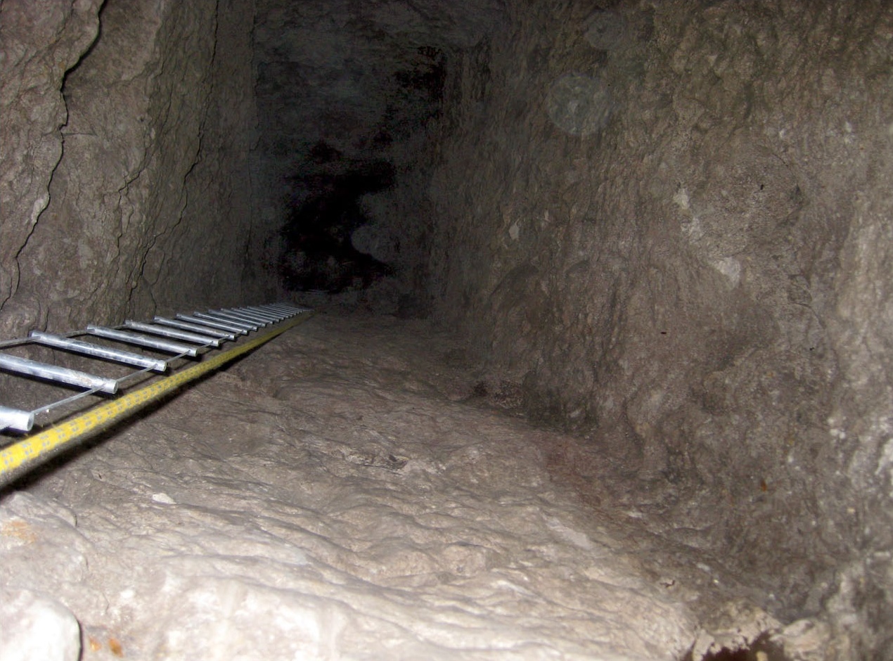
A shaft examined in May 2010 descended approximately 22 metres below the upper tunnel floor. Sockets cut into its sides showed where timber staging or ladder supports had been installed. An intermediate gallery branched from the shaft, while an incline and two small chambers lay above its head. Their arrangement suggested facilities for raising loads and accommodating the miners, but proposed identifications of a winch position or explosives store remain interpretations.
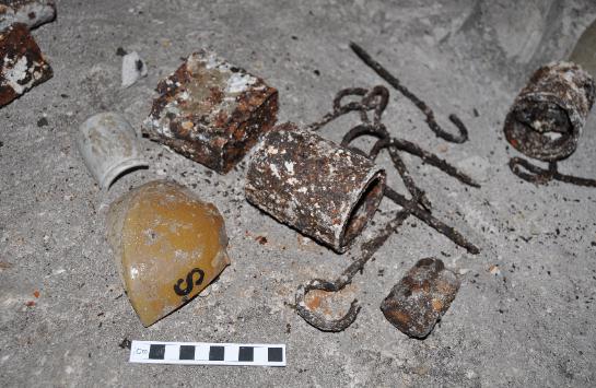
Post-war activity also left its mark. Local volunteers had cleared and supported parts of the upper workings, and the former quarry area was altered for a mushroom-growing enterprise. Some objects displayed underground had previously been gathered by the local association. Their presence was therefore not evidence of an undisturbed wartime deposit at the exact spot where visitors encountered them.
Reconnaissance and a new programme of investigation
Earlier inspections had recognised the passages’ historical interest and the limitations of a site with a single access route. Renewed work followed an invitation from the local Association Sur les Traces de la Grande Guerre. The association supported the Durand Group’s work and provided local knowledge of the passages and their post-war history.
On 13 March and 15 May 2010, the Durand Group examined the accessible upper system, recorded its condition and investigated routes towards deeper workings. The objectives included checking potential alternative access, understanding shafts and galleries, and recording inscriptions. Teams worked in stages, with communication between the underground parties and the surface. Photographs and measured observations provided a record of the accessible passages and a basis for planning further work.
The inspection identified deteriorated supports in the upper workings and a substantial chamber excavated for the former mushroom farm. Its condition mattered because collapse could obstruct the only entrance route. Two blocked inclines offered possible alternative exits, but neither was located from the surface during the reconnaissance. The deeper workings consequently became a separate objective requiring clearance and controlled descent.
Opening the deep system
Between 7 and 13 May 2012, the Durand Group prepared the shaft called Shaft 2 in its working records for clearance. Five platforms, spaced approximately 3 metres apart, were installed with ladders and a pulley hoist. Plywood laid in the approach passages allowed spoil to be moved on a trolley, and a telephone linked the surface to the working area.
Further clearance in autumn 2012 lowered the debris at the shaft bottom. The next major result came on 28 April 2013, when the team broke through into a deep lateral—a main passage running across the system, with subsidiary galleries branching from it. This opened a previously inaccessible level for examination.
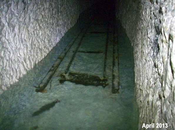
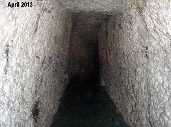
The main passage had a roof height of about 1.8 metres, but water reached approximately 0.9 metres deep in places. The initial reconnaissance followed it east for about 40 metres to another shaft and west for about 250 metres to a substantial obstruction near an incline. Around fourteen southward branches were noted. The time available did not permit their systematic examination.
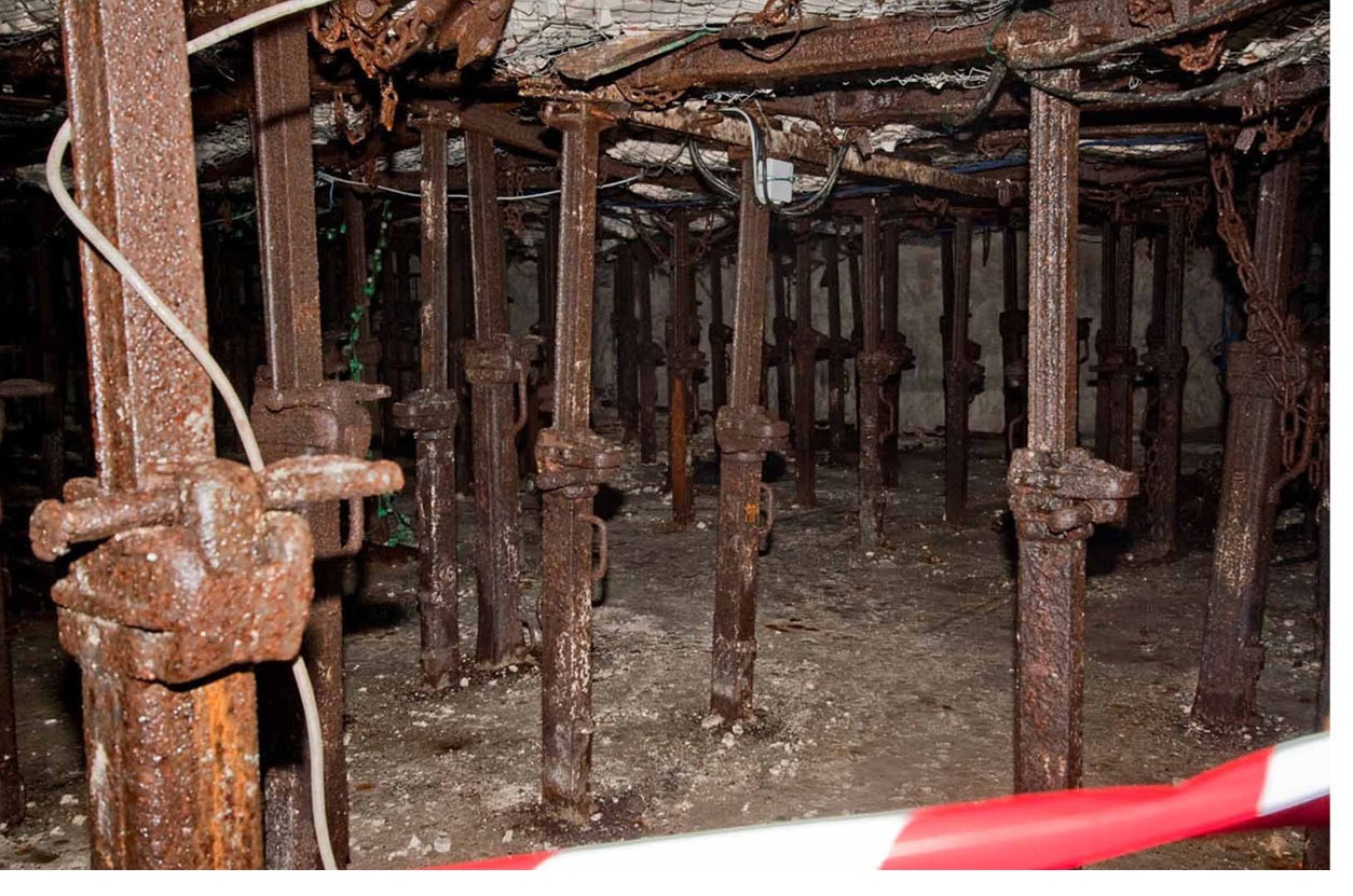
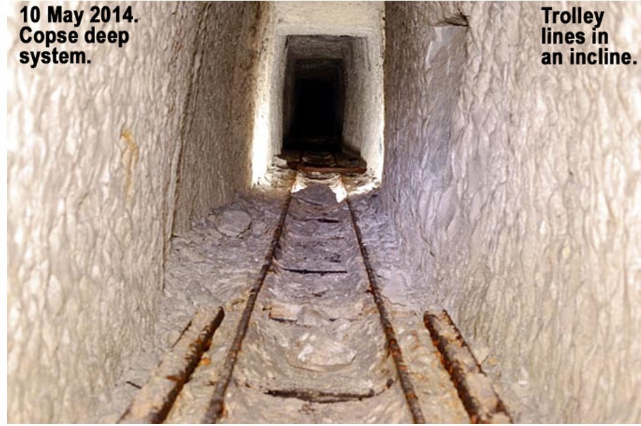
Rails, turntables and ventilation pipes survived in place, revealing the practical organisation of work at depth. The rails and turntables provided a means of moving materials through the workings, while pipes carried air along the passages. Few small artefacts were noted during this initial visit. Beyond the western obstruction, the lateral appeared to continue, but its further extent remained unmeasured.
Water, exploration and a blocked route east
Conditions changed markedly between visits. During the 28–30 March 2014 reconnaissance, water had risen almost to the roof of the deep passage, preventing further exploration. By May, much of it had disappeared. The cause of the flooding remained unresolved: the accounts considered both the level of the water table and accumulated seepage.
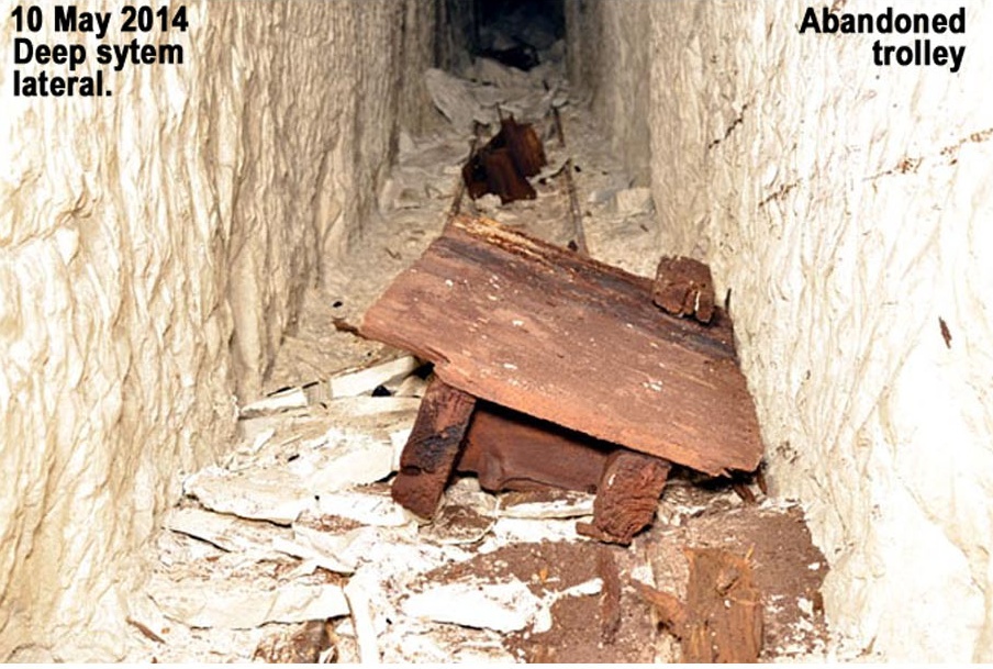
On 10 May 2014, the Durand Group returned to the western deep workings and examined a number of branches and inclines. One incline retained more than 120 metres of railway. An empty camouflet chamber was also found. Other blocked passages were interpreted as possible tamping—the material packed behind a mining charge to contain its force—but their appearance alone did not prove that explosives remained beyond them.
A separate operation sought the eastward route towards Hill 70 beneath the former mushroom-growing chamber. In March, the Durand Group traced drainage pipes in the floor and located a passage for investigation. Excavation continued in May, but after approximately 14 metres a complete collapse prevented further progress. The excavation was abandoned; the suggested connection between this blockage and collapse in the chamber above remained unconfirmed.
The entrance incline and chamber were surveyed during this work, and the plans were corrected. In particular, the revised mapping placed the chamber south of the A21, correcting an earlier impression that it lay beneath the motorway. This illustrates the value of checking historical and inherited plans against measured observation. The eastward excavation did not establish a usable connection into Hill 70.
Names and dates in the chalk
Inscriptions preserve a different record of the workings. The northern passages contained numerous marks described by the reconnaissance team as predominantly Canadian and previously recorded by the Loos Association. The southern passages contained fewer inscriptions, including a South Wales Borderers reference. The recorded names and unit references offer evidence of occupation and visits, but do not by themselves identify the builders or establish when a unit used a particular passage.
Dates recorded in the shaft’s intermediate workings included 17 March 1917, 26 February 1927 and 1 August 1944. Further inscription searches took place in May 2014. On 9 May, the Group located a sought inscription at the western end of the Link while assisting a BBC film crew. Preserving each mark’s wording, position and appearance allows its date and association to be investigated without losing the original context.
Preserving a changing underground record
The Copse investigations documented the relationship between upper passages and deep workings, surviving transport and ventilation fittings, inscriptions and blocked routes. Clearance made new examination possible, while water and collapse limited its extent.
The photographs, measured plans and field accounts preserve conditions observed during those investigations, particularly 2010–14, rather than the site’s present condition. Read with contemporary military records, they allow future researchers to test identifications, reconstruct changing uses and revisit passages that could not be fully examined. Preserving that combined record is especially valuable where deterioration may remove fittings, inscriptions or access to the workings themselves. The Durand Group also prepared portable interpretive displays for the museum of the Association Sur les Traces de la Grande Guerre in Loos-en-Gohelle, extending the use of the investigation record beyond the underground site.
Sources and further reading
- The National Archives, 173 Company Royal Engineers, war diary, WO 95/335/5. Catalogue search for WO 95/335/5.
- Australian War Memorial, 3rd Australian Tunnelling Company, Australian Imperial Force: unit war diaries, AWM4, 16/4. Series catalogue and digitised records. Relevant monthly diaries: November 1916 (AWM4, 16/4/9, RCDIG1007696); April 1917 (AWM4, 16/4/14, RCDIG1007162); and July 1917 (AWM4, 16/4/17, RCDIG1007165).
- C. E. W. Bean, The Australian Imperial Force in France, 1917, Official History of Australia in the War of 1914–1918, Volume IV, Appendix 3, The Work of the 3rd Tunnelling Company at Hill 70, 11th edition, 1941. Digitised appendix, Australian War Memorial.
- Damien Finlayson, Hades’ Henchmen: The Australian Tunnelling Companies and ‘Alphabet Company’, originally published in Stand To!, No. 83, August/September 2008; republished online by the Western Front Association, 23 August 2024.
- Myles Lauchlan Sanderson, Three Aussies and an Englishman: A personal story of family and war, Stand To!, No. 128, October 2022. Family archives and military records inform its account of the Hill 70 mining front; the author also describes joining the Durand Group’s Copse exploration and its separate attempts to reach Hythe. WFA issue contents; full text through the WFA digital archive (member access).
- Damien Finlayson, The Lightning Keepers: The Australian Alphabet Company in the Great War, Stand To!, No. 112, June 2018. For the electrical and mechanical services supporting the Loos and Hill 70 sector. WFA digital archive (member access).
- National Army Museum, Battle of Loos.
- Veterans Affairs Canada, Battle of Hill 70.