O Sector

O Sector

Mining beneath Vimy Ridge

O Sector formed part of the British mining front east of Neuville-Saint-Vaast, towards the southern end of Vimy Ridge. Beneath this ground, earlier French galleries and British fighting tunnels developed into a deep defensive system intended to detect and counter German mining beneath the front line. Its construction belongs chiefly to the underground struggle of 1916, well before the Canadian attack on Vimy Ridge in April 1917. The surviving passages therefore preserve a phase of the ridge’s history that cannot be explained solely through the preparations for that battle. They record the continuing effort to hold ground, listen for enemy work and protect troops above from attack below.

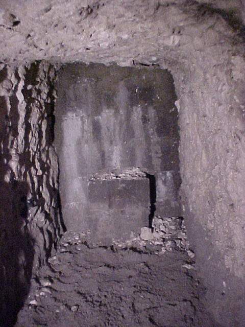
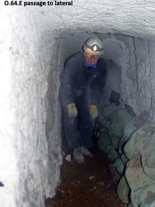
O.64.E passage connecting the incline to the main lateral
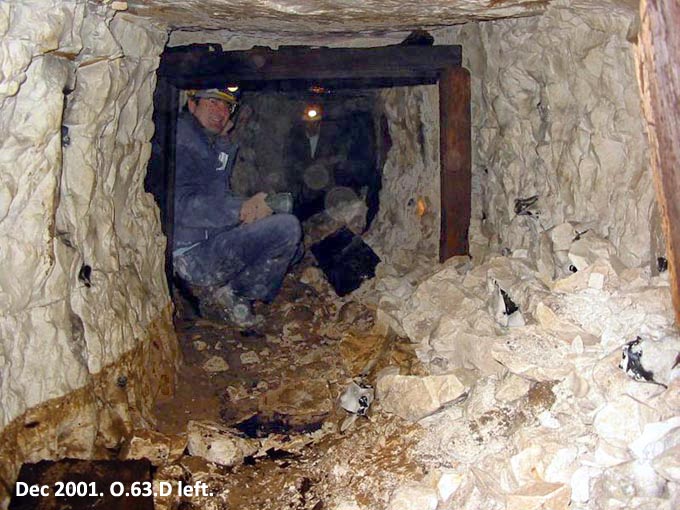
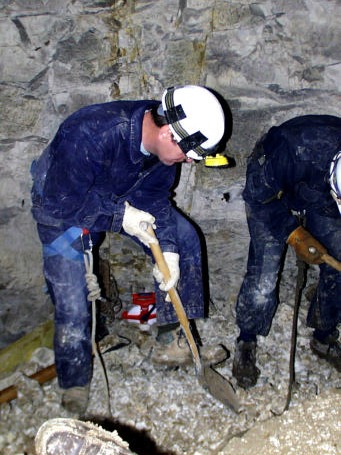
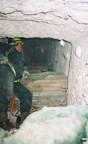
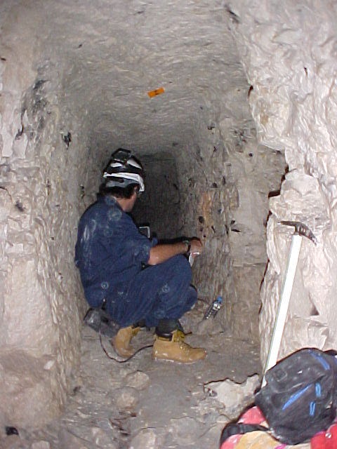
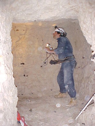
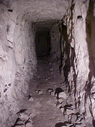
The O.64.E passage leading towards the deep lateral. A member of the Durand Group gives scale to the confined working space.

The northern portion of the system lies beneath the Canadian National Vimy Memorial site, while the wartime sector extended southwards beyond the memorial boundary into surrounding farmland. Investigations by the Durand Group recovered access inclines, haulage equipment, a connecting lateral and numerous fighting galleries, together with inscriptions left by the men who worked underground. These remains allow the engineering plans to be read alongside the physical workings and the tunnellers’ own marks. Their position within the memorial grounds preserves only part of a mining landscape that once extended across the British front.

Colour overview of northern O Sector, showing trench lines, mine craters and galleries at different depths, with the O.64.E access circled in amber.
Durand Group composite plan of northern O Sector, showing trench lines, crater positions and galleries coloured by depth. The O.64.E access is circled in amber; the highlight and explanatory note are modern additions.

From French galleries to a British defensive system

The British inherited an established mining front when they took over this part of Vimy Ridge from the French. O.65.C began as a gallery excavated by the French engineer company M/6. The 175 Tunnelling Company war diary records the transfer of O.65.A, O.65.C and O.65.T from M/6 at midnight on 5/6 May 1916. The length of O.65.C at the handover is not established, so its later extent cannot be attributed wholly to the French miners.

The company’s journal des marches et opérations records its continued service during this transition. M/6 was a territorial engineer company of the 4th Engineer Regiment, with earlier diary entries recording mining work in Belgium in 1915. On 3 March 1916, following the relief of French troops, it was assigned to mining work under the British Third Army. The change in responsibility for the front therefore included a period in which French engineers continued underground work within British arrangements.

On 11 March 1916, M/6 moved to Mareuil and recorded front-line mining ahead of Neuville-Saint-Vaast, with its platoons alternating at four-day intervals. The first platoon began work at 5 am on 12 March. Entries record the company drawing supplies through the British 14th Division on 4 March and the 51st Division on 17 March. Its departure came on 7 May 1916, when it left the British Third Army and its Mareuil billets at noon, travelling by rail from Aubigny and reaching Ailly-sur-Noye the following morning. Read alongside the British diary’s handover of O.65.A, O.65.C and O.65.T at midnight on 5/6 May, this distinguishes the transfer of individual workings from the subsequent departure of the French company. The French entries establish the company’s activity in the area, but do not identify O.65.C by that designation or establish its extent.

Part of this earlier French work remained recognisable during the Group’s survey. The passage rising towards the original O.65.C entrance measured approximately 1.5 metres wide and 1.5 metres high, noticeably larger than the narrower galleries beyond it. This larger approach was identified as part of the original French workings. The surviving layout therefore preserved successive phases of construction: an earlier approach from the trench line, the offensive gallery continued by the British, and a connection with the deeper lateral developed subsequently. The date and original arrangement of that connection remain uncertain.

The broader transition also involved 182 Tunnelling Company, which took over existing French galleries in the sector in April 1916 and developed shallow offensive workings before handing workings to 175 Company in May. The 175 Company diary records the transfer of the O.63 and O.64 saps from 182 Company at noon on 5 May 1916, together with three officers and 150 other ranks. O.65.C’s specifically recorded handover from M/6 shows that the change was a sequence of transfers and continued construction across individual workings. These higher-level galleries preceded the deep defensive network described below. The designation O Sector referred to an area of mining responsibility rather than a single tunnel or a subway built for infantry movement.

Work on the deep system began under 175 Tunnelling Company in June 1916 and continued under 172 Tunnelling Company later that year. By December, the network was largely complete. A principal lateral ran broadly parallel to the front line for approximately 3,600 feet, or 1.1 kilometres, at a recorded depth of 60–80 feet, roughly 18–24 metres. Nine inclines provided access from the support line and communication trenches, while forward galleries extended beneath no man’s land towards the German positions. Depth and layout gave the tunnellers a defensive position from which to listen, investigate enemy approaches and prepare countermining operations.

Contemporary plans show successive stages of this development rather than one fixed arrangement. The plan corrected to 25 October 1916, preserved under National Archives reference WO 153/41, shows northern and southern works before their connection was complete. Other drawings include July plans, a late-November tracing and Captain John Warnock’s personal plan from late 1916 or early 1917. Differences between these records are part of the construction history: a passage shown on one drawing may have been proposed, unfinished or altered by the time another was prepared. The modern survey records the passages actually reached during investigation and should be read alongside these wartime drawings.

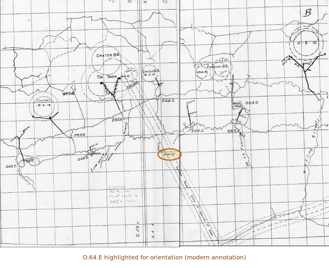
The end-of-July 1916 plan below places these workings among the named craters and the communication trenches that served the front. Chassery and Craters B4, B5 and B6 help orient the reader, while the sunken road provides another reference across the sector. The highlighted O.64.E label connects this wartime geography with the access used in the Group’s investigation. The map records an evolving mining front: the arrangement of shallow workings, access points and developing defensive galleries changed during construction. Comparing it with the surveyed plans helps distinguish the wartime positions and names from the passages that the Group subsequently reached and measured.
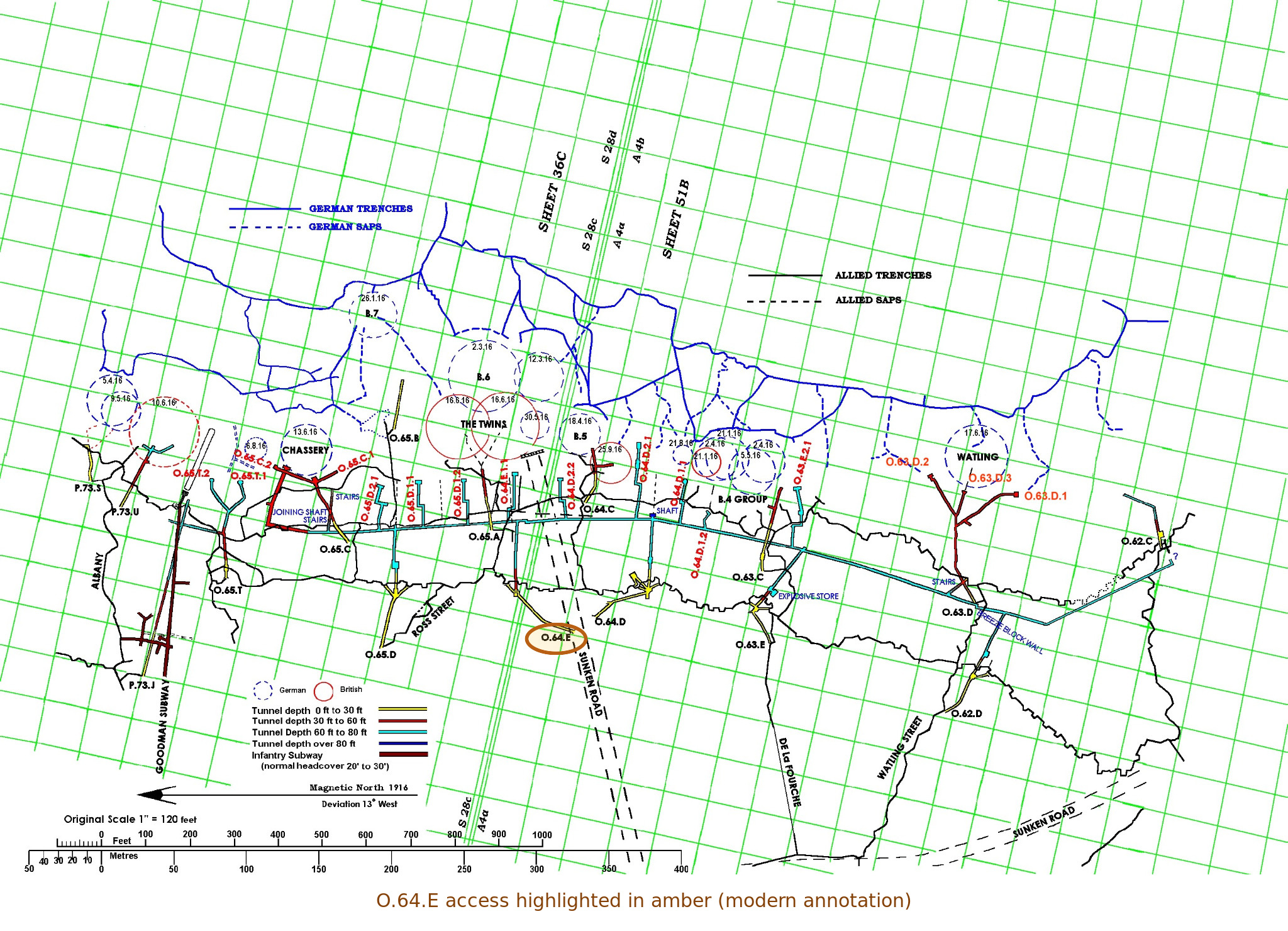
Historical map of O Sector at the end of July 1916, showing crater fields, trenches and mining workings, with the original O.64.E label circled in amber.
175 Tunnelling Company RE map of O Sector, end of July 1916. O.64.E is highlighted with a modern coloured ring.

Mining beneath an active front

The higher galleries were exposed to the effects of nearby German explosions while the deeper defensive works were being developed. On 13 June 1916, a German mine was fired near Chassery at 4.20 pm, without recorded damage to O.65.C. The British plan dated 5 July 1916 places construction of C.1 between 13 and 28 June and C.2 between 13 June and 5 July. Their development on either side of Chassery crater shows how the inherited O.65.C working was extended in response to the changing mining front. Another explosion near Watling on 17 June, at 6 pm and approximately 50 yards from the observation line, caused little damage to the galleries. These dated events show that O Sector was already an active mining battlefield in the summer of 1916.

Listening shaped the pace of this work. The 175 Company diary records that all work stopped for 24 hours, from 3 pm on 26 June to 3 pm on 27 June 1916, for listening tests. Such pauses allowed the tunnellers to listen for enemy activity without the interference of their own excavation.

A 175 Company diary entry records that on 6 August 1916, gas entered O.65.C and O.65.T after an enemy explosion. Cracks opened and the ground heaved, although the leads to the charge in C.2 were reported undamaged; gas remained a problem in O.65.C. On 10 January 1917, the 172 Company diary recorded a German mine fired beneath Chassery at 7.15 pm, damaging O.65.C without casualties. These dated accounts help explain the damaged and obstructed passages encountered during later exploration. The higher galleries were affected by successive mining operations.

Reopening O.64.E

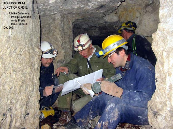
The modern investigation centred on the northern access through O.64.E. Earlier attempts to enter the system had encountered clay and collapsed ground, and the work was overshadowed by the death of Mike Watkins during the 1998 access investigation. The subsequent programme proceeded through staged clearance and recording. A weather-related opening in May 2000 allowed renewed work; the stairway was cleared in September 2000, part of the winch chamber in June 2001 and the incline in November. Access to the deep lateral was finally achieved in December 2001, followed by further survey and recording in May and September 2002 and July 2003.

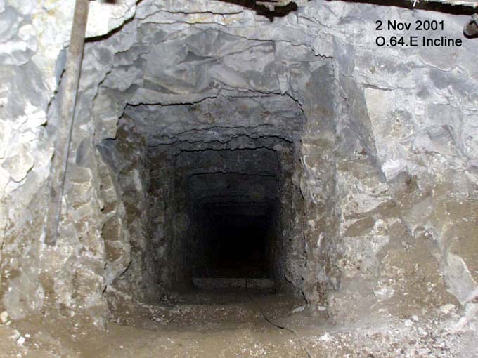
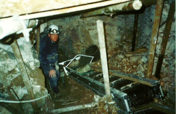
At the head of the incline, the winch chamber retained evidence of the arrangements used to move spoil between the deep workings and the surface. A roof channel and raised platform helped establish the position of the mechanism, although the complete wartime installation had not survived intact. Recovered components included the winch drum and handles, together with bogie parts and rubber wheels. Decay had removed much of the wood while leaving metal fittings comparatively well preserved. The surviving parts, chamber form and incline together support a reconstruction of mechanical haulage, including the movement of spoil carried in sandbags on a trolley.

The incline led down to a connecting passage approximately 34 metres long, recorded as about five feet high and three feet wide, reaching the lateral at a depth of roughly 80 feet. A slight change of direction interrupted the otherwise straightforward route, while candle marks and soot preserved traces of working illumination. These details describe a practical access system used repeatedly by men and equipment, rather than an isolated exploratory shaft. They also explain why the entrance, chamber and connecting passage must be considered together when interpreting the recovered winch components.

The main lateral and its limits

The accessible main lateral was surveyed over 466.5 metres, only part of the much longer wartime network. Typical dimensions were approximately 1.4 metres high and 0.9 metres wide, sufficient for underground work but restrictive for modern investigation and photography. Sleeper positions at intervals of about 90 centimetres preserved evidence of the trolleyway. Timber had been removed in places, and two collapsed gas doors marked former divisions within the system. A northern extension remained unfinished; its intended relationship with P Sector cannot be treated as an established traversable connection.

Southwards, a modern breeze-block wall cemented into place obstructed the main lateral approximately 15 metres before its junction with the O.62.D incline gallery. This was a deliberate blockage associated with construction of the A26 motorway. The road builders had apparently entered through O.63.D and surveyed the deeper passages. Concrete powder near the wall suggested that the tunnel beneath the road had been enclosed between blocking walls and filled with concrete. The wall prevented onward access to the southern section of O Sector. Only the northern third of the mapped wartime system lay beneath the memorial grounds, with three of the nine access inclines within that estate; the surveyed passages therefore represented only part of the wider network.

Modern cemented breeze-block wall obstructing the chalk-cut main lateral of O Sector.
The blocking wall in the main lateral, associated with construction of the A26 motorway, prevented onward access to the southern workings.

Access branches, stores and rescue provision

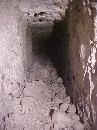
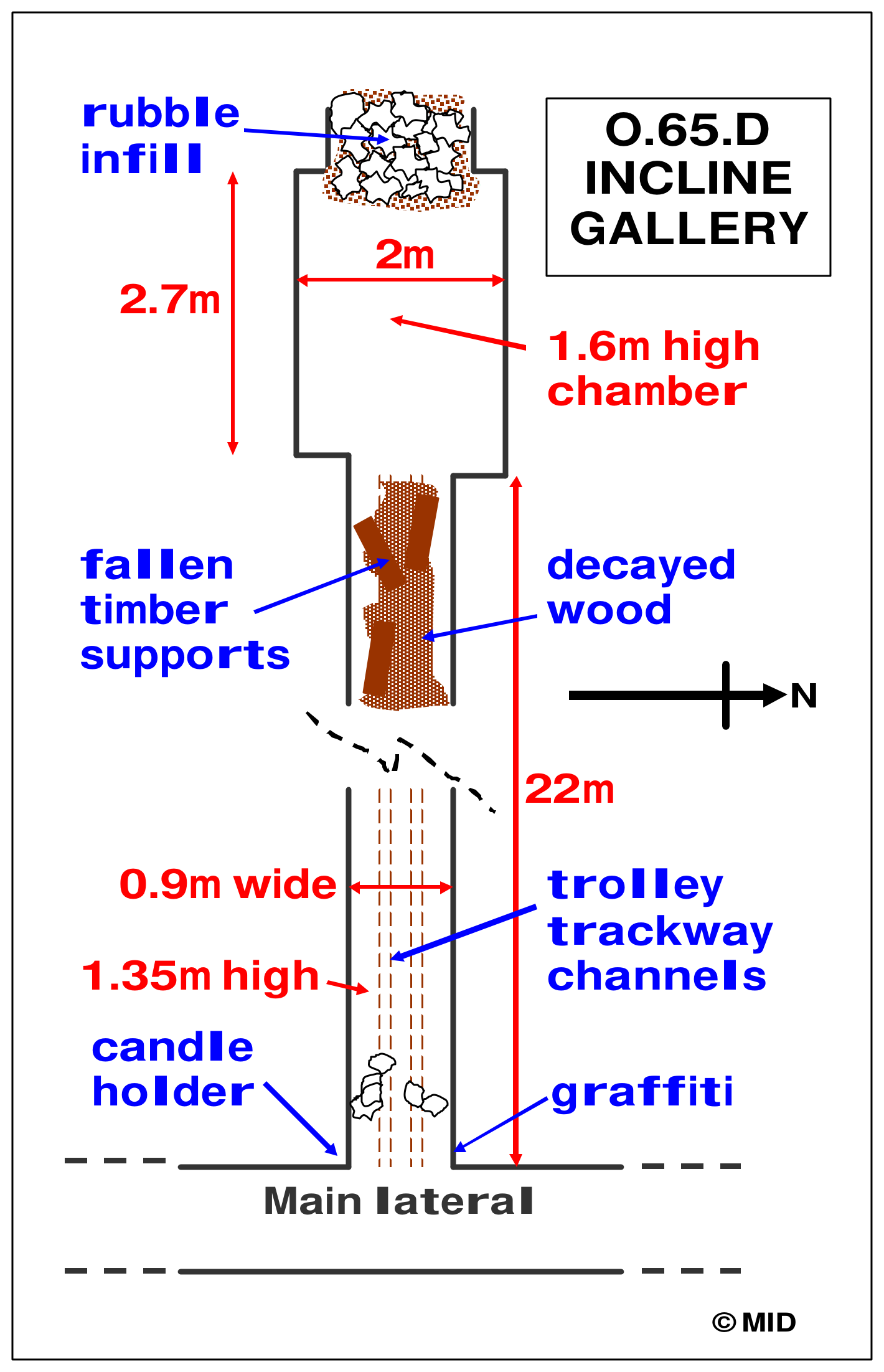
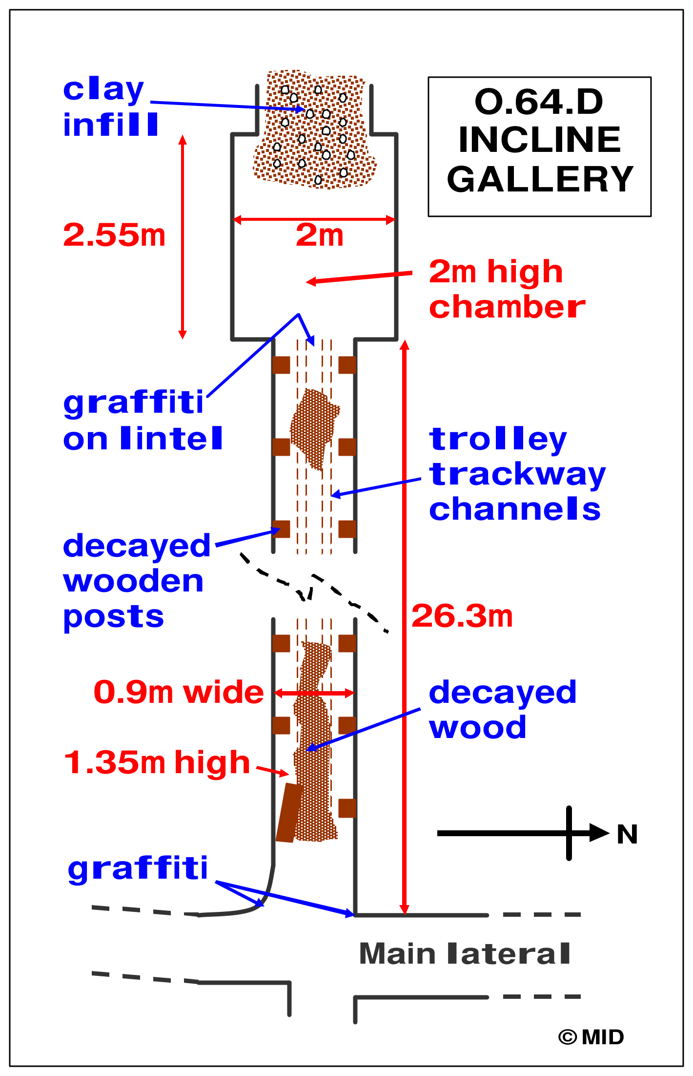
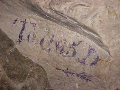
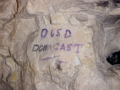
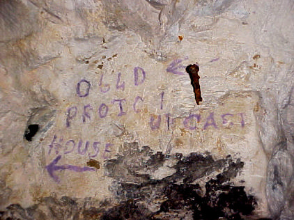
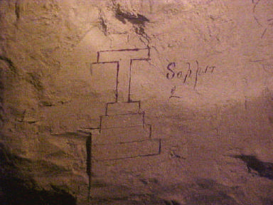
The branches from the lateral preserved different parts of the underground working environment. At O.65.D, collapsed chalk and timber obstructed an access chamber approximately 2.7 metres long and 1.6 metres high. An inscription naming Sapper A. Kins survived nearby, together with the directional word “Downcast”. At O.64.D, a 26.3-metre passage led towards an incline blocked by clay; “Upcast” and “Proto House” were marked on the wall. The latter wording connects the area with the terminology of breathing apparatus and rescue provision, although the inscription alone does not establish what equipment was stored there or reconstruct the complete ventilation system.

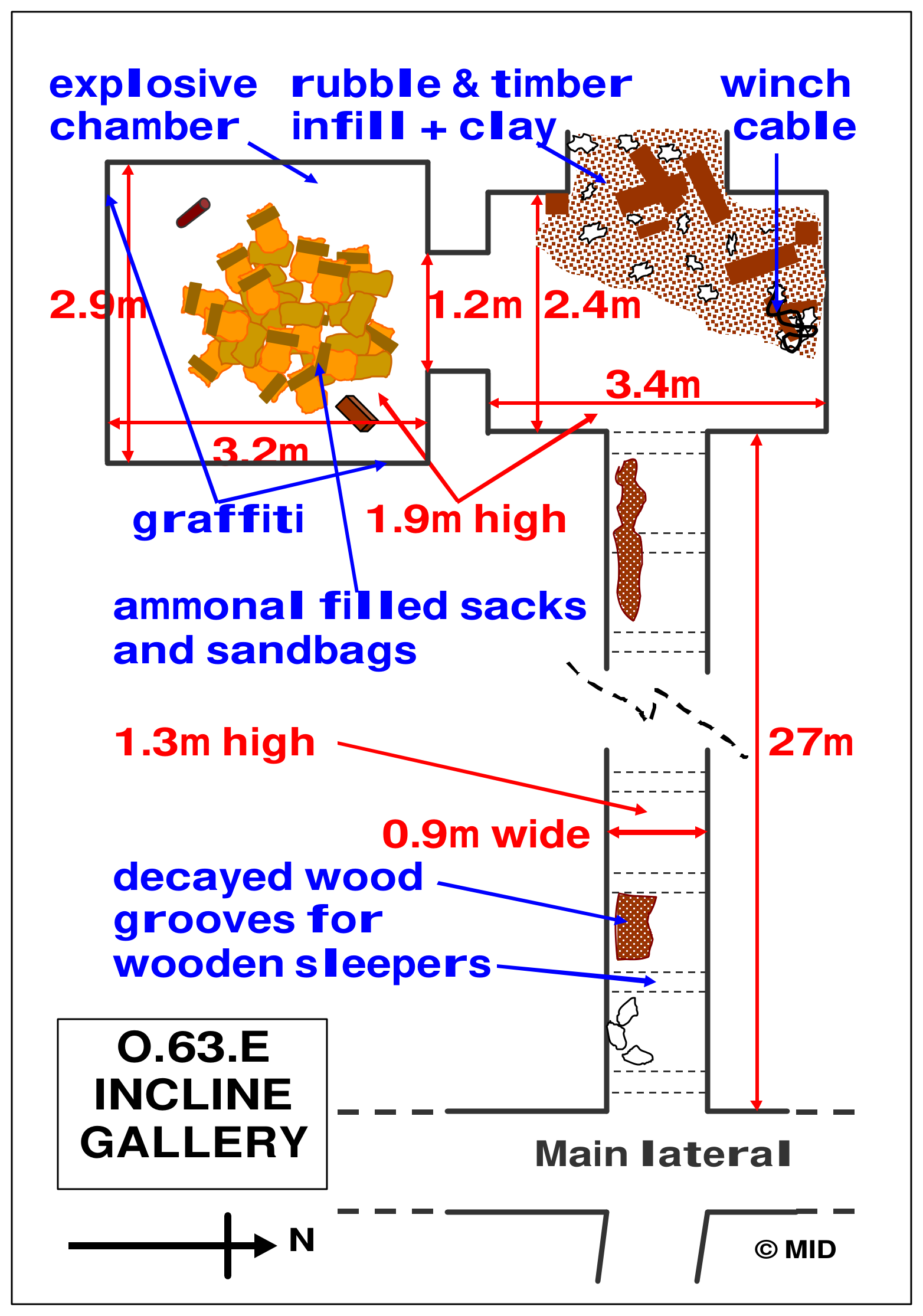
A store at O.63.E contained one of the most significant groups of surviving material. In a chamber approximately 2.9 metres long, 3.2 metres wide and 1.9 metres high, investigators recorded around 50 bags of loose ammonal, shoulder bags and an empty casing for a portable 30-pound charge. Analysis during the investigation showed that the explosive material remained viable. Newspaper recovered from the chamber included the Toronto Sunday World dated 11 March 1917, subsequently lodged with Veterans Affairs Canada in Ottawa. The store brought together supplies, explosive handling and an independently dated object within the same archaeological setting.

Tunnel interiors and fieldwork

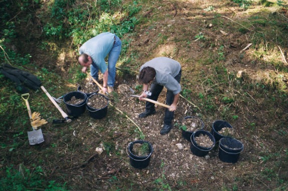
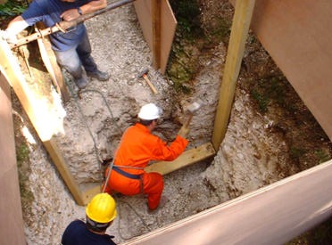
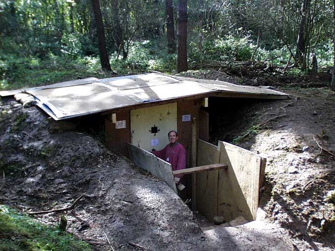
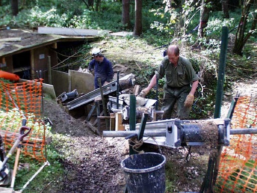
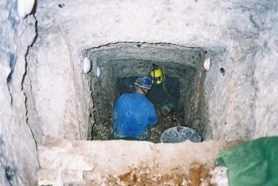
The fieldwork photographs trace the practical stages of reopening rather than a single breakthrough. Hand excavation followed the buried trench staircase, while timber supports and bracing protected the developing pit. A roofed structure, known as the Hobbit House, secured the opening at the end of the September 2000 work. Beneath it, the winch chamber required further clearance before the steep incline could be opened. Protective scaffolding and a miniveyor conveyor system allowed chalk and soil to be carried upwards; close to the blockage, confined working space still required material to be shovelled and bucketed by hand. In December 2001, timber and sandbag retaining walls stabilised the remaining debris as the passage into the deep system was enlarged.

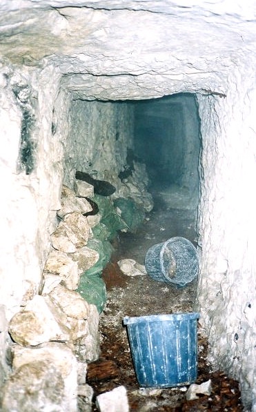
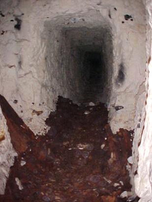
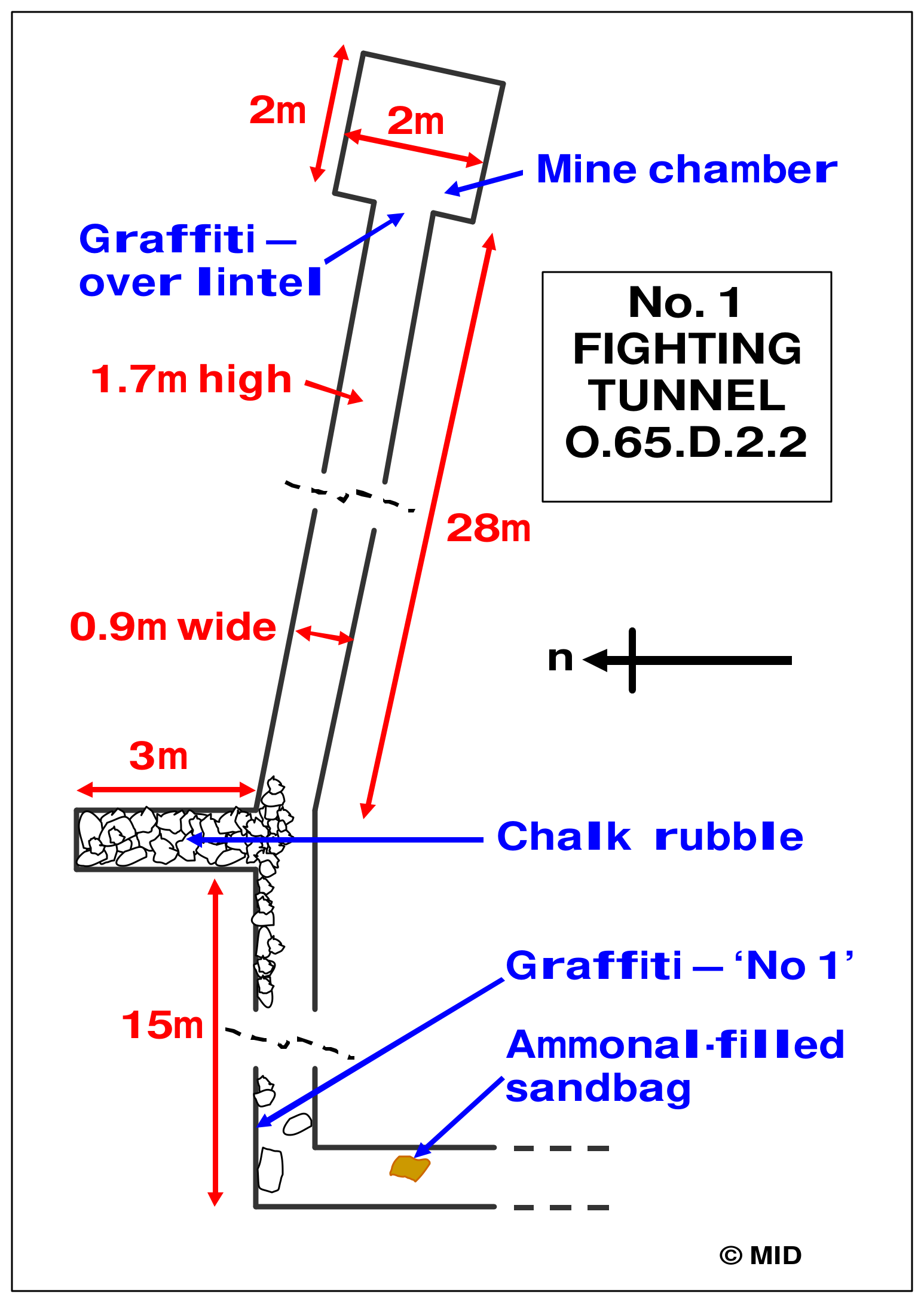
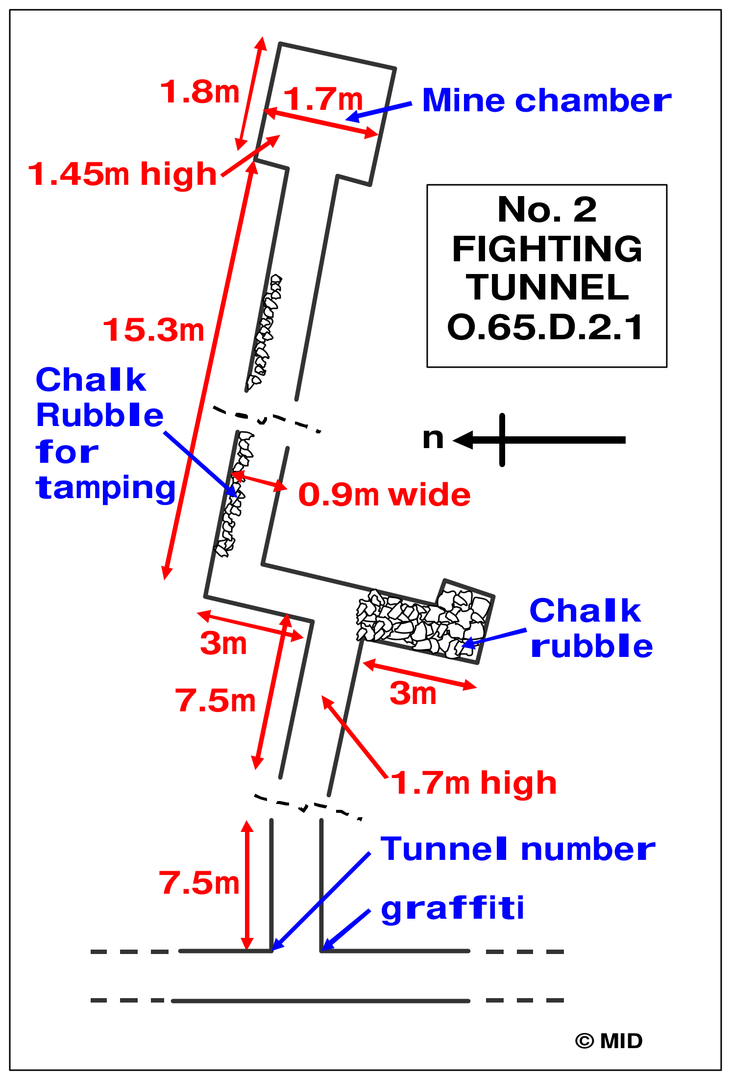
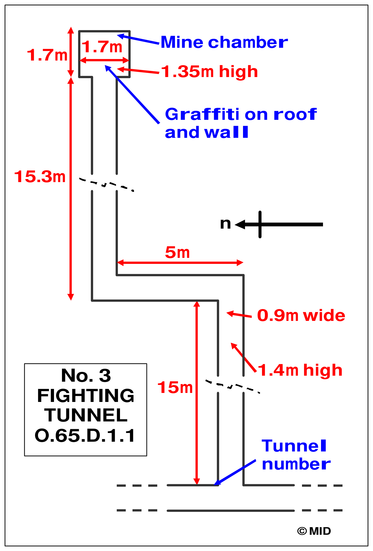
The interior photographs also separate wartime traces from material moved during excavation. Chalk stacked beside the O.64.E passage was placed there by the Group during clearance and subsequently used in retaining walls. In No. 1 fighting tunnel, chalk stacked along the drive was interpreted as material prepared for tamping a mine charge. Recesses for sleepers record former haulage arrangements where the wood itself had disappeared, while decayed timbers and a floor sump mark the remains interpreted as a gas door. The No. 1 mine chamber measured approximately two metres wide, deep and high, providing more room than the narrow passage leading to it.

Ten fighting tunnels

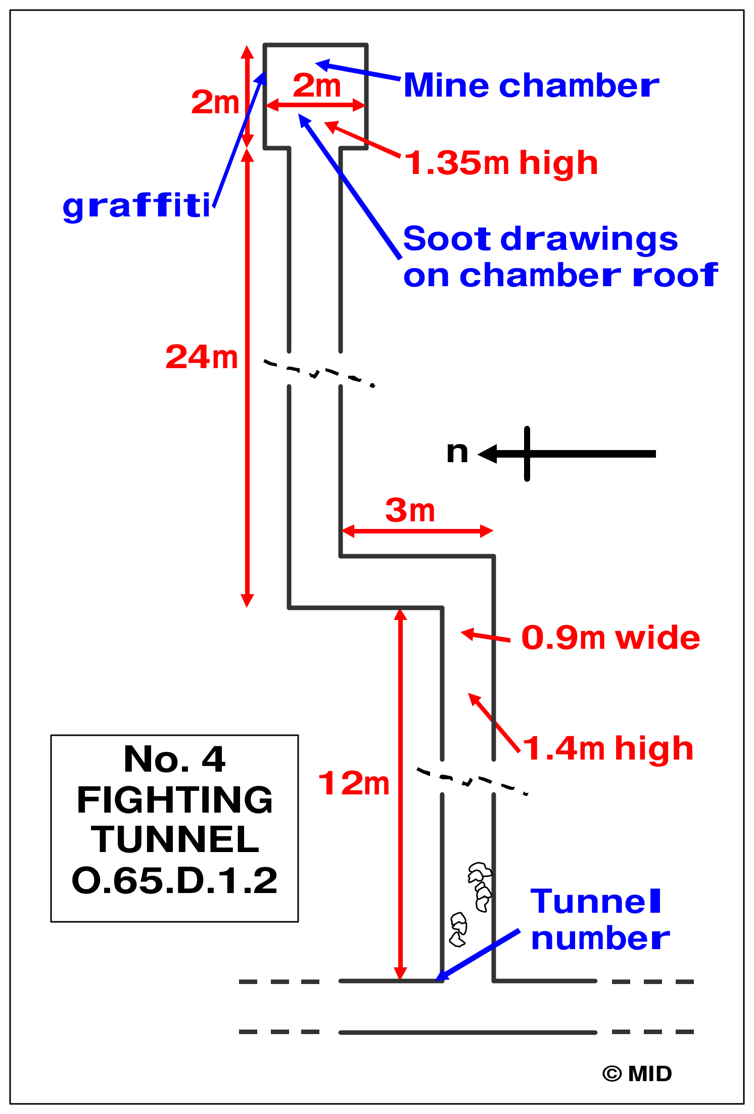
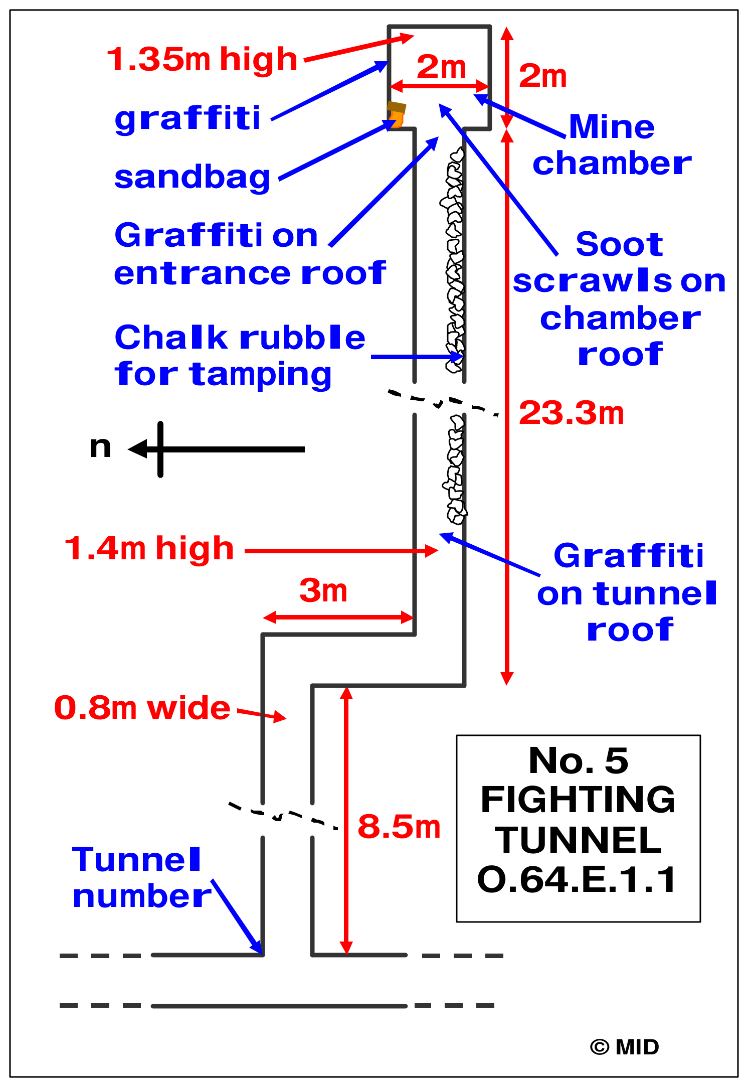
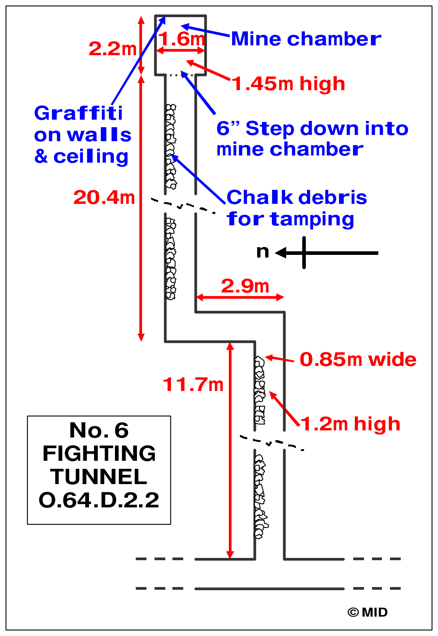
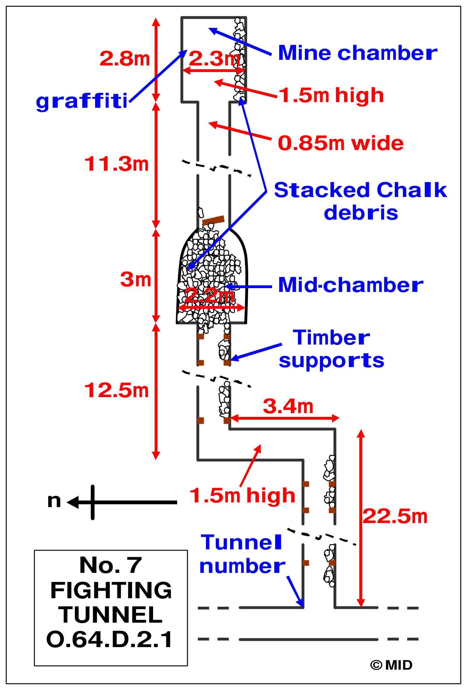
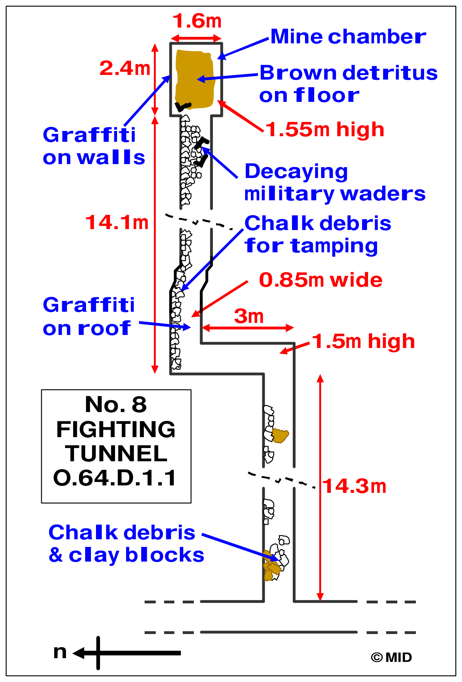
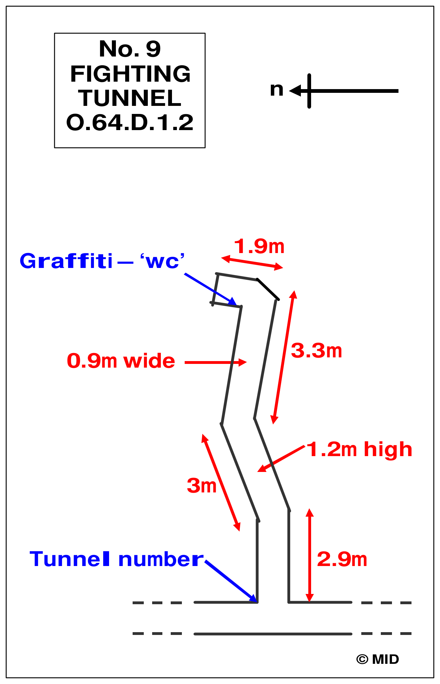
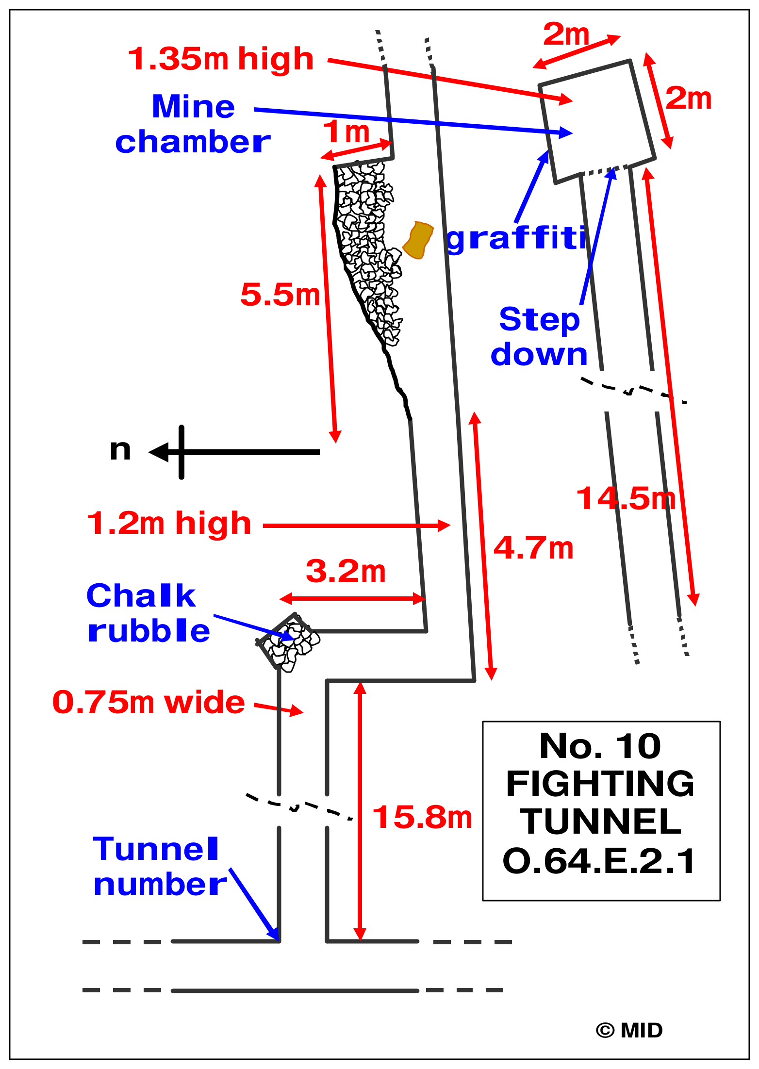
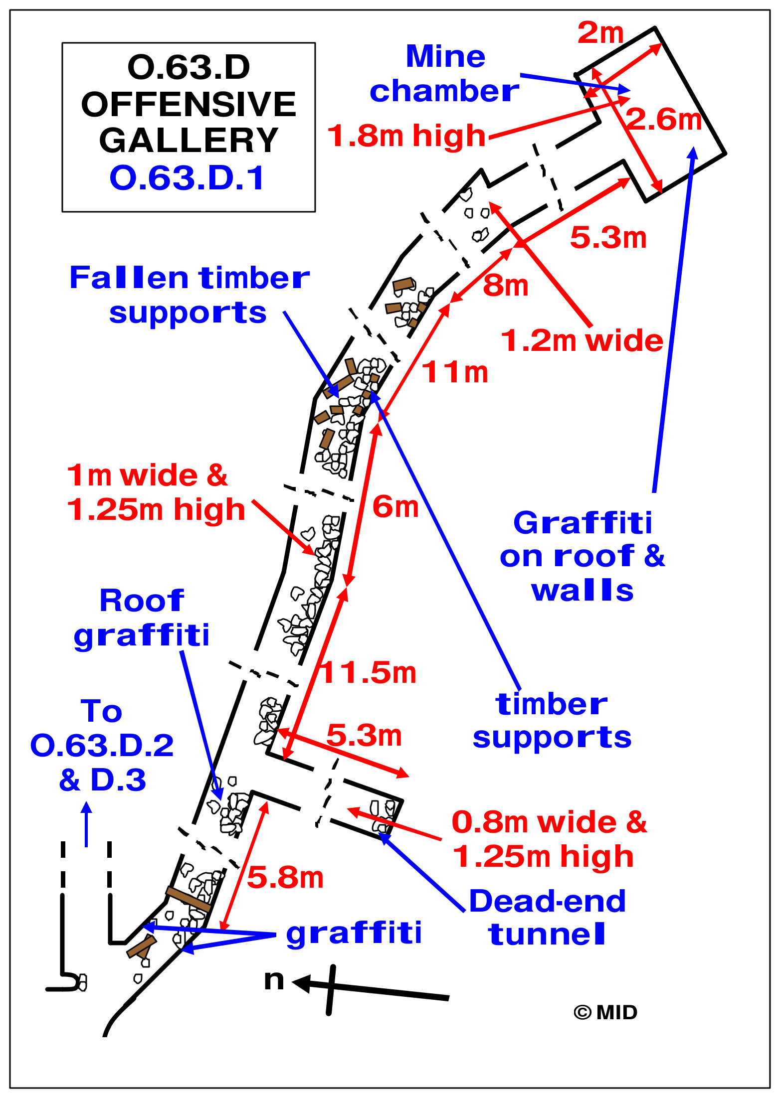
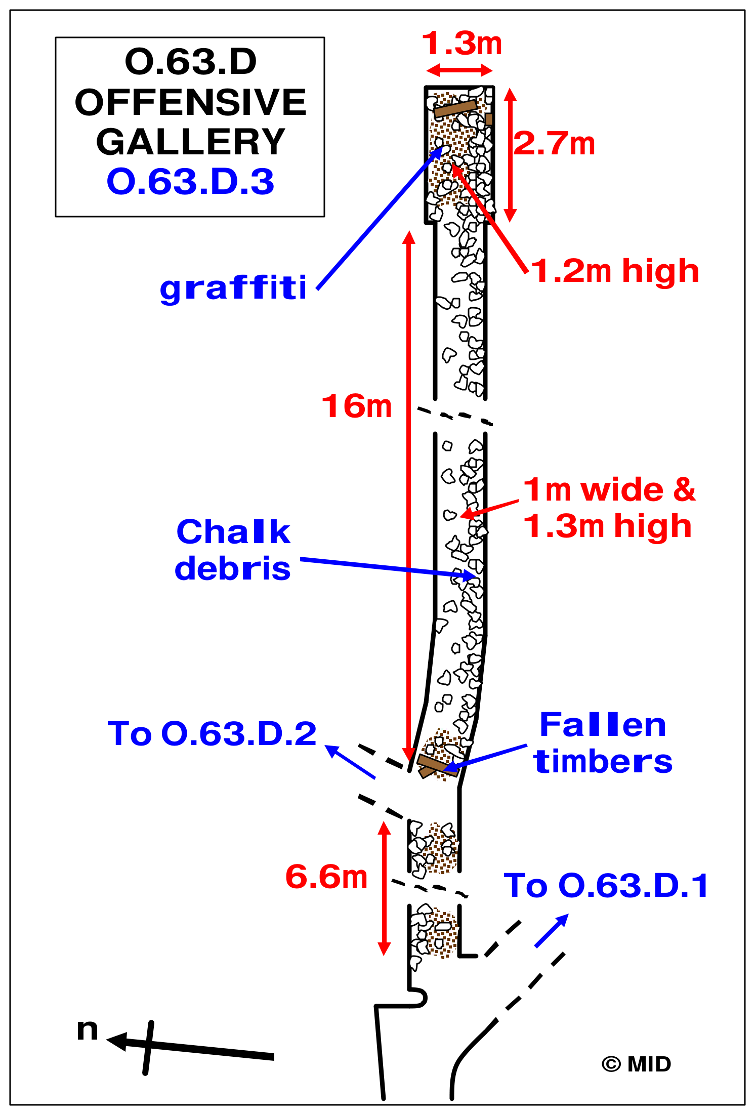
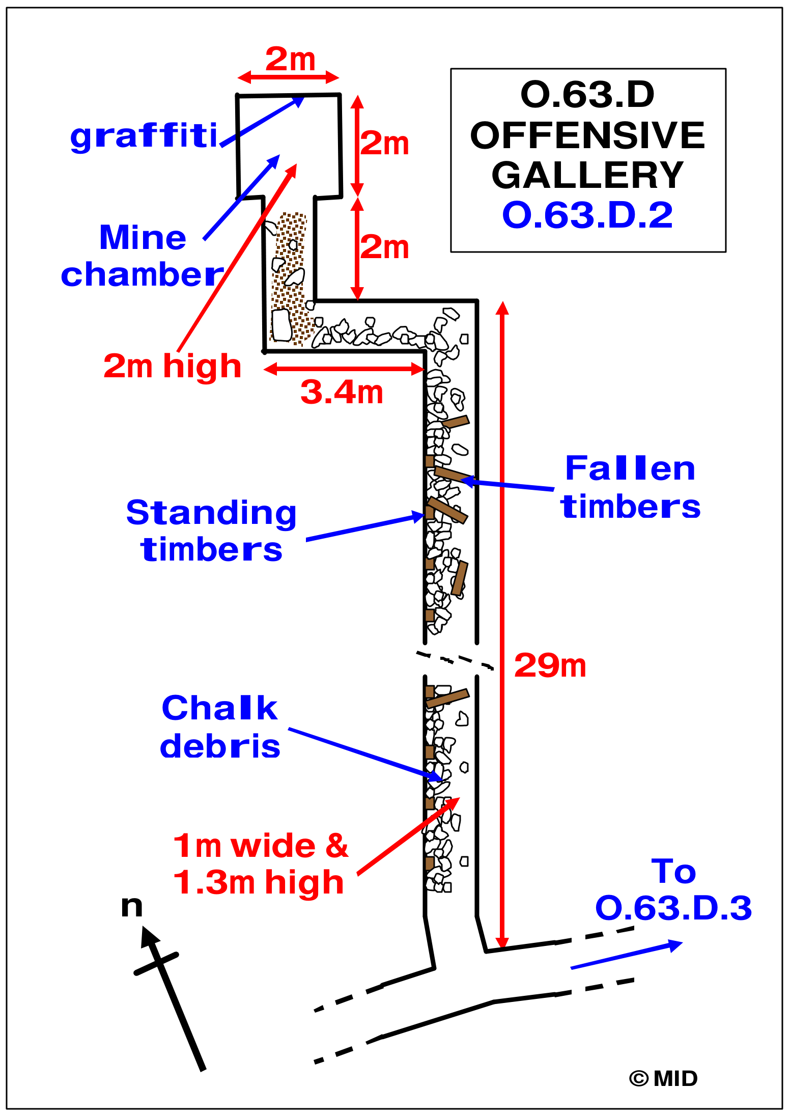
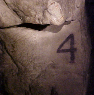
Ten forward workings were recorded from the accessible lateral. Their modern numbering provides a convenient way to follow the survey, while the original identifiers preserve their relationship with the wartime system. The dimensions, chamber forms, spoil deposits and inscriptions vary considerably, so the tunnels should not be presented as identical units. Some reached prepared chambers, others preserved backfilled or obstructed branches, and at least one remained a short unfinished drive. Their plans show how much can be learned from features that are difficult to appreciate in a photograph taken within a narrow passage.

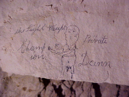
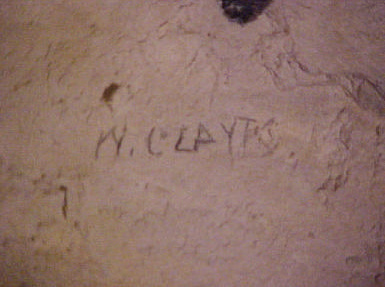
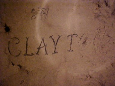
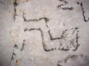
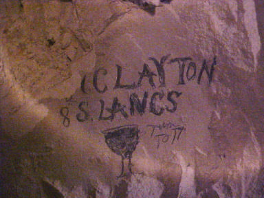
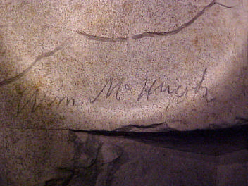
Nos 1–4 lay in the O.65.D group. No. 1, O.65.D.2.2, reached a chamber approximately two metres square and two metres high, with an inscription referring to Private Dann as a boxer and a side gallery filled with chalk. No. 2, O.65.D.2.1, had a smaller chamber, about 1.8 by 1.7 metres and 1.45 metres high, and contained chalk tamping. No. 3, O.65.D.1.1, was a narrower passage retaining soot marks and a tunnel plan. In No. 4, O.65.D.1.2, a chamber about two metres square preserved drawings associated with W. Clayton. Together these workings record both preparation for mining and the men’s use of the available wall surfaces.

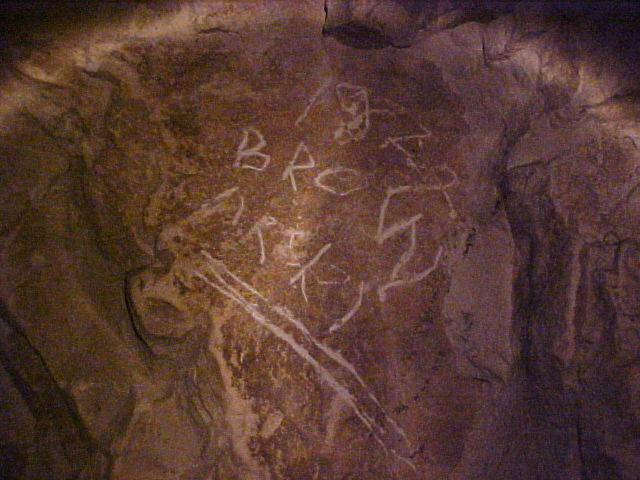
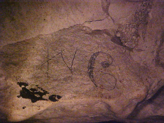
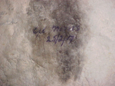
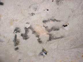
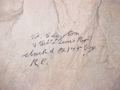
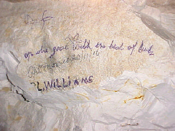
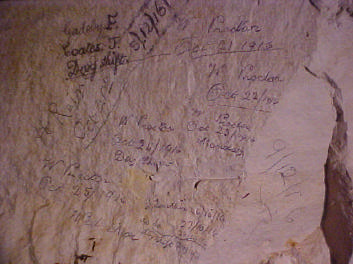
No. 5, O.64.E.1.1, contained a particularly extensive group of inscriptions. Corporal Morris recorded a date of 25 February 1917, while Private Clayton’s marks included an emblem, flower and heart; another tunnel plan was drawn in soot. Nos 6–9 belonged to the O.64.D group. No. 6, O.64.D.2.2, retained stacked chalk and a chamber reached across a small step; No. 7, O.64.D.2.1, preserved chamber timbers and further writing. Waders, boots, a belt and a scratched tin lid were recorded in No. 8, O.64.D.1.1. No. 9, O.64.D.1.2, extended only 8.9 metres, and its “WC” marking suggests a possible intended or actual latrine use without proving the final arrangement.

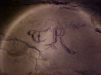
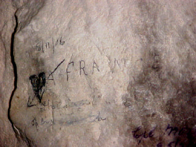
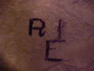
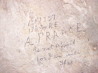
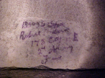
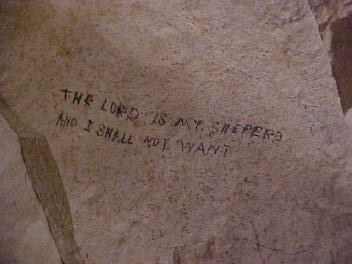
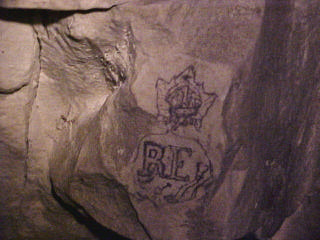
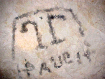
No. 10, O.64.E.2.1, led down a 35-centimetre step into a chamber approximately two metres square and 2.05 metres high. Its inscriptions included an RE monogram and the name of Private A. France, number 127757, of 175 Tunnelling Company, alongside religious wording. Clayton’s identification with the 8th Battalion South Lancashire Regiment and attachment to 175 Company illustrates the contribution of infantrymen working with specialist tunnellers. The chamber and its writing are therefore evidence of personnel as well as engineering. Names, numbers and units provide starting points for further comparison with service records and diary entries, although identification must follow the surviving lettering rather than assumptions about who occupied a particular tunnel.

The higher offensive galleries

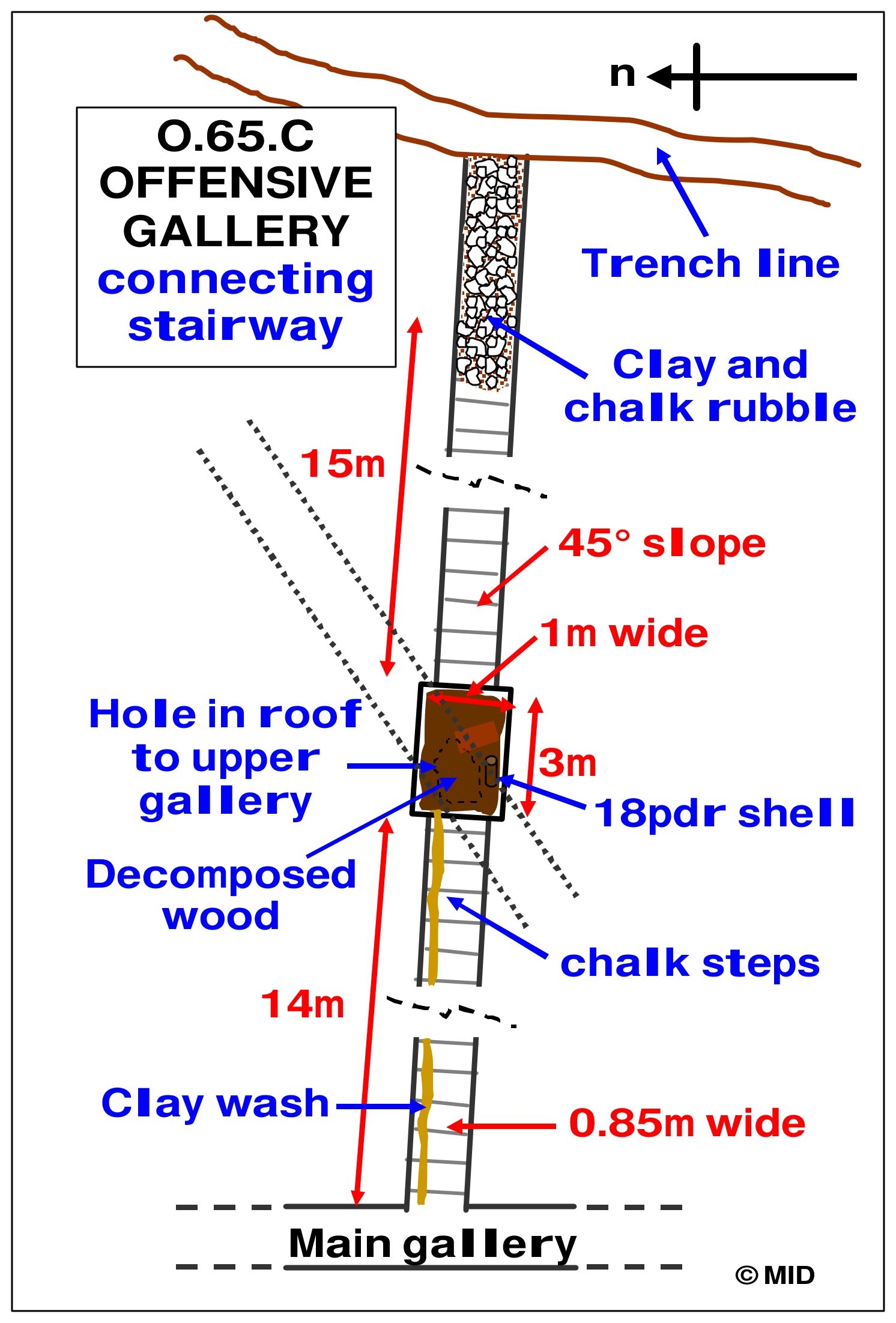
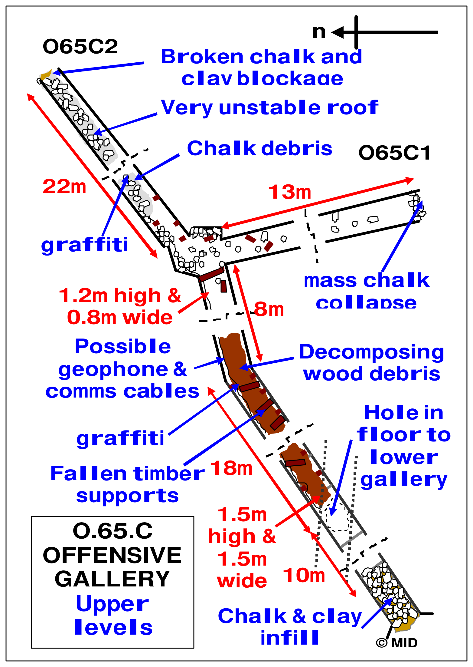
O.65.C belonged to a different level and phase of the system. A steep stairway descended about 14 metres at approximately 45 degrees to a landing, with another stretch leading towards a blockage above. A hole connected with an upper gallery, but the purpose and date of that connection remained uncertain. C.1 could be followed for about 13 metres, while C.2 extended for approximately 22 metres before collapse stopped access short of the chamber. Possible cable remains raised questions about listening arrangements, but their presence alone was insufficient to establish a geophone installation.

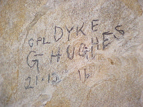
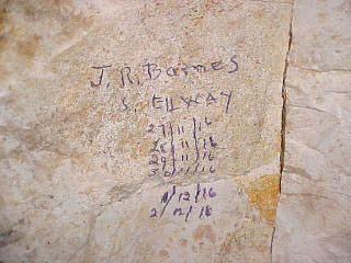
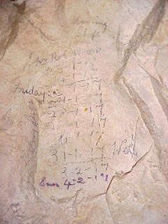
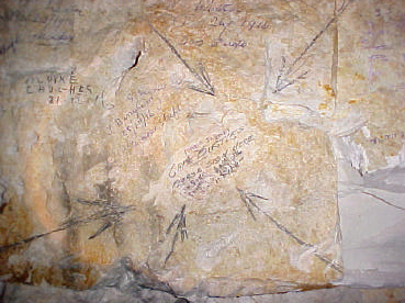
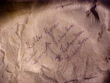
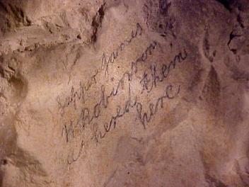
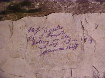
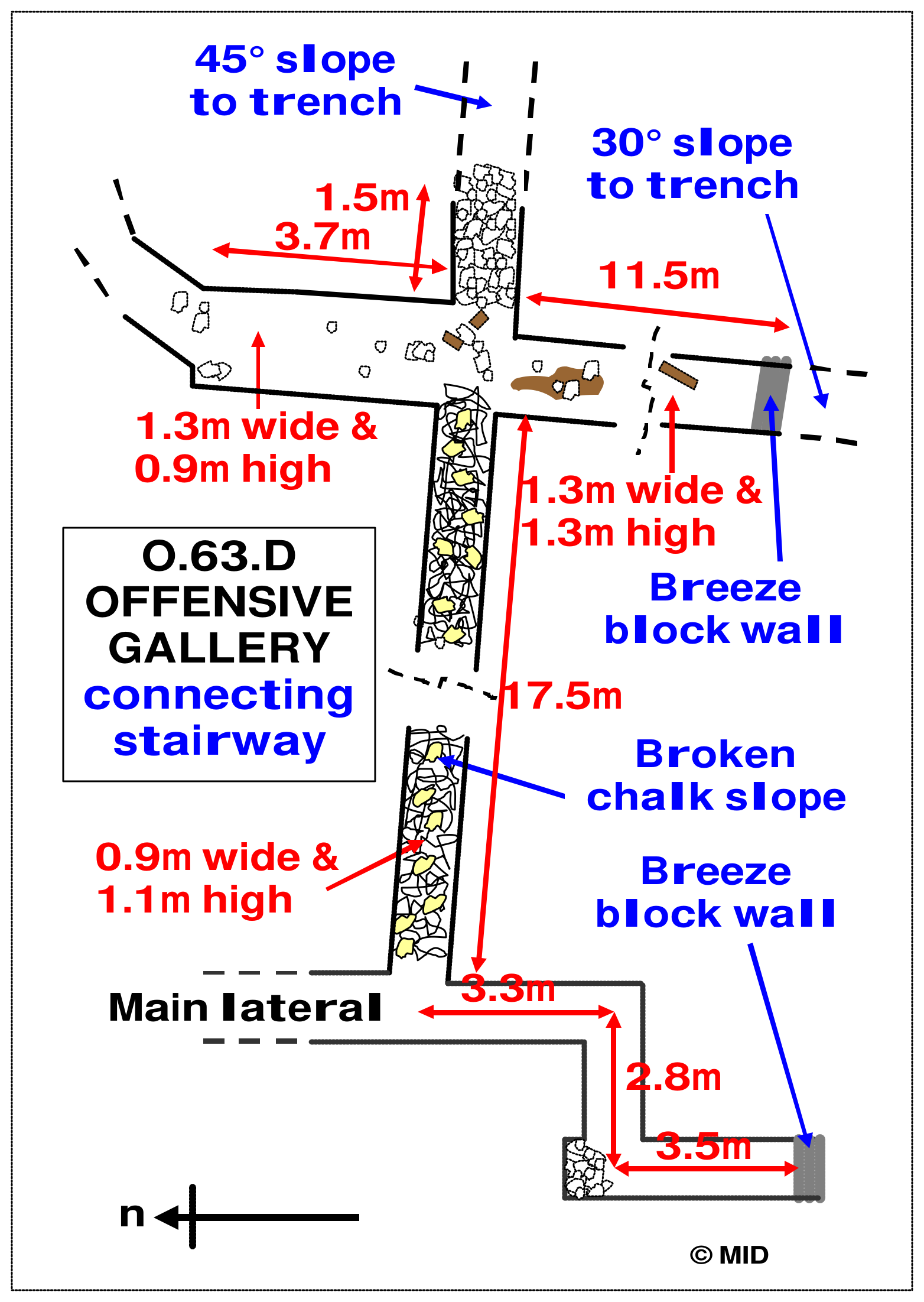
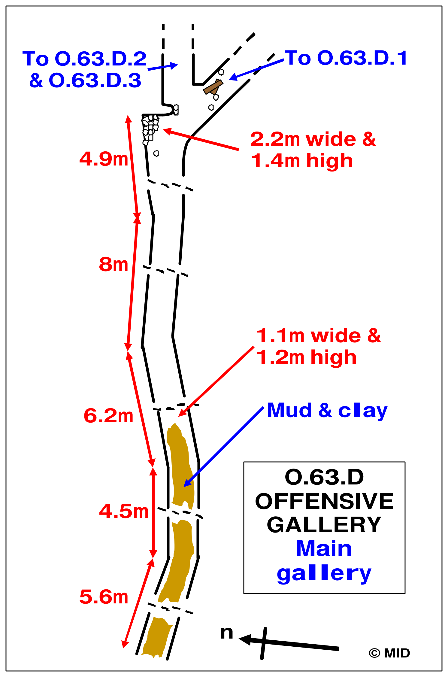
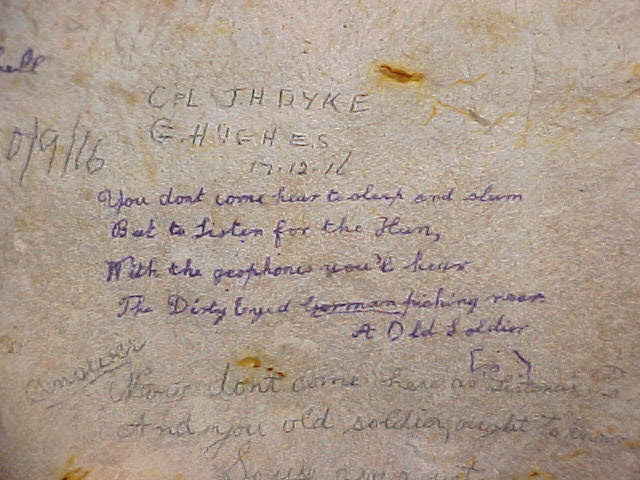
The higher O.63.D workings were also more heavily affected by deterioration than much of the deep lateral. The main passage extended for 29.2 metres before its branches were considered, with roof falls, timber remains and water marks recording changing conditions. Its D.1, D.2 and D.3 branches preserved some of the clearest listening inscriptions in the sector. In D.1, names included Dyke and Hughes, Barnes and Ellway, and Sapper Robinson, with dates in December 1916. D.3 included “Listen here” and a statement that Sapper James H. Robinson had heard the enemy there. These marks place individual men at particular listening positions within the mining front.

Names, drawings and listening records

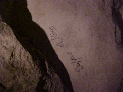
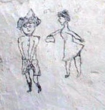
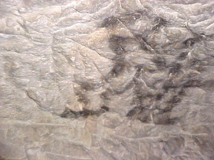
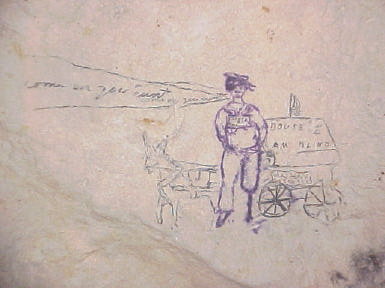
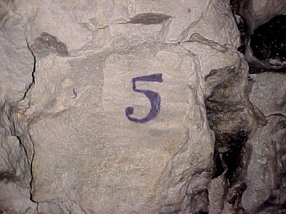
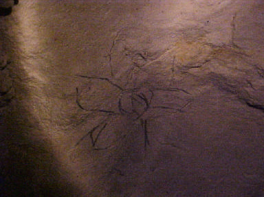
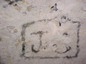
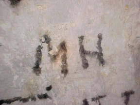
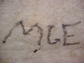
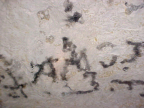
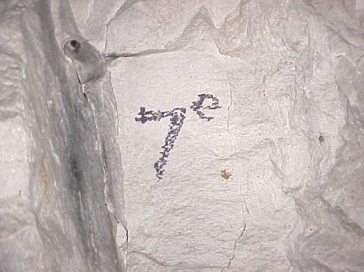
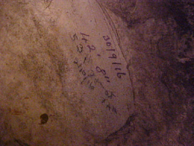
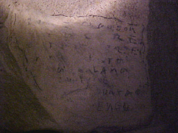
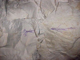
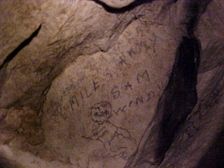
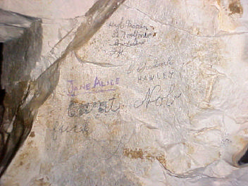
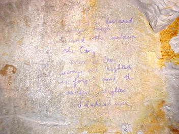
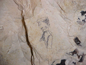
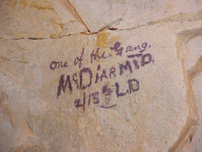
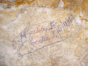
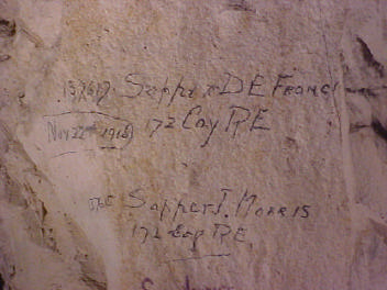
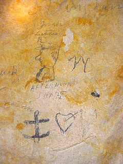
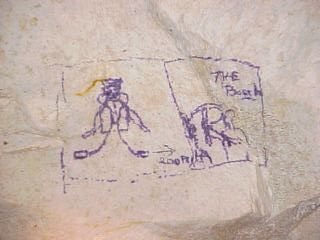
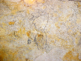
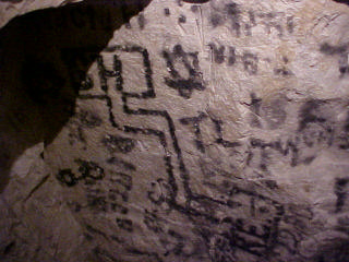
The inscriptions range from operational notes to personal expression. D.2 preserved the names Francis and Morris, a date of 22 November 1916 and a record of an afternoon listening pair on 28 January 1917. Elsewhere, names and regimental references appeared with portraits, flowers, hearts, humorous remarks, verse and religious phrases. Chalk, pencil, ink, scratches and soot produced different kinds of mark on the same underground surfaces. Reading them together reveals the mixture of concentrated work, waiting and personal life within the galleries, while their location supplies context that a transcription alone cannot retain.

The references to hearing the enemy are especially valuable because they connect the passages directly with their defensive purpose. They record where men listened and, in some cases, who shared the duty and when. References to geophones contribute to that record, but do not prove that an identifiable instrument survives at every marked position. Likewise, a drawing of a tunnel layout is evidence of how a man represented the workings, rather than a substitute for the measured survey. Photography preserves the original relationships between lettering, wall surface and adjacent marks; the gallery presents those records alongside captions identifying their recorded locations.

Disarming the O.65.C camouflet

The camouflet investigated by the Durand Group lay at the end of O.65.C.2, a branch of the higher-level O.65.C offensive workings. Further war-diary research by Nick Pryor identified it as a probable 950 lb charge, approximately 431 kg. A camouflet was intended to destroy or disrupt enemy galleries underground, rather than open a crater at the surface. The discovery connected the surviving tunnels with the explosive charges laid during the struggle beneath Vimy Ridge in 1916.

The charging work is recorded directly in the 175 Tunnelling Company war diary (WO 95/404/5). On 1 July 1916, the diary noted: “In SAP O.65C chamber being made for charging”. On 2 July 1916, it recorded 950 lb of ammonal being loaded in O.65.C. During the charging work, German shellfire wrecked the sap head, killing three Royal Engineers and five infantrymen from the carrying party. Second Lieutenant R. Horsley and two other ranks were wounded. The diary records that Horsley continued his duties for two hours after being wounded. The July entry names O.65.C without identifying C.2, so it cannot by itself establish that the 950 lb charge was placed in that branch.

On 5 August 1916, the diary recorded a German camouflet between O.65.T and O.65.C, reporting no damage to the British saps. The diary entry for 6 August 1916 states that the charge and leads in O.65.C.2 were undamaged, while recording gas, cracks in the workings and heaving of the floor in O.65.T. It confirms that a charge was present in C.2 by that date, although its weight is not specified in that entry. On 10 January 1917, at 7.15 pm, 172 Tunnelling Company reported a German mine beneath Chassery crater damaging O.65.C without casualties. The records examined for the original survey contained no subsequent entry confirming that the C.2 charge had been fired or removed, which helped frame the later investigation.

In October 2005, the Group returned to investigate the suspected charge. Survey work compared the surviving passages with contemporary plans, while access, ventilation and the protection and recording of graffiti were arranged. On 11 October, a bore intersected a shaft connected with the stairway between the deep lateral and the higher O.65.C workings. Subsequent archaeological clearance exposed the chamber and the corner of a rubberised ammonal bag on 16 October. The surviving tamping—the material packed behind a charge to confine its blast—provided evidence of how the mine had been prepared.
The charge was exposed in October 2005, with further work required to neutralise it. It was subsequently made safe, as described in Mike Dolamore and Andrew Hawkins’s first-hand account presented at TAG 2010, which describes the charge being recorded after it had been made safe. The film below documents the Group’s work on the camouflet and complements the wartime documentary evidence and archaeological record.

A section through the Vimy chalk

The O Sector inclines also provided unusually informative exposures of the rocks beneath the ridge. Maureen White’s geological investigation examined approximately 20 metres of stratigraphy in the entrance decline and compared it with a second incline about 250 metres away. In the winch chamber, the association of the fossil bivalves Platyceramus and Volviceramus, considered with the flint and sponge-rich beds below, supported identification of the lower Seaford Chalk. A prominent marl seam at approximately 12 metres depth lay above tubular flints and was interpreted as the Shoreham Marl. A fragment of Cremnoceramus near the base of the decline provided further evidence for the upper Lewes Nodular Chalk beneath it.

These findings connect the measured tunnel profile with an identifiable succession of chalk beds. The formation names represent geological interpretation of observed fossils and layers, rather than labels used by the wartime miners. White’s study of roughly 300 metres of the lateral found much of the deep passage dry, with smooth pick-marked walls and a largely intact roof. Near-vertical joints intersected horizontal bedding surfaces, dividing the rock into blocks. At a roof failure about 200 metres south of the access tunnel, the fractures and increased span helped explain how a slab could break away through beam failure.

Local differences matter as much as the general impression of preservation. Wider passages and junctions reduced support beneath the roof, while the higher galleries recorded clay intrusion, flooding and more extensive collapse. White found comparatively little water-related alteration in the deep O Sector exposures she examined, in contrast with the more altered chalk at Grange. The geological work thus explains why adjacent parts of the Vimy underground landscape can preserve differently. It complements the engineering and archaeological record without turning a dated survey into a current stability assessment.

Preserving the record

O Sector brings together successive French and British workings, deep defensive mining, mechanical haulage and the personal record of the men underground. Its significance lies in those relationships: an incline explains how spoil was moved, a dated listening inscription identifies activity within a branch, and a chalk bed helps explain the condition of a roof. Wartime plans, diaries, surveyed drawings, photographs and later field observations each contribute a different part of the account. Keeping their dates and limits visible allows the record to develop as further documents are checked and linked.
The inaccessible southern works, uncertain connections and differences between plans remain part of that research. They should neither be filled with assumptions nor allowed to obscure the substantial evidence already recorded. The galleries on this page preserve the measured layouts and inscriptions, while the full investigation provides the wider photographic and artefact sequence. Together they present O Sector as a documented part of the underground battlefield at Vimy, with a history that began before the 1917 battle and continued through later investigation and preservation.
For a related Vimy project, explore the Goodman Subway, which preserves another part of the ridge’s underground battlefield.
Sources and further reading