
Gustav South
German Tunnel System
German mining beneath the Hairpin
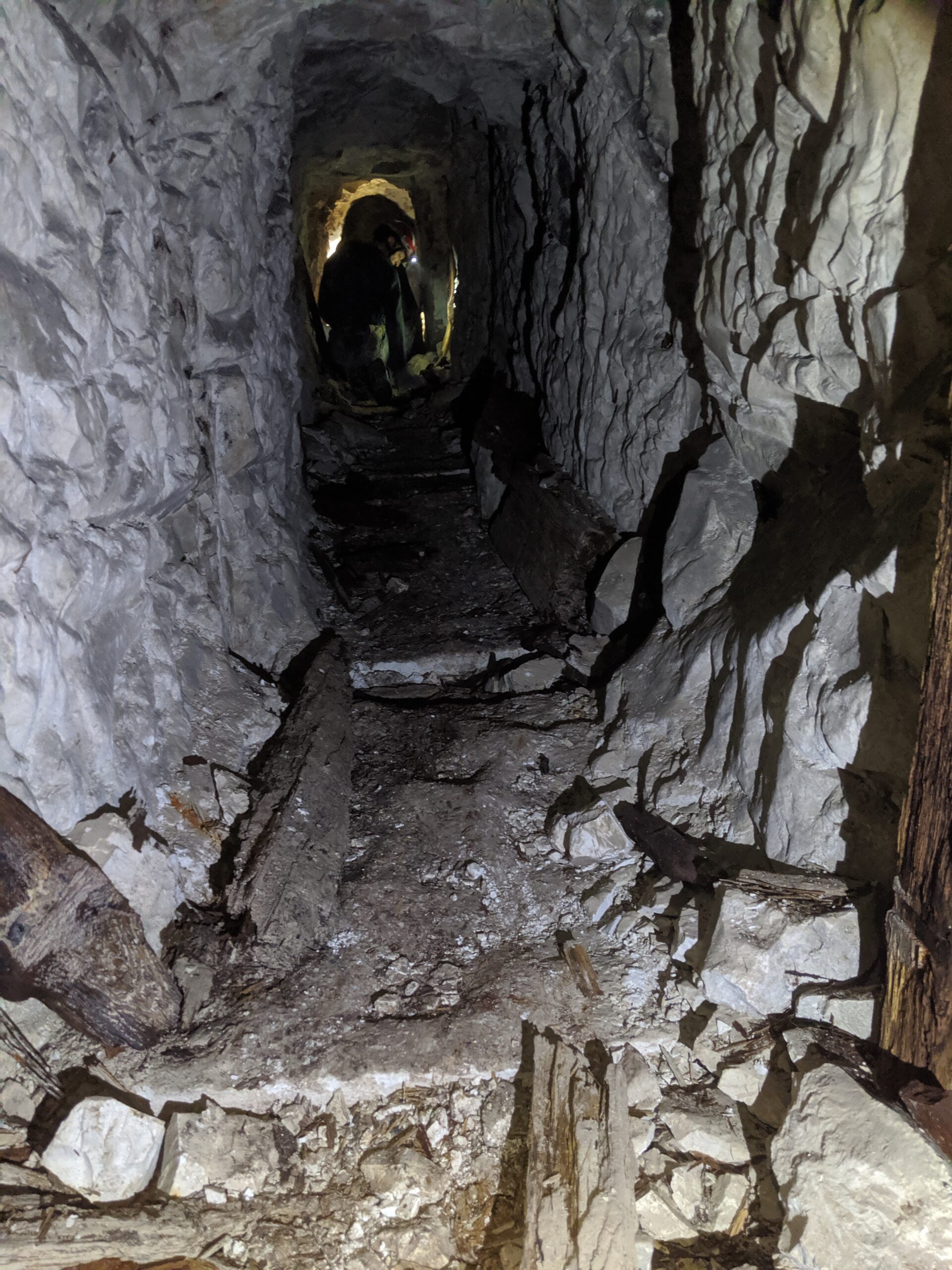
Beneath the former front line east of Hulluch, near the Hairpin craters, lies part of a German First World War mining system known as Gustav. Inclined passages descended from the surface and met an underground gallery running along the front. From there, German pioneers could reach working faces beneath the contested ground. More than a century later, surviving timberwork, candle marks and inscriptions preserve evidence of both the construction and the people who used these tunnels.
The Hairpin and the underground war
After the Battle of Loos in September 1915, the line east of Hulluch became a closely contested mining front. British troops called an advanced, sharply bent trench beside the quarries the Hairpin. During the winter of 1915–16, mining and counter-mining progressively transformed this position and the neighbouring front into a landscape of craters, damaged trenches and underground approaches.
German preparations began before the underground struggle reached its later intensity. On 4 November 1915, Leutnant van der Linden of Pionier-Kompagnie 269 examined the mining situation around Fosse 8 and Puits 13. By the middle of December, II Bavarian Corps had begun establishing a more systematic defensive mining scheme across the sector. These investigations preceded the increasingly organised underground contest that developed during 1916.
The position of a mine depended on the ground above it. The quarries, trench bends and advanced saps gave both armies points from which to describe the front, while below ground the fighting took place along passages that could not be seen from the surface. The danger was mutual: a gallery approaching an enemy position could itself be detected and attacked by opposing miners. The cratered ground around the Hairpin records explosions, but the galleries show the less visible work that preceded them.
The British response was organised by the 253rd Tunnelling Company, Royal Engineers (WO 95/488/5), which arrived in the sector at the beginning of January 1916. Its working area extended from the Hairpin towards Vendin Alley: No. 1 Section operated at the Hairpin, while the company’s other sections worked at the Quarries, St Elie and Hulluch. This allocation demonstrates that Gustav formed part of a much wider and closely connected underground battlefield rather than an isolated tunnel position, although the diary does not identify a particular British gallery as directly facing Patroklus.
German mining organisation was also evolving. Before dedicated mining companies were formally established in April 1916, much of the work was undertaken by regimental pioneer and mining detachments, often drawing upon men with pre-war mining experience. Some of these formations became known as Bergkompagnien before the mining service was reorganised into more specialised companies. This changing structure helps explain the different unit names and abbreviations encountered on contemporary plans and surviving inscriptions.
A British trench map with the lines corrected to 12 June 1916 offers a contemporary surface reference for the Quarries and Hulluch; like the German underground plan, it must be read with its date in mind. The British map traces the surface line at one moment in 1916, while the German underground plan was drawn in 1917. Reading them together can help place the Hairpin, the quarries and the tunnel entrances in relation to one another.
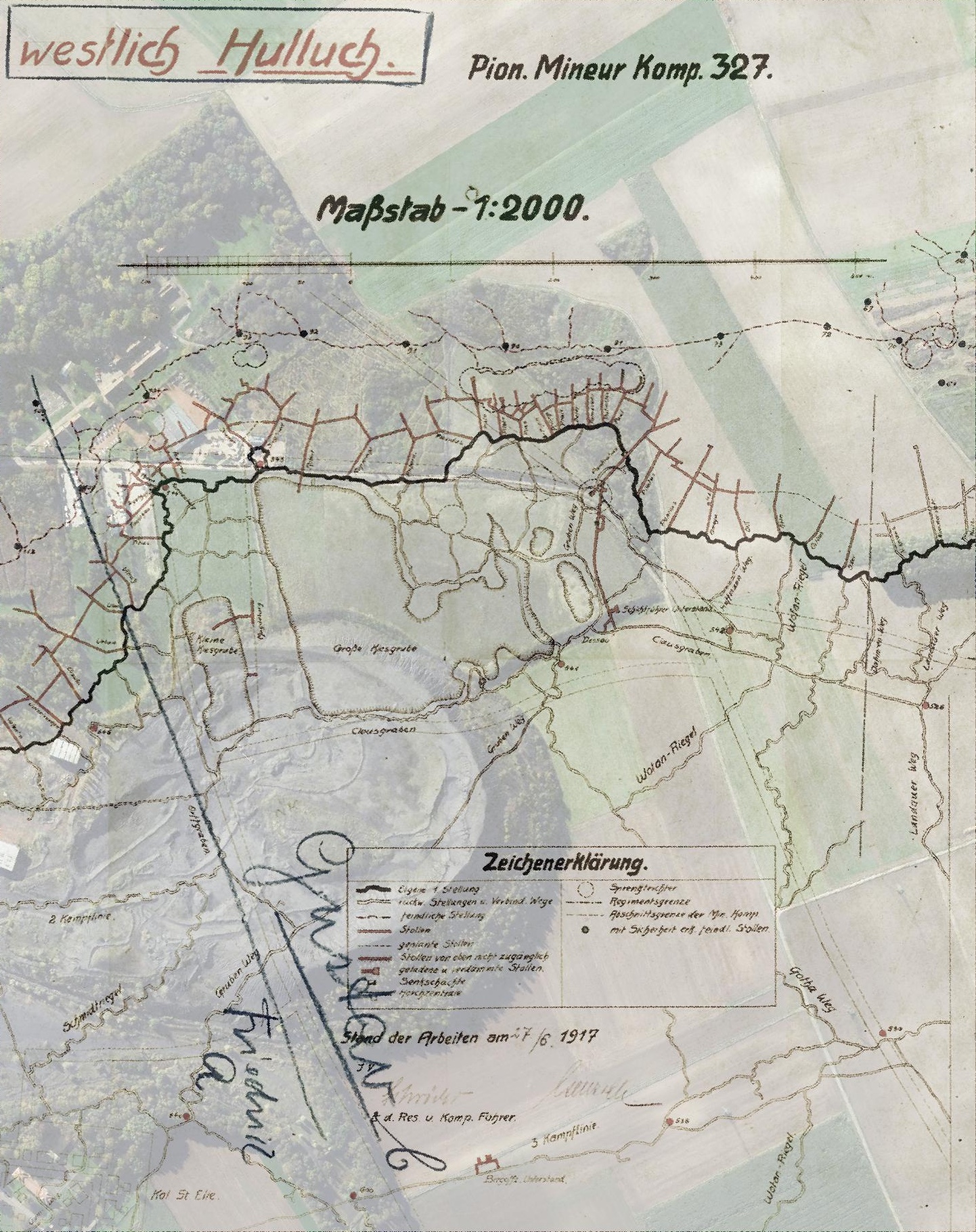
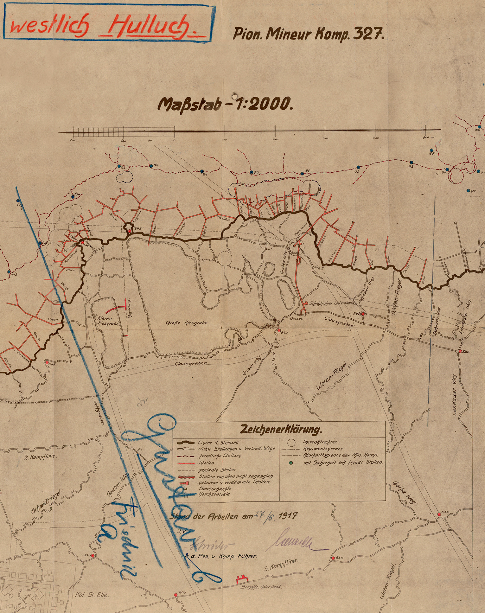
A German plan dated 27 June 1917, captioned westlich Hulluch, Pion. Mineur Komp. 327 (“west of Hulluch, Pioneer Mining Company 327”), shows a network of inclines and connecting galleries. The plan is a guide to the system as depicted at that date: a line on a wartime map does not establish that every section was completed or remains open.
The caption and the layout answer different questions. The caption supplies a contemporary company designation and date. The drawn passages show how the entrances were arranged across a stretch of the front. Neither identifies the men at every working face, and a later phase of construction could alter the system without appearing on this particular plan.
Gustav within the German front
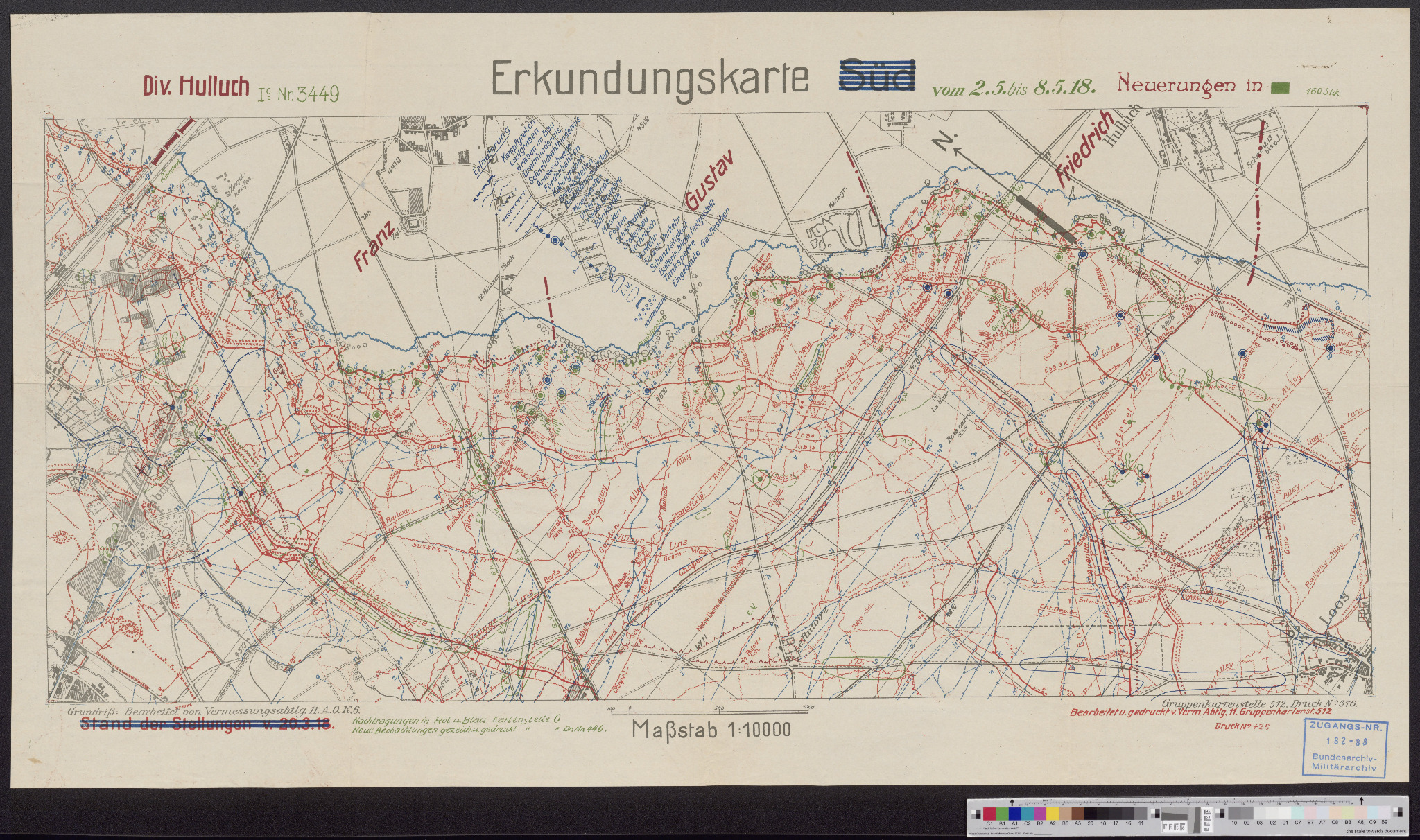
The name Gustav belonged to a wider German system of named positions west of Hulluch. A reconnaissance map prepared for Division Hulluch in May 1918 marks neighbouring sectors including Franz, Gustav and Friedrich. These were operational labels used to organise a complex defensive landscape of trenches, galleries, craters, communication routes and strongpoints.
The reconnaissance map is later than the detailed Gustav tunnelling plan and serves a different purpose. It places the sector within the broader German front rather than recording the precise underground layout. Read together, the two maps move from the wider battlefield to the individual system beneath it.
The Gustav system in 1917
The German tunnelling plan records the system as it stood on 27 June 1917. Its heading, westlich Hulluch, means “west of Hulluch”, while Pion. Mineur Komp. 327 identifies Pionier-Mineur-Kompagnie 327. The legend distinguishes the German front line, existing and planned tunnels, entrances that were inaccessible from above, damaged or buried galleries, shafts and listening galleries.
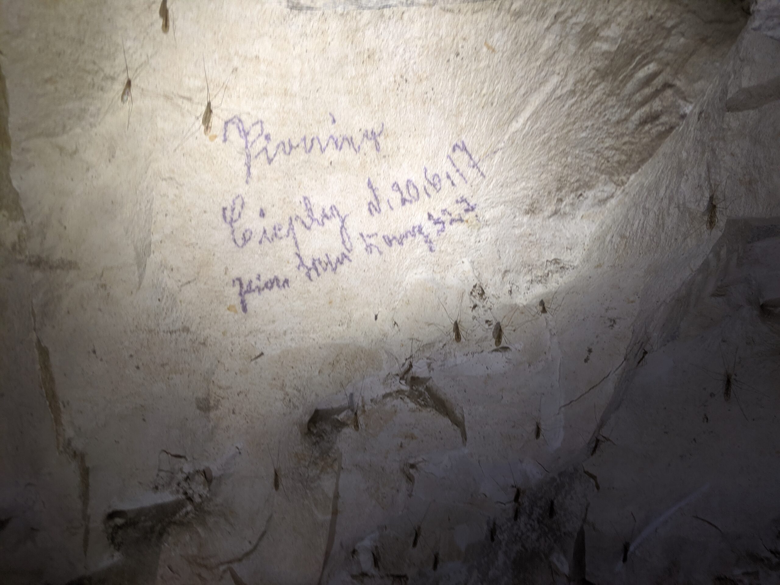
This makes the plan more than a simple route map. It records the state of the works at a particular moment: what had been completed, what was proposed and what had already been lost or obstructed. The company designation also closely matches the inscription inside Gustav dated 20 June 1917. The official plan and the underground writing are independent contemporary evidence for Company 327’s presence in the system during that month.
How the system worked
The named inclines on the wartime plan run, from south to north, through Permasens, Patroklus, Paul, Pankratius, Pilatus, Pantius, Omega, Ortt and Otto. An underground lateral gallery linked the inclines roughly parallel to the front, with other passages extending towards the opposing line.
An incline offered a way down from the surface. A lateral connection offered a route between these entrances below ground. Together, they created a network rather than nine isolated tunnels: men and materials could enter at one point and move along the underground line. The branches reaching towards the British positions served a different purpose, bringing mining work closer to contested ground.
A lateral gallery was more than a passage between entrances. It reduced dependence upon any single shaft or incline and allowed underground positions to be reached from several points. Narrower listening galleries were driven forward from protected networks to detect enemy excavation and establish its direction and distance. By the summer of 1916, the British defensive scheme elsewhere on the Hulluch front included dozens of connecting laterals and 59 listening galleries. Although Gustav was a German system, this contemporary development illustrates the scale and density that underground defence could attain in the sector.
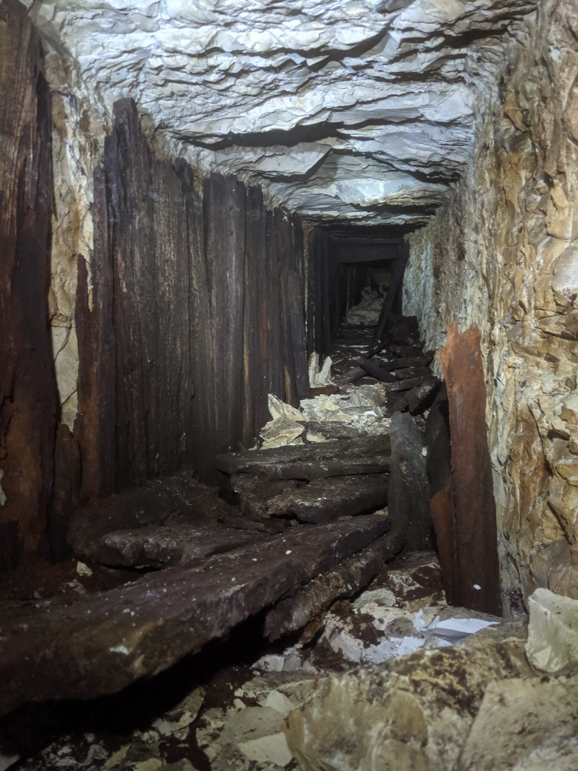
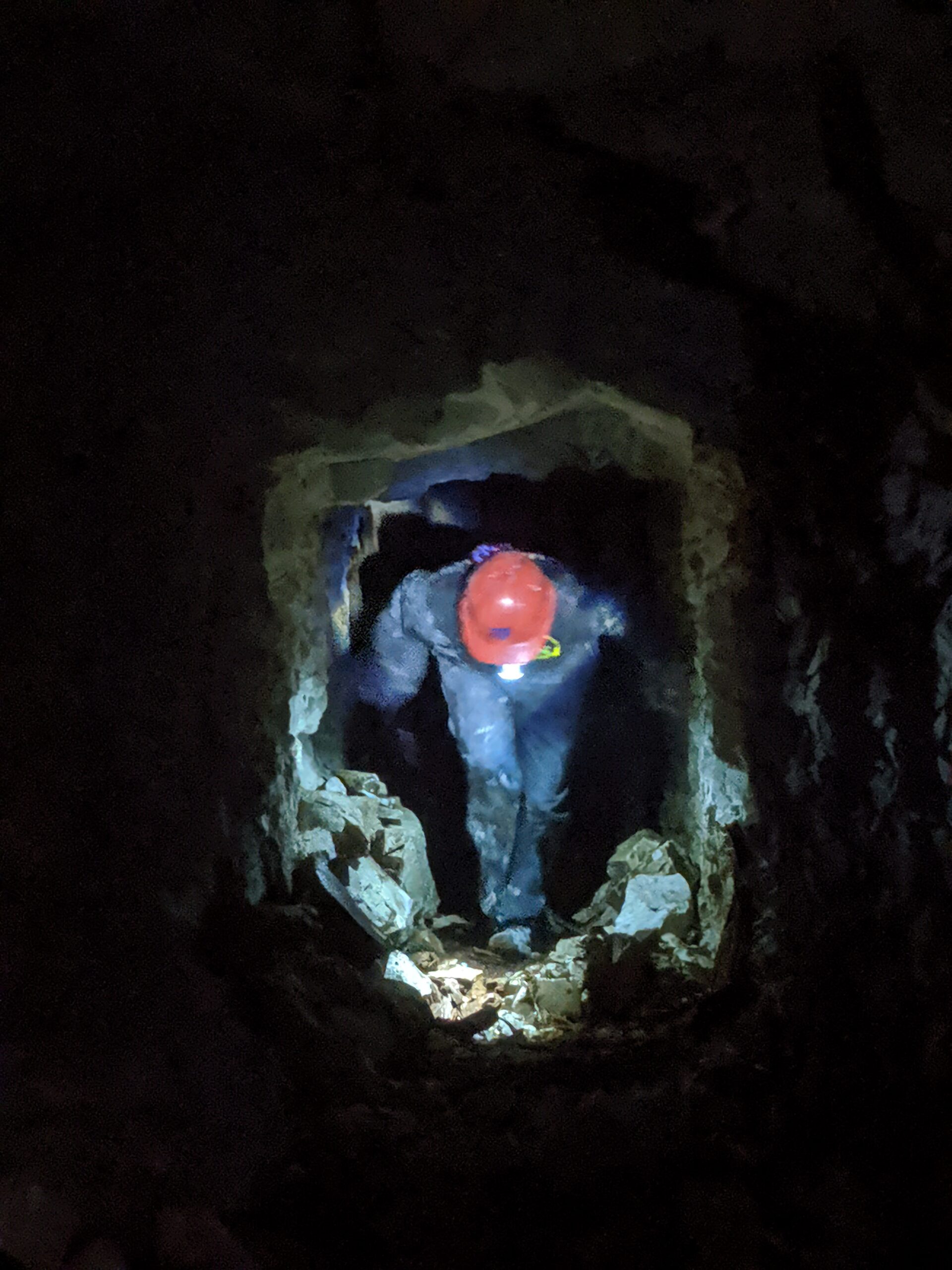
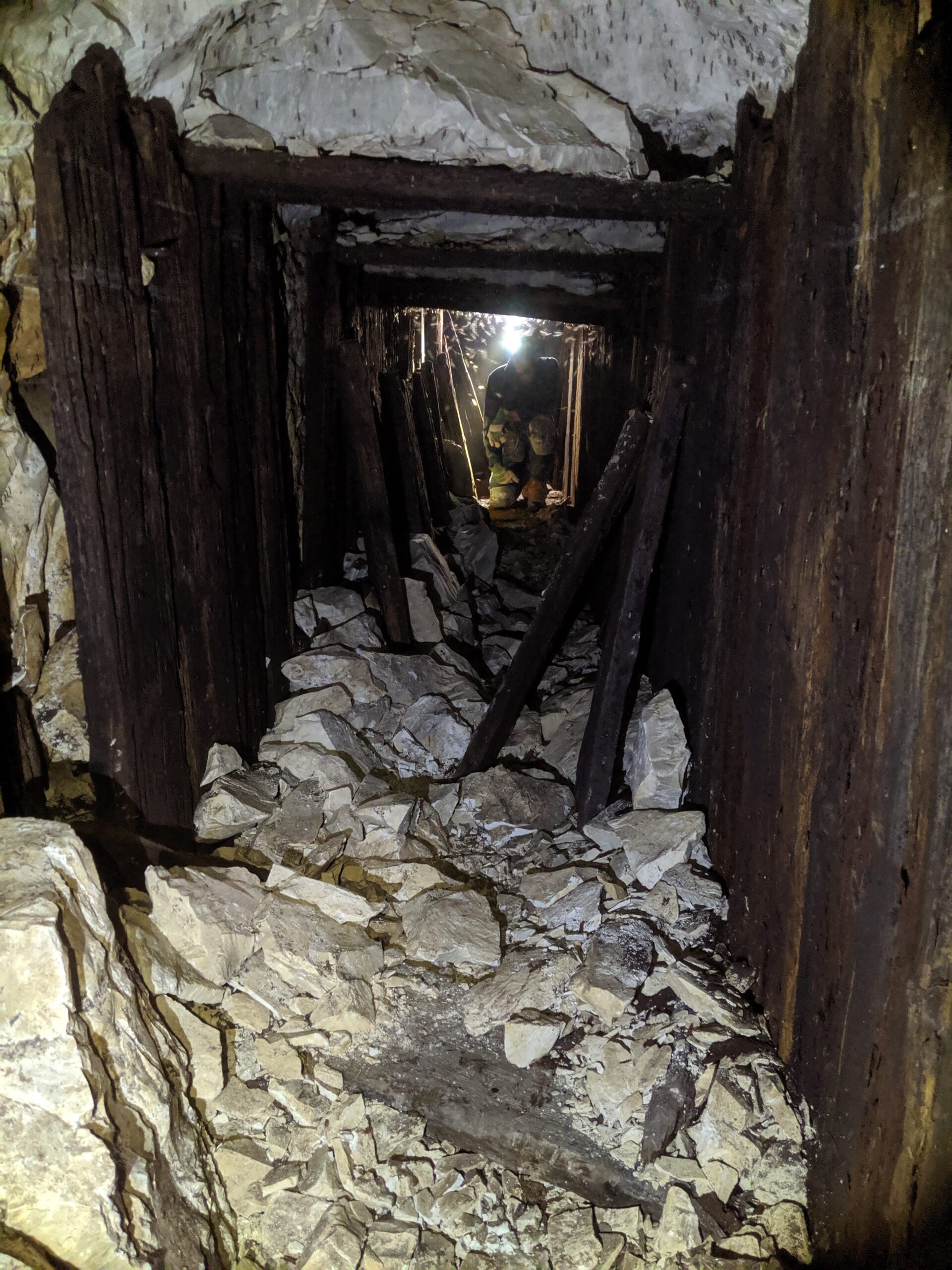
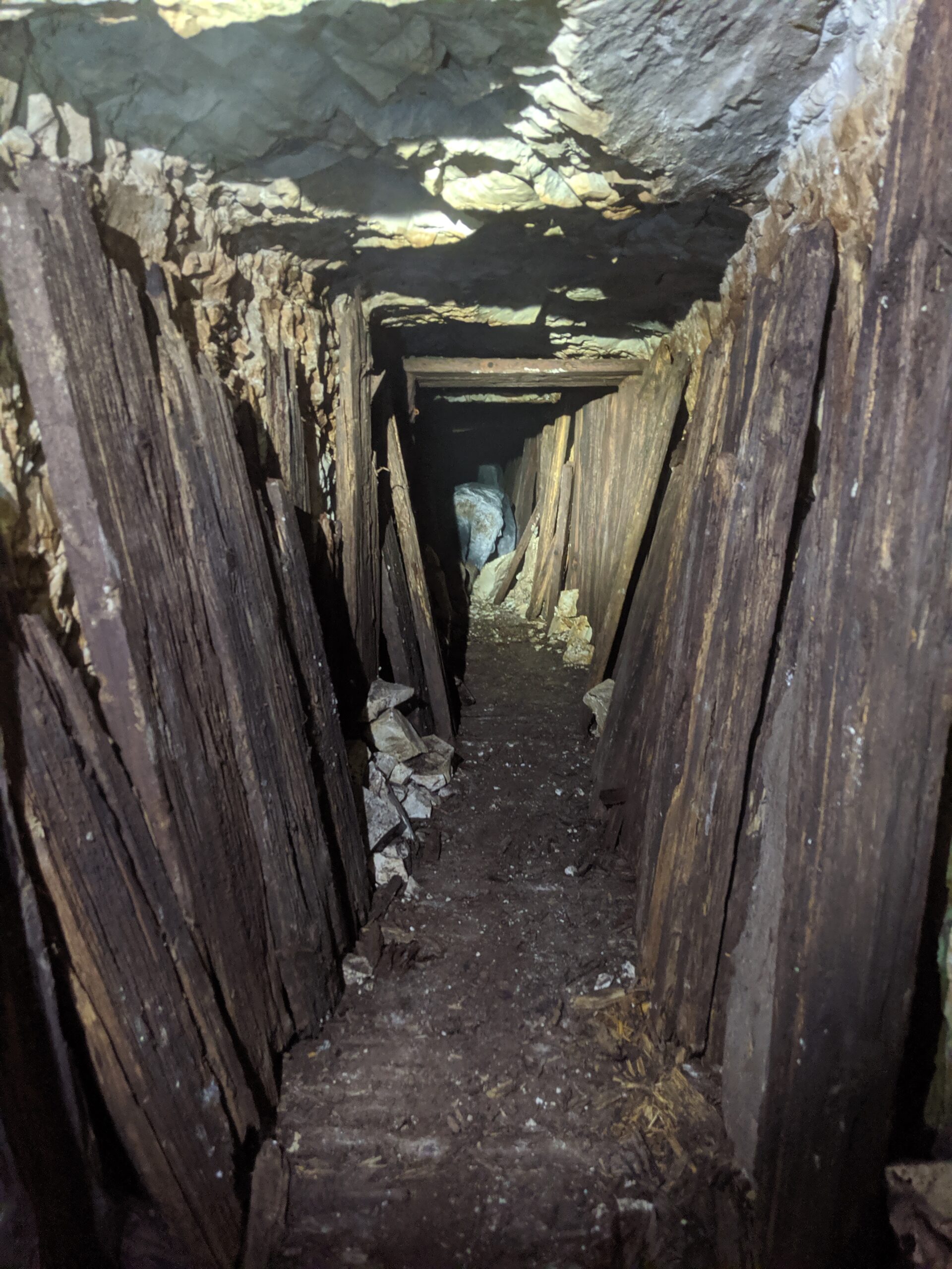
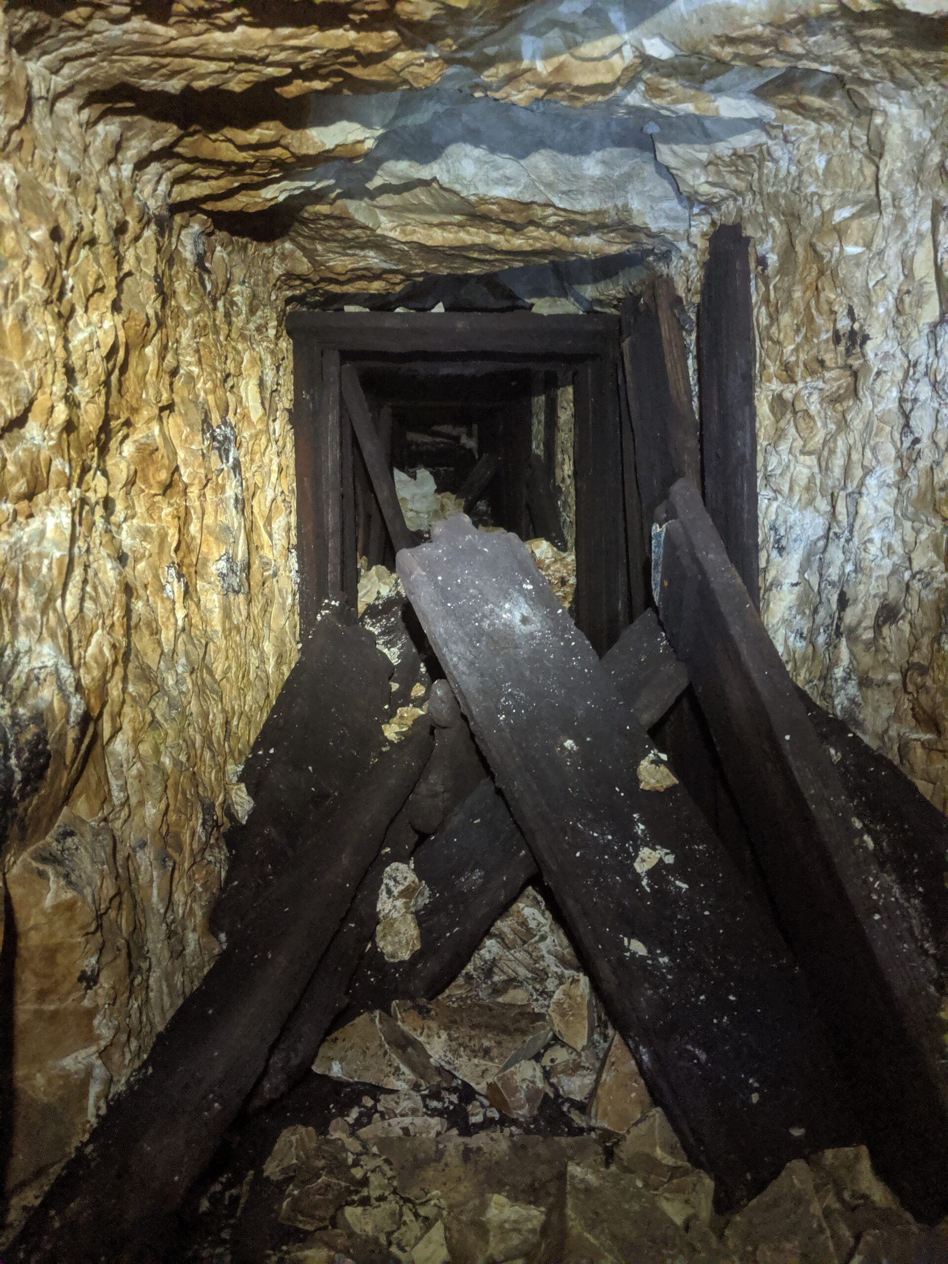
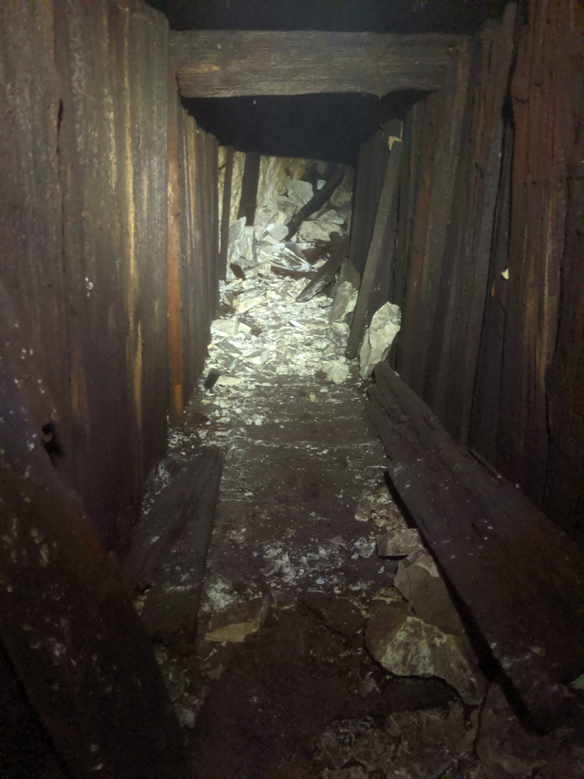
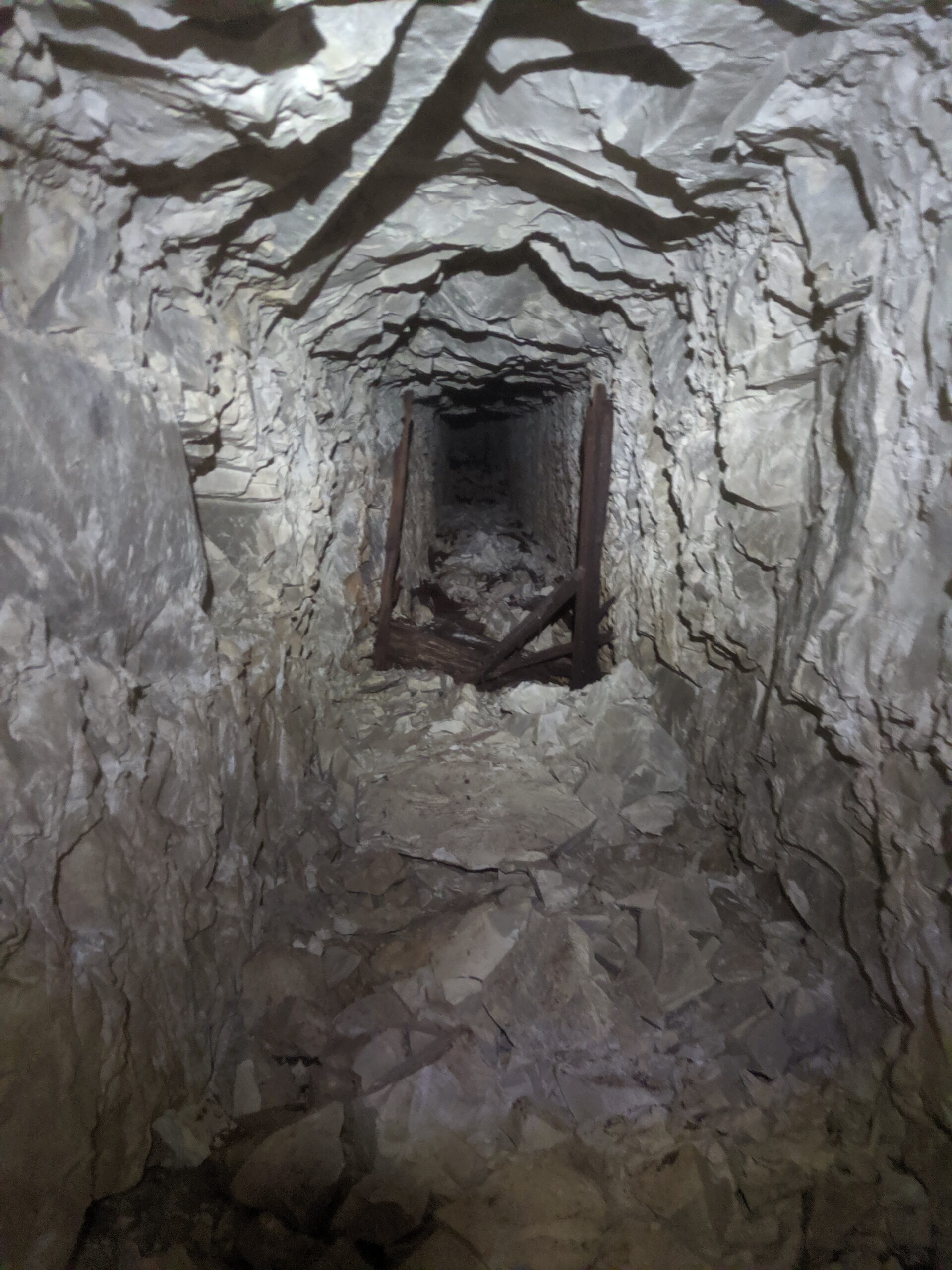
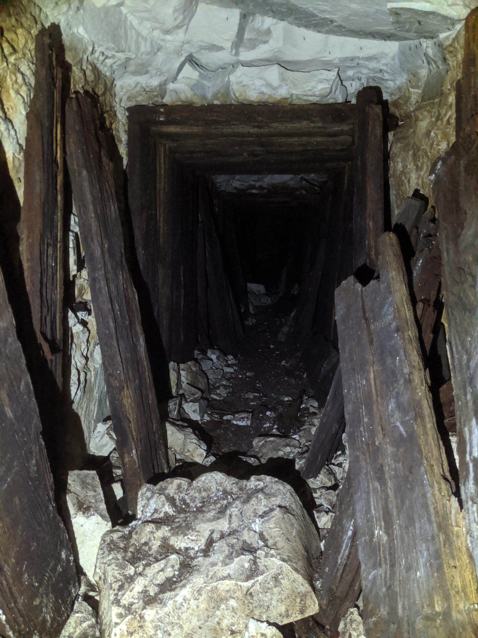
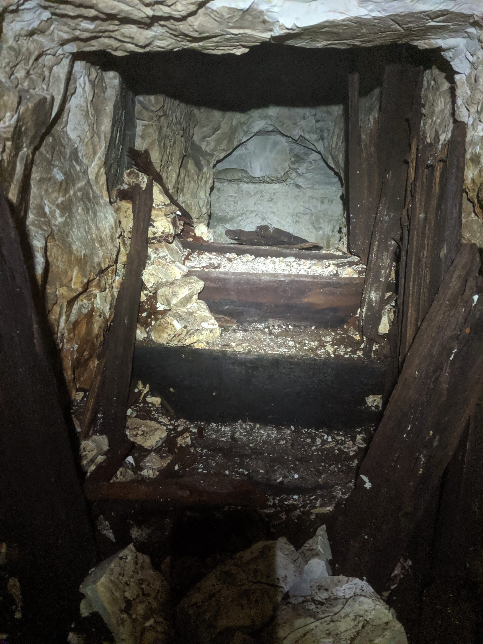
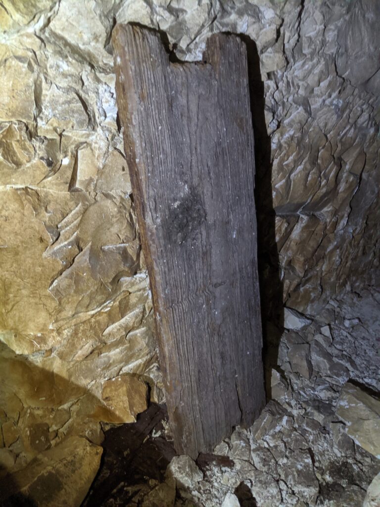
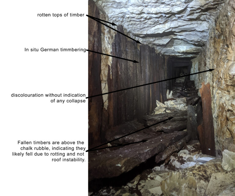
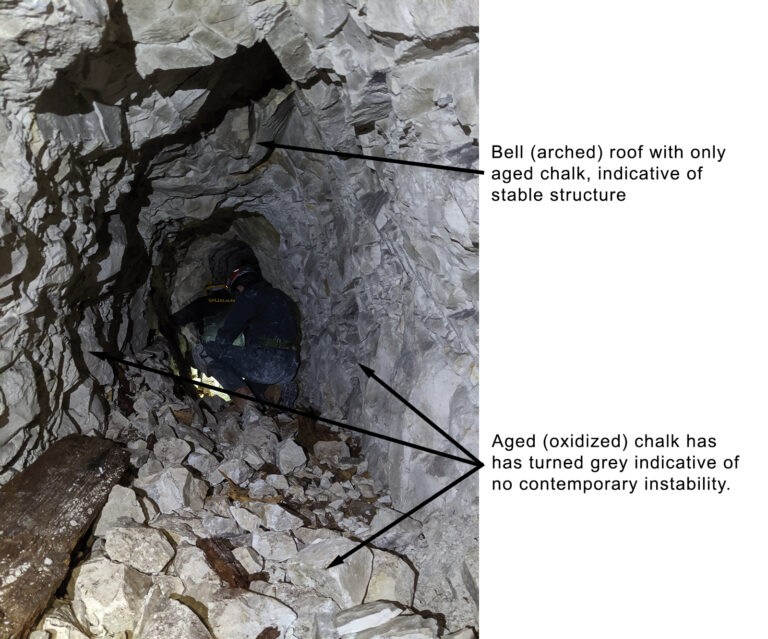
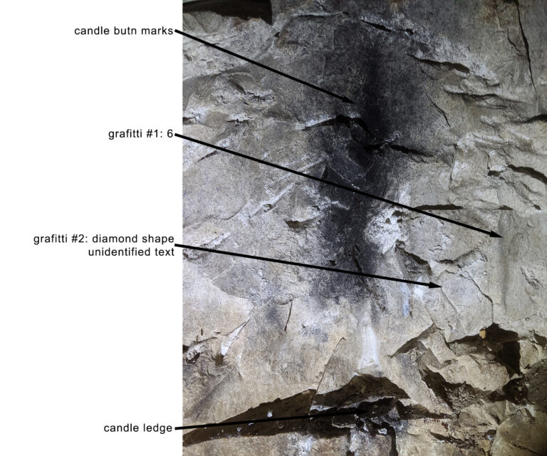
The surviving galleries show how German pioneers worked in chalk. Sections retain closely spaced wooden framing, while others expose the cut chalk directly. Some frames have decayed, and local roof falls and water limit what can be inferred about the system as a whole. Candle ledges and soot survive on the walls.
These details add a physical dimension to the plan. Timber marks where frames were installed; exposed chalk retains the shape left by excavation. A small ledge and the soot above it can identify where a candle was placed. No single detail dates a passage by itself, but the relationship between the cut walls, framing and marks can help explain how different parts were used.
German gallery construction
German pioneer units made extensive use of closely spaced timber frames, or Stollenrahmen, even when galleries were driven through competent chalk or rock. At Gustav, the surviving framing therefore appears to reflect established German construction practice as much as geological necessity: it offered additional security, provided fixing points for cables and pipes, and may also have helped to dampen sound during mining.
The frames formed a continuous lining around the floor, walls and roof of the gallery. Comparable squared-timber construction has been documented archaeologically at the German Kilianstollen at Carspach, where contemporary German instructions emphasised carefully assembled frames of dressed timber in underground access galleries. Wider archaeological research into First World War construction timber also demonstrates the immense logistical importance of wood along the Western Front.
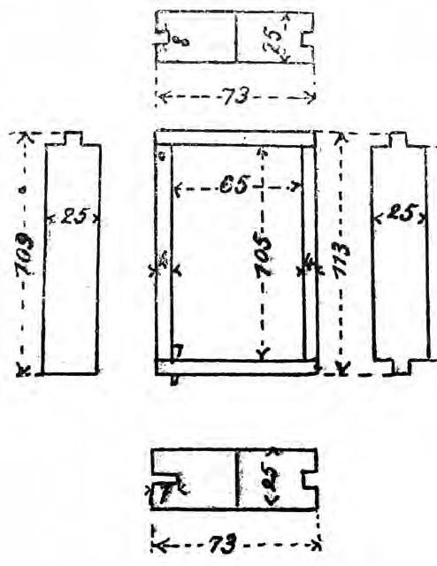
Measured drawings from another German First World War tunnel system help explain the compact timber framing visible underground. The comparative sections show a narrow rectangular frame assembled around the gallery, with rebates at the joints. They provide useful construction context, but they are not measurements taken at Gustav; the dimensions and surviving fabric at Gustav must be recorded independently.
Marks left by German pioneers
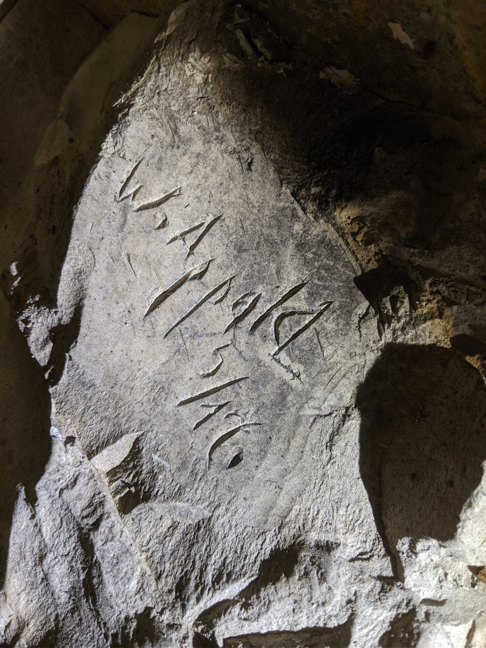
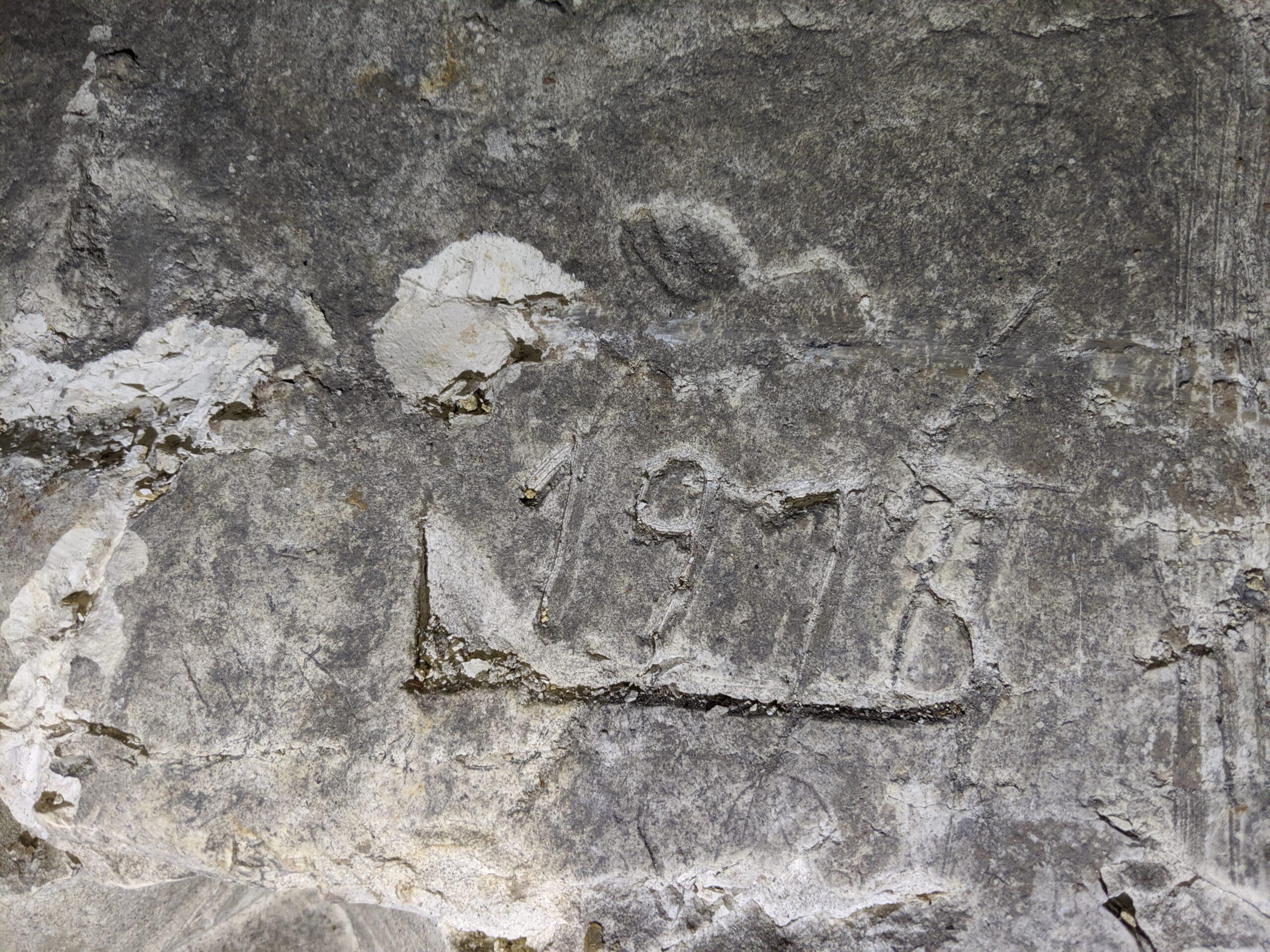
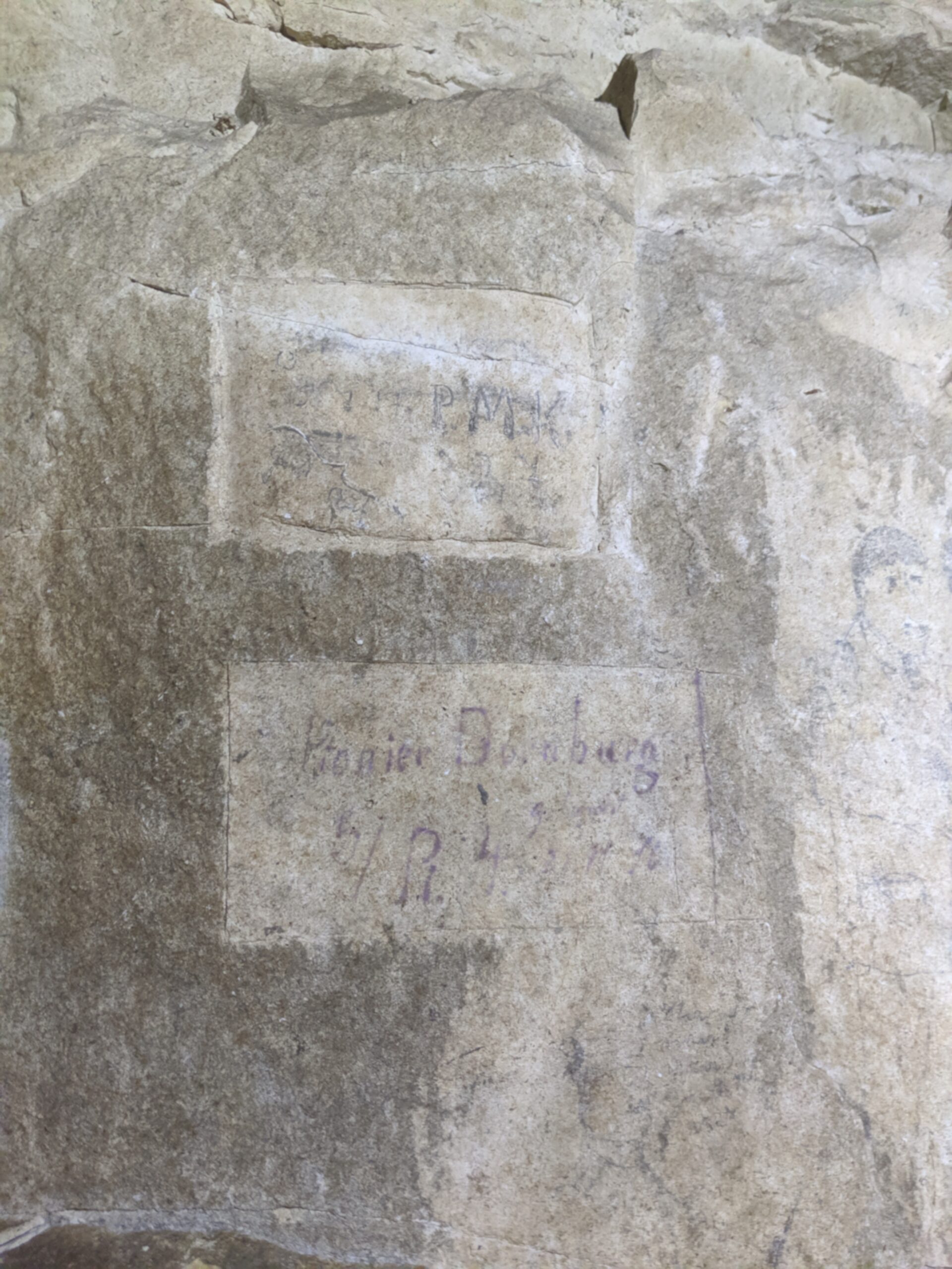
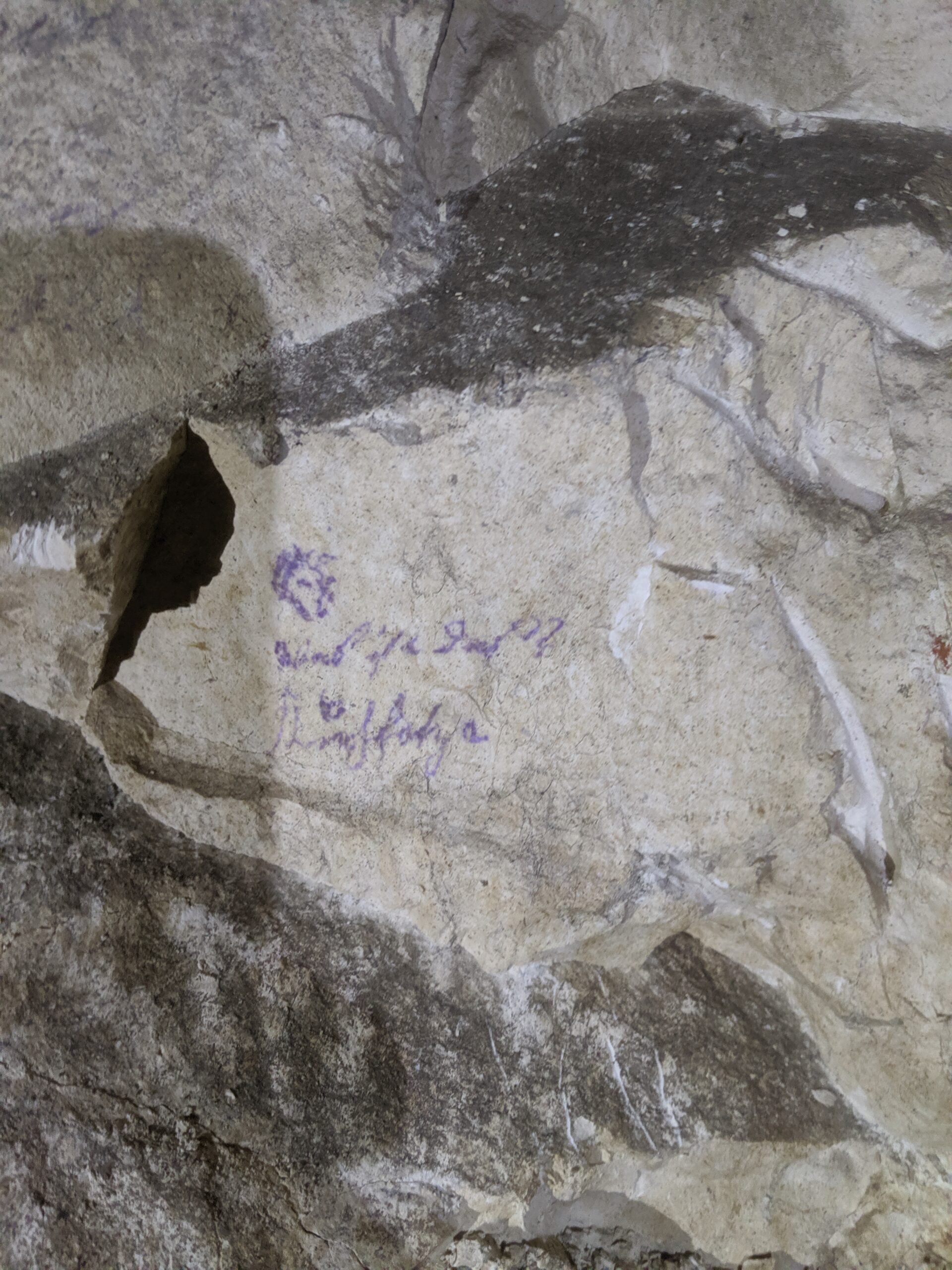
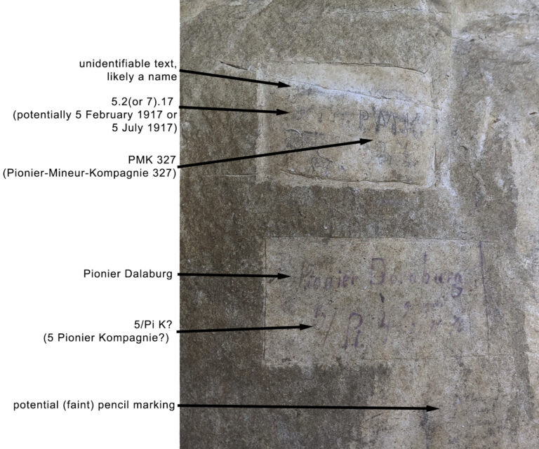
Names, dates, unit references and drawings on the chalk give Gustav a human record alongside its engineering history. An inscription naming Cieply and Pionier-Mineur-Kompagnie 327 bears the date 20 June 1917. The company’s name also appears in the caption of the map drawn a week later. These two records connect Company 327 with Gustav that summer; they do not establish when it left or identify every gallery its men made.
The inscription is particularly valuable because it is in the tunnel itself. Its date precedes that of the plan by only seven days. Where the plan records the system in a formal military document, the writing on the chalk places a named individual and a numbered company within the surviving underground space. That connection provides a starting point for investigating who occupied the galleries in June 1917.
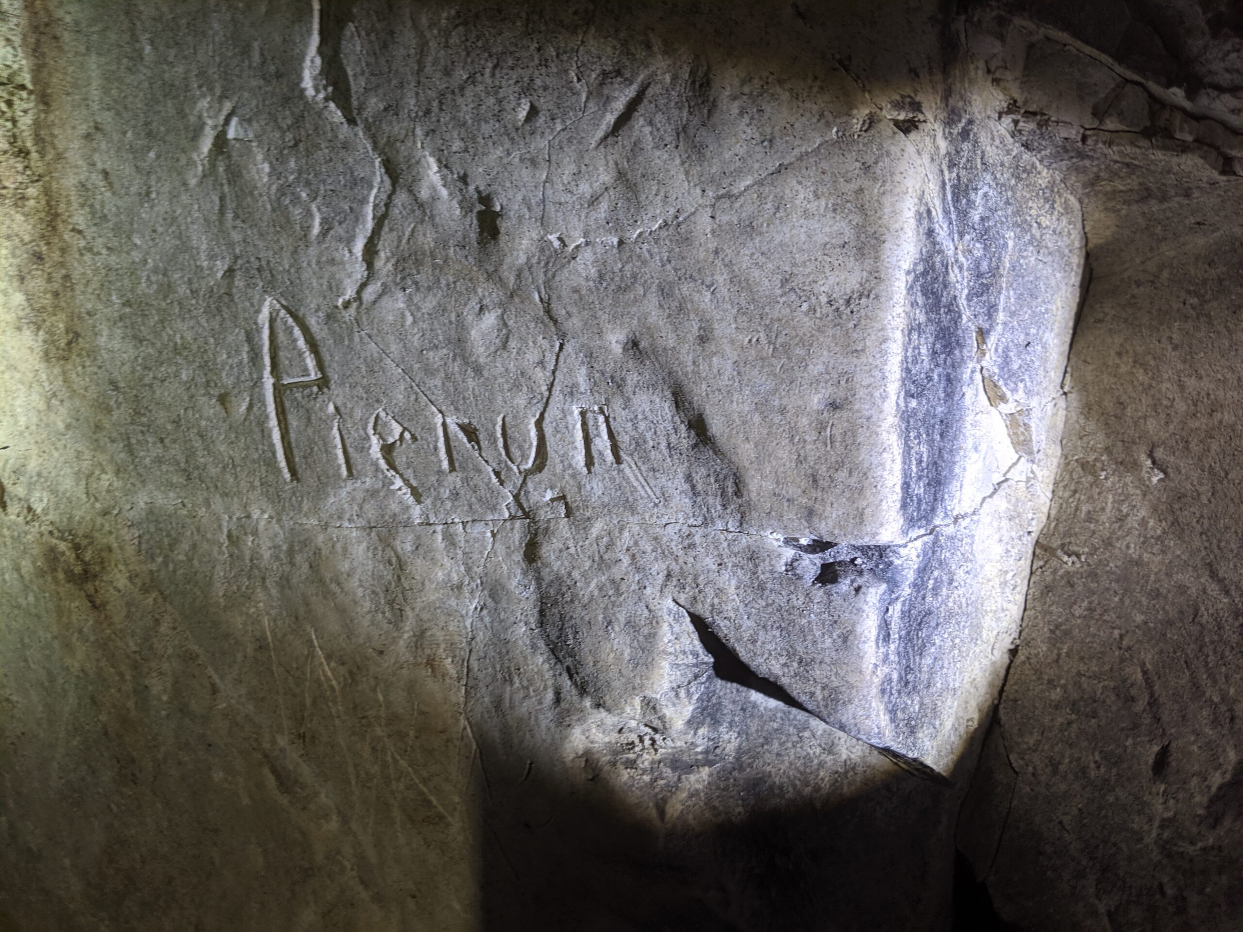
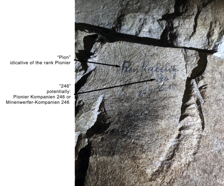
Another inscription may refer to Pionier-Kompagnie 246, although that reading remains uncertain. The named units provide a route into further German company records.
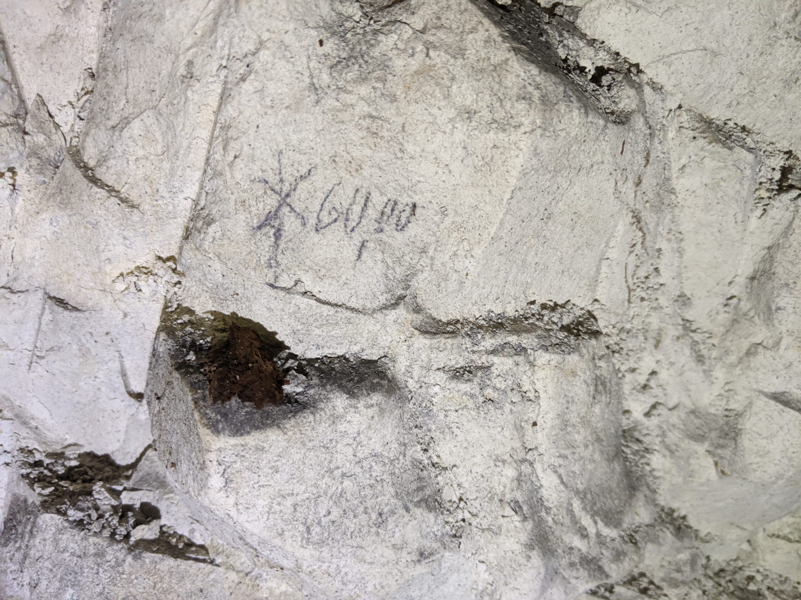
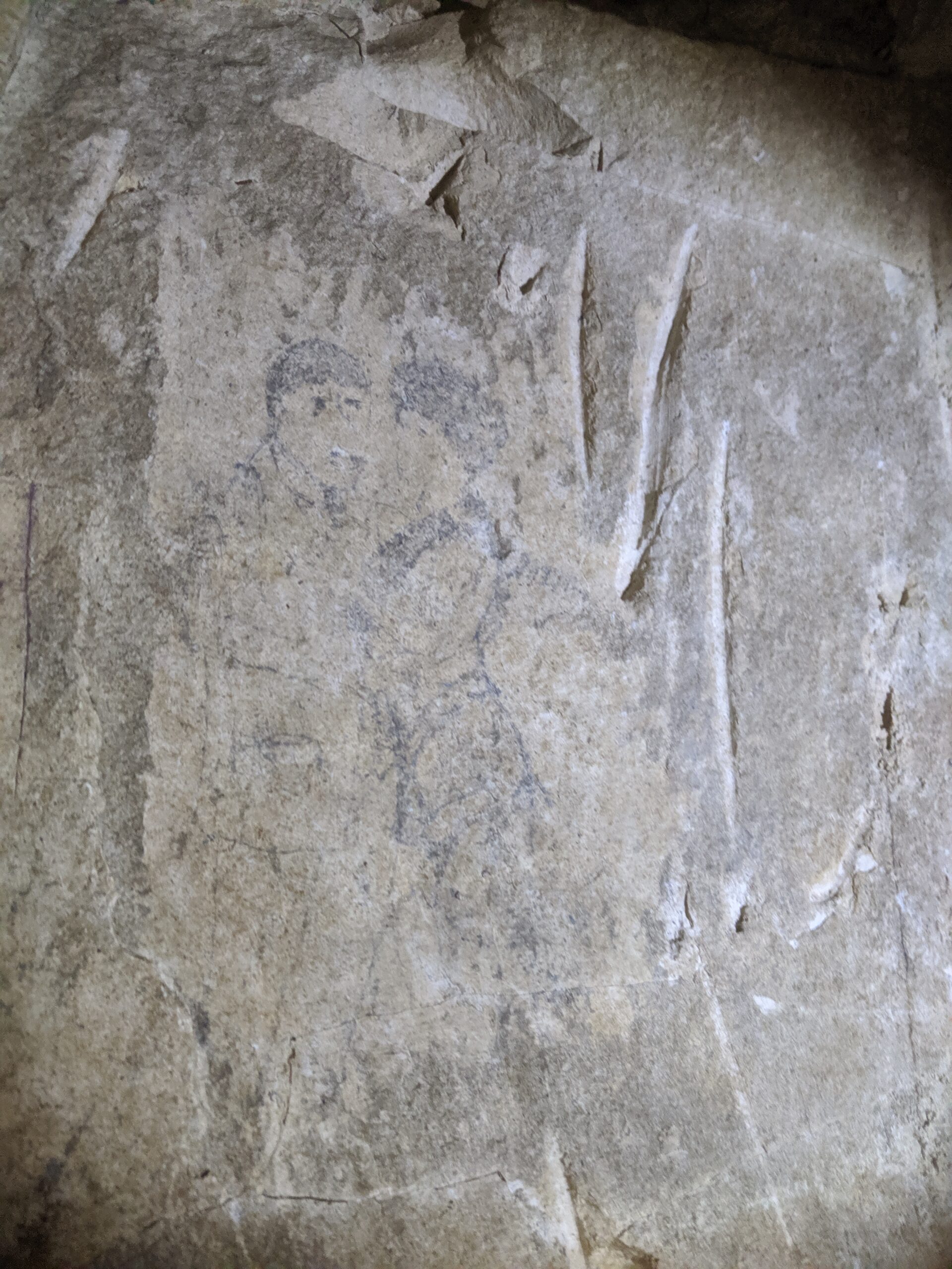
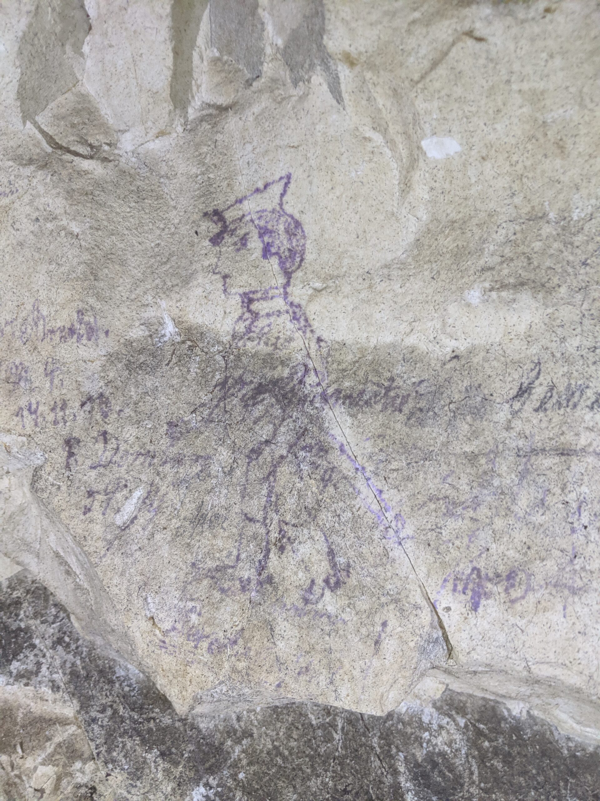
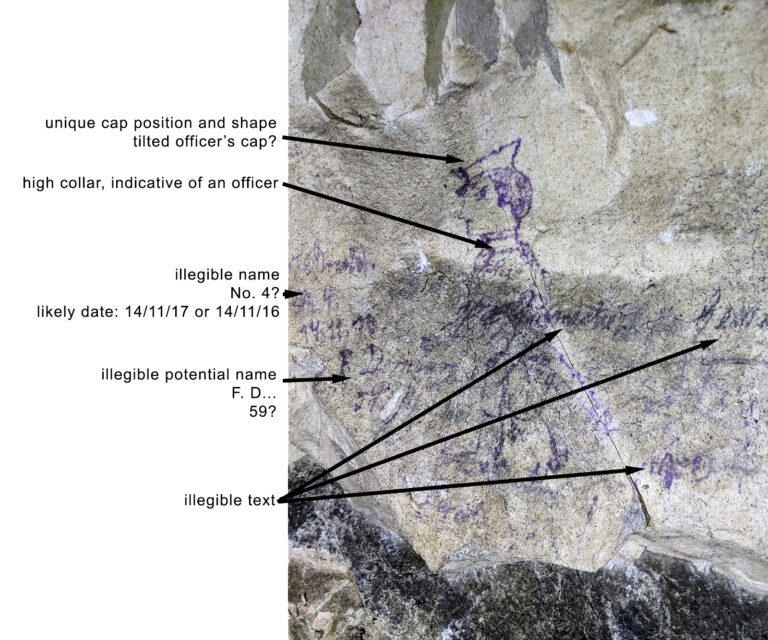
Other marks include possible measurements and drawings of people. Several readings remain provisional.
The marks differ in character. A name or unit number can suggest who was present; a number without a clear label may have been a measurement, a date or something else entirely. Drawings speak to the time spent underground beyond the immediate task of excavation. Their meanings depend on exact wording, placement and the surrounding marks, so uncertain readings should remain identified as such.
Recording where each inscription sits in relation to a gallery, candle ledge or neighbouring mark will help connect individual soldiers and units to the changing use of the system. That work may be especially useful where surviving German archival records are incomplete.
Why Gustav South matters
Gustav offers a rare opportunity to study a connected German mining system through its surviving fabric, wartime mapping and marks made by its occupants. The lateral gallery shows how separate inclines could function as one underground network. Timber joints, candle traces and inscriptions can answer different questions about construction, movement and daily life.
The evidence also has different limits. The 1917 plan depicts the intended or recorded layout at a particular date. An inscription establishes that its text was left at a particular place, but does not explain every task undertaken by the writer. The surviving chalk and timber show physical traces of use, though later damage may obscure their sequence. Examined together, these records offer a fuller account of Gustav than any one of them could provide alone.
Further reading
- British trench map of the Loos–Hulluch sector, corrected to 12 June 1916 — contemporary surface mapping showing the Hairpin, the quarries and the opposing trench system.
- Andy Prada, “No Ordinary Working Environment: The Hulluch Tunnels during the Great War”, Stand To!, No. 134, June 2024 — a detailed examination of British and German mining organisation around Hulluch, including 253rd Tunnelling Company and the development of defensive laterals and listening galleries.
- The Carspach Tunnels — archaeological evidence for the construction, arrangement and use of a comparable German underground system.
- “Timber for the trenches: a new perspective on archaeological wood from First World War trenches in Flanders Fields” — peer-reviewed archaeological research providing wider context for the extensive use and preservation of timber along the Western Front.