Goodman Subway
Longest Road Beneath Vimy Ridge
Goodman Subway was an underground road to the front line at Vimy Ridge. Cut through chalk during the winter of 1916–17, it allowed Canadian soldiers to move towards their assault positions under cover from observation and shellfire. It also carried the cables, equipment and supplies needed to support the attack of 9 April 1917. At about 1.72 kilometres, Goodman was the longest subway under the Vimy battlefront, according to the Canadian Department of National Defence’s history of the battle and the published preliminary investigation. Its forward end lay in the area of today’s Canadian National Vimy Memorial; the intended route reached back towards Neuville-Saint-Vaast.
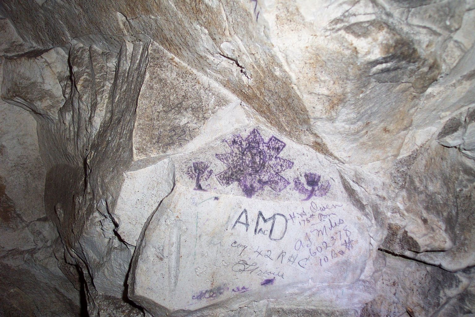
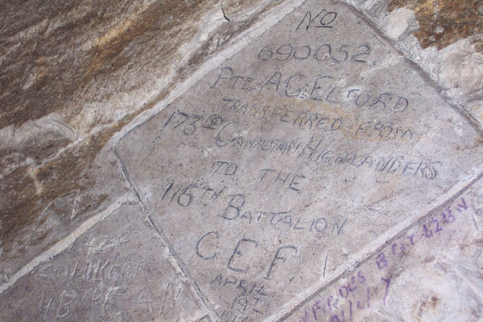
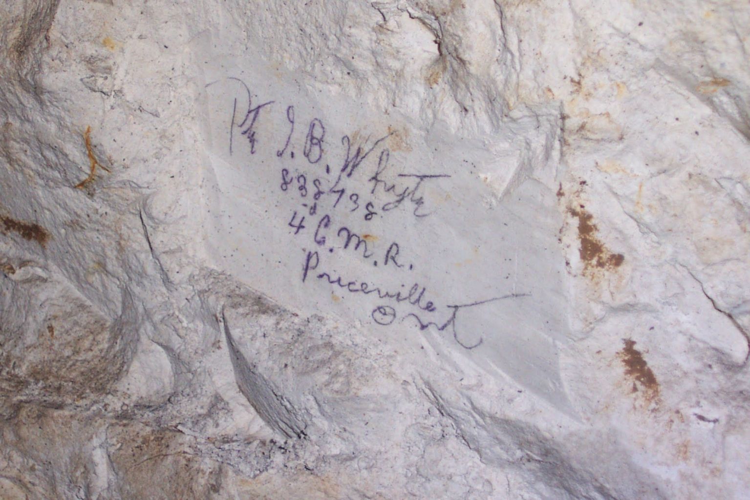
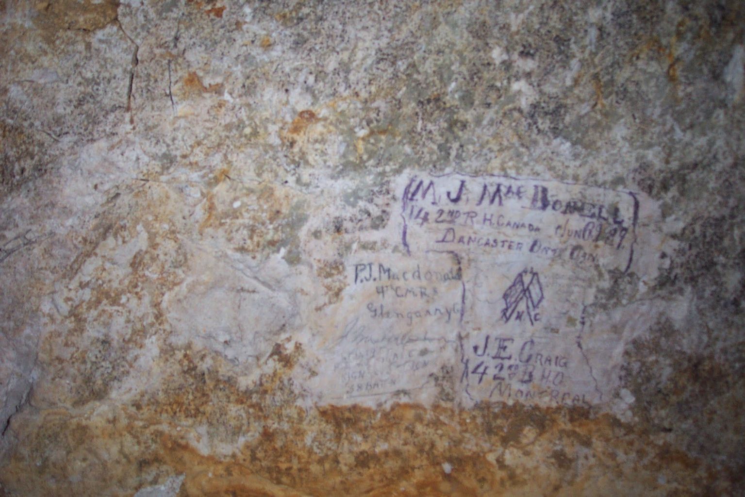
The passage retains evidence of the men who built and used it. Inked names and drawings, carved inscriptions, cables, chambers and construction details survive in sections investigated by the Durand Group. The chalk itself is also part of the story. Geological studies have shown how layers, fractures and water affected both the original construction and the tunnel’s later condition. Mike Dolamore’s published preliminary investigation and Maureen White’s geological study offer two different ways of reading this underground record.
A subway in First World War usage was a covered military passage, not a passenger railway. At Vimy, such passages ran between rear areas and the support and front lines. They complemented the exposed communication trenches and differed from the deeper fighting tunnels driven towards enemy positions for mining. Goodman connected with the separately named Pylones Subway at its forward end and, through subsidiary galleries, with the La Folie deep-mining system and indirectly with the neighbouring Grange Subway.
The published totals vary because authors use different boundaries and count connected works differently. Cave and Robinson count twelve when Goodman and Pylones are treated as one system, while a total of thirteen results when they are counted separately. Dolamore’s investigation describes fourteen subways built for Vimy Ridge and its environs, a total that includes Souchez. Operational boundaries also changed when the Canadians assumed responsibility for the Pimple sector. The geomechanics study by Hutchinson and colleagues uses the thirteen-subway total for the Canadian Corps Vimy front, together amounting to about 10 kilometres. The figures therefore describe different counting conventions, not a newly found or missing tunnel.
The need was practical. Troops and carrying parties moving along crowded surface trenches could be seen, shelled or delayed before they reached the firing line. The Vimy subways provided protected approaches, controlled circulation and space for the services on which an assault depended. In Goodman those services included an internal tramway, electric lighting, stores, communications cabling, trench-mortar positions and a large water reservoir. Veterans Affairs Canada describes the wider preparations. Individual installations varied, so a feature recorded in Goodman should not automatically be assumed to have existed in every subway.
Who dug Goodman, and how long it took
The 172nd Tunnelling Company, Royal Engineers, built Goodman. The company’s weekly mining records, identified in The National Archives catalogue as WO 95/244/4 and excerpted in Dolamore’s investigation, place the documented construction campaign from 2 November 1916 to 9 April 1917. Matthew Leonard gives September 1916 as the beginning of the broader undertaking, which may reflect planning or preliminary work; the more precise 2 November date is retained here for recorded driving.
This was not a single team excavating continuously from one end. The work developed from three access or working points: one near Albany Trench, another at the second sunken road, and a third making use of an existing section. By the week ending 16 November 1916, three working faces were already reported. Further faces were opened so separate headings could be driven towards one another, and the main lengths had joined by mid-February 1917. Work on the western extension, entrances and shafts continued as the system was completed.
Progress was uneven. Wartime reports cited shortages of carrying parties in late November and early December, interference from German mining later in December, and shortages of timber and transport in late January. Yet the synopsis for the week ending 17 February 1917 records 413 feet (about 126 metres) driven on Goodman in one week, closely matching Leonard’s account of roughly 125 metres. Electric lighting followed the next week, using enclosed 20-candlepower lamps.
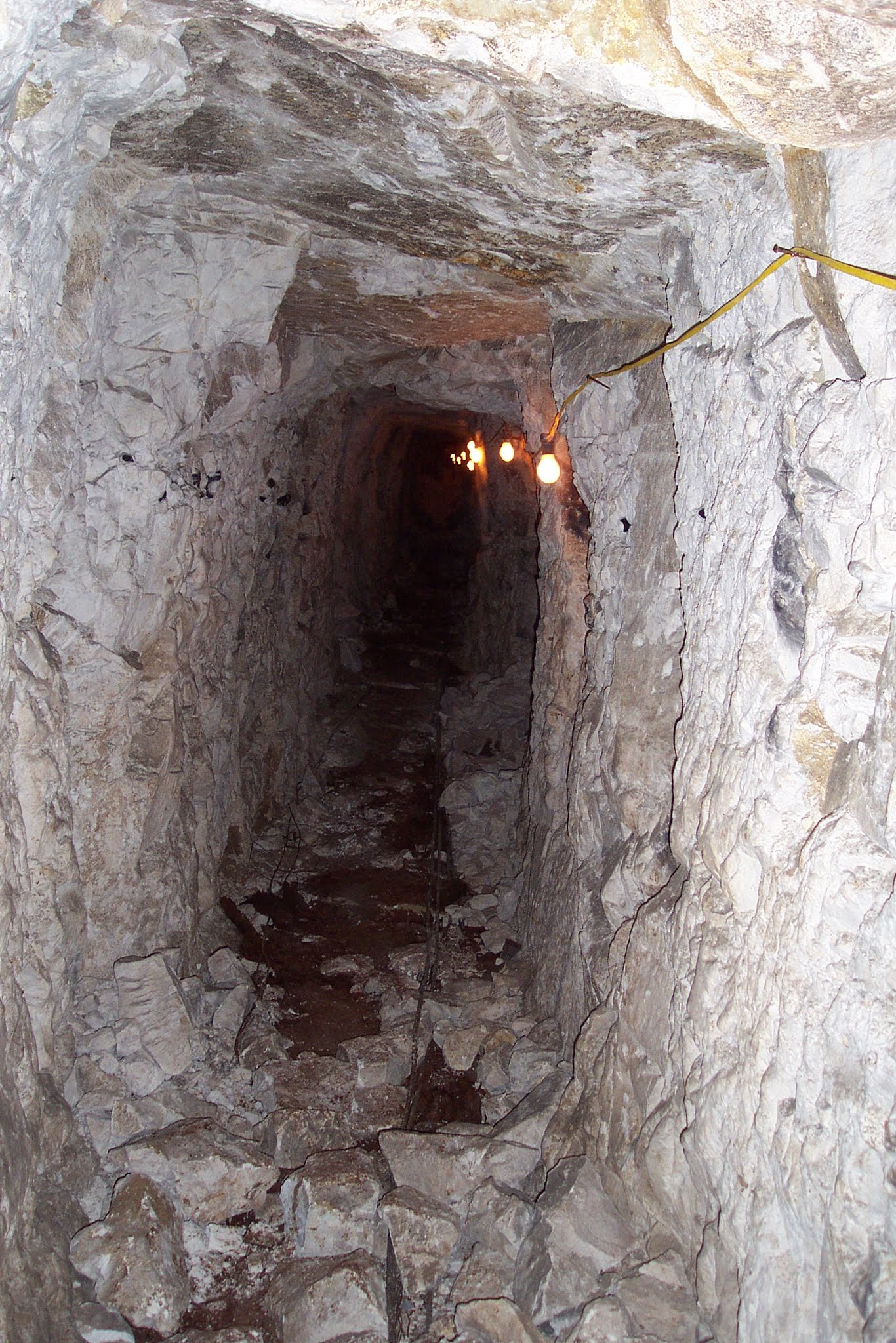
The main passage was generally about 3 feet (0.9 metre) wide. Wartime records give an initial height of 6 feet (1.8 metres), later increased to 6½ feet (2 metres), with overhead cover of about 26 feet (8 metres) in the documented section. These were working dimensions, not a guarantee that the entire 1.72-kilometre route had an identical profile or depth. The narrow width limited excavation and helped support the roof while still allowing equipped men and the internal tramway to pass.
Goodman in 1917
The subway served the 8th Canadian Infantry Brigade of the 3rd Canadian Division. Its assault battalions were the 1st, 2nd and 4th Canadian Mounted Rifles, with the 5th CMR providing one company to reinforce the 1st and holding the rest in reserve. Captain S. G. Bennett’s history of the 4th CMR places its battalion headquarters in Goodman on the night of 5–6 April. The 2nd CMR operation order of 7 April likewise places 4th CMR headquarters there.
Traffic through the system was controlled by Lieutenant-Colonel Lang from brigade headquarters beneath Bay Street. Movement was inward only, apart from runners and small parties of officers. Men waiting below were ordered to sit down, keeping the narrow passage and the flow of air as clear as possible, while exit steps had to remain unobstructed. The 4th CMR approached through Pylones; the 2nd CMR’s D Company came from Cenot Cave into Bay Street and filed into its assembly trenches after the 4th CMR had passed. The battalion’s report on 9 April records all companies in position by 5:10 a.m.. The order also sent guides back to 4th CMR headquarters in Goodman to lead 5th CMR carrying parties forward.
Goodman was a working military installation as well as a protected approach. Plans and later investigations record an internal tramway; electric lighting; stores and bays; communications and power cables; and three pairs of medium trench-mortar emplacements with associated magazines. A reservoir holding about 50,000 gallons was supplied from a nearby well. Beyond a section now blocked by an unpenetrated collapse were a generator powerhouse and signals station; a possible radio transmitter has been suggested, but is not securely established. The Australian Electrical and Mechanical Mining and Boring Company—known as the “Alphabet Company”—provided and maintained Goodman’s electrical power and lighting. The specialist unit also supplied the Wombat boring equipment used to drive the two boreholes at the subway’s forward end; the 172nd Tunnelling Company then loaded and fired the charges.
The Wombat charges were fired at 5:30½ a.m. on 9 April 1917—thirty seconds after Zero. The 172nd Tunnelling Company diary, quoted by Cave and Robinson, identifies the charge driven from the east end of Goodman Subway as producing a trench across no man’s land 170 feet long, 35 feet wide and 15 feet deep (about 52 by 11 by 4.6 metres). A second charge, south of Chassery Crater, formed a trench 150 feet long, 30 feet wide and 15 feet deep. Two forward exits were then opened from Goodman, and saps were driven into the communication trench created by the blasts. This contemporary account removes the earlier uncertainty over which charge adjoined Goodman. Later figures of 195 and 174 feet, derived from L. A. Cotton’s unpublished account and repeated by David Branagan, are best treated as later comparative measurements rather than substitutes for the tunnelling company diary.
Goodman remained useful after the opening assault. A 2nd CMR order of 29 April directed the battalion forward to Goodman on 30 April. The 42nd Canadian Battalion war diary records its move into Goodman Tunnel on 21 April 1917, remaining there until it moved into close support in Vimy village on the night of the 23rd. The 1st CMR diary records relief of a reserve battalion at Goodman on 30 April, although the following day places the battalion in the Grange Tunnel quarry area and should be checked against the original scan. The 116th Battalion’s postwar account names Goodman as a landmark passed on 10 April but does not establish that the party entered it.
Inside Goodman Subway
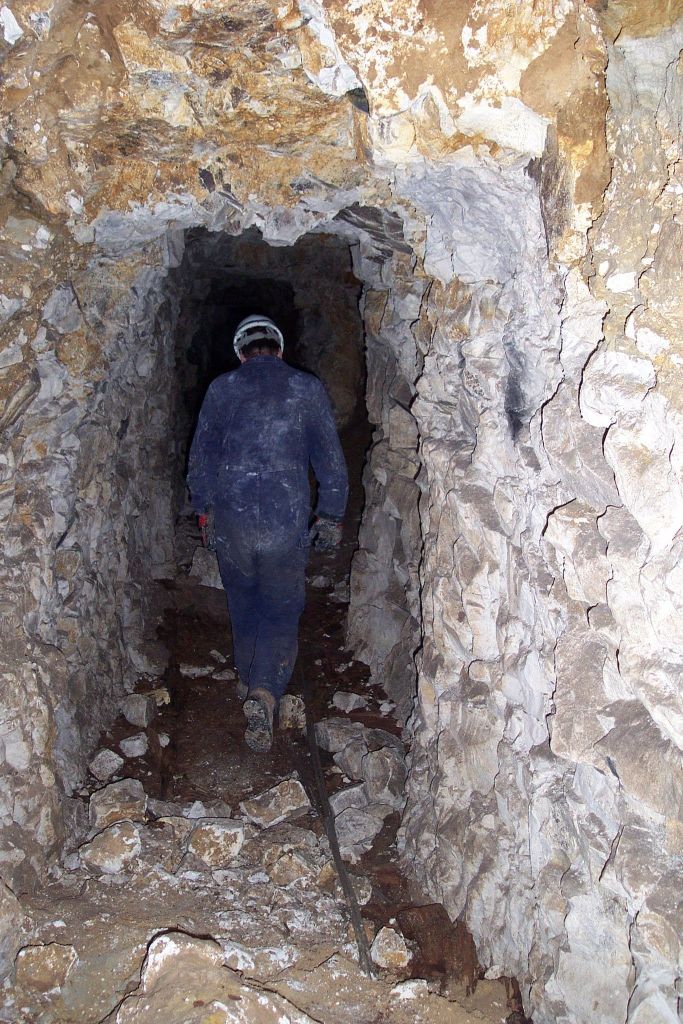
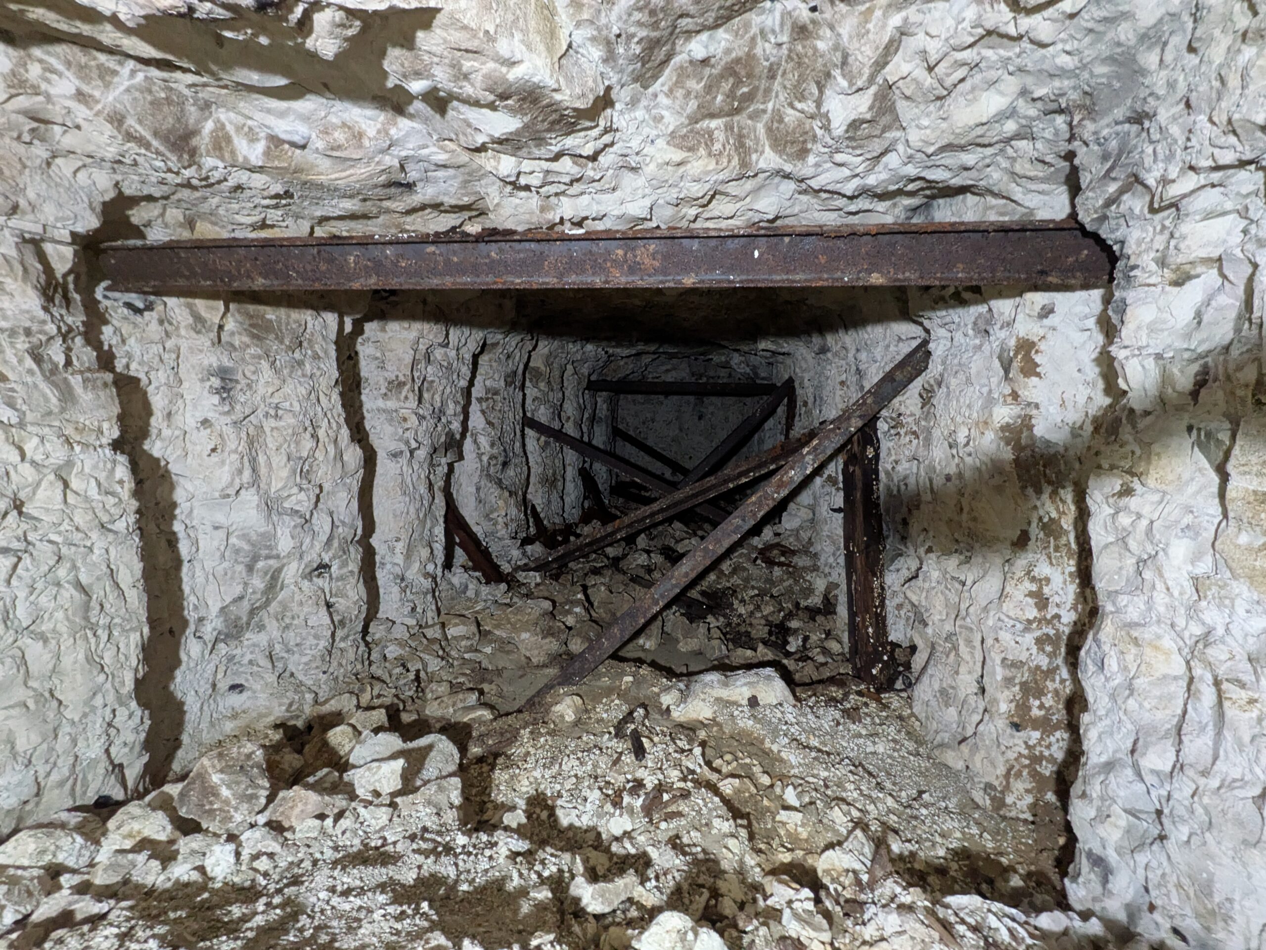
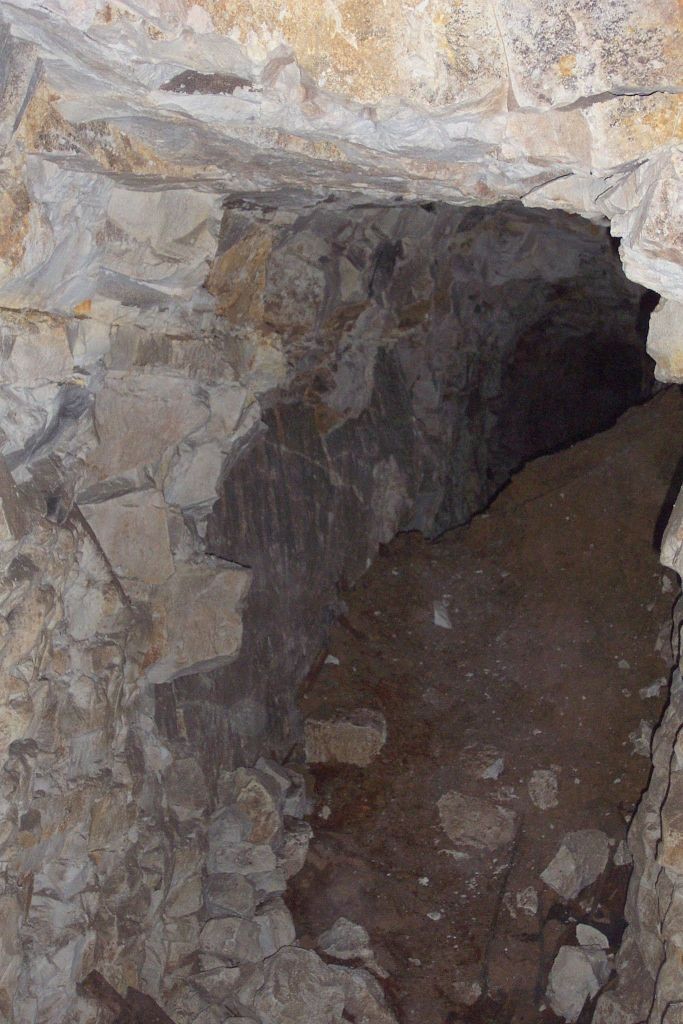
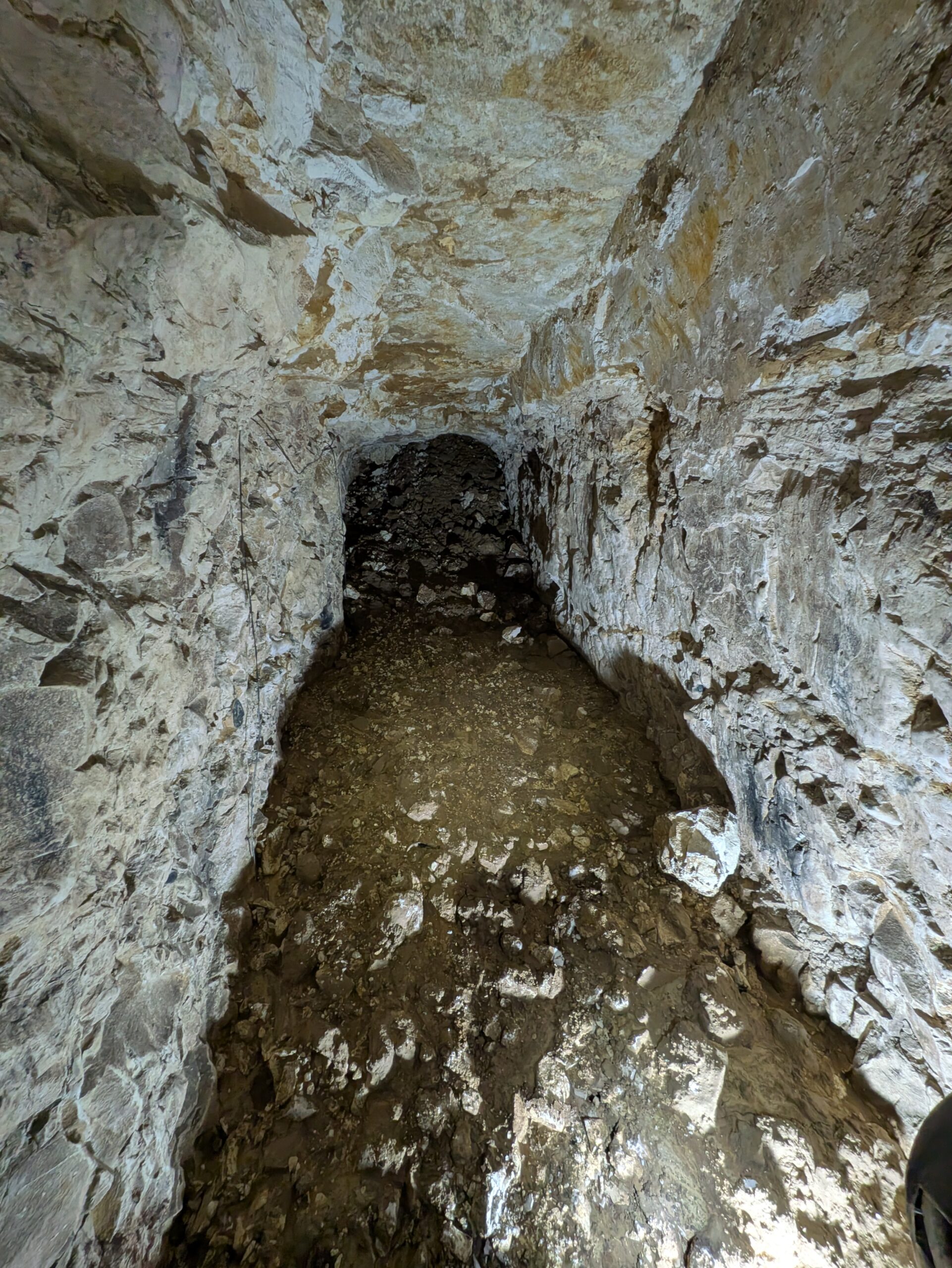
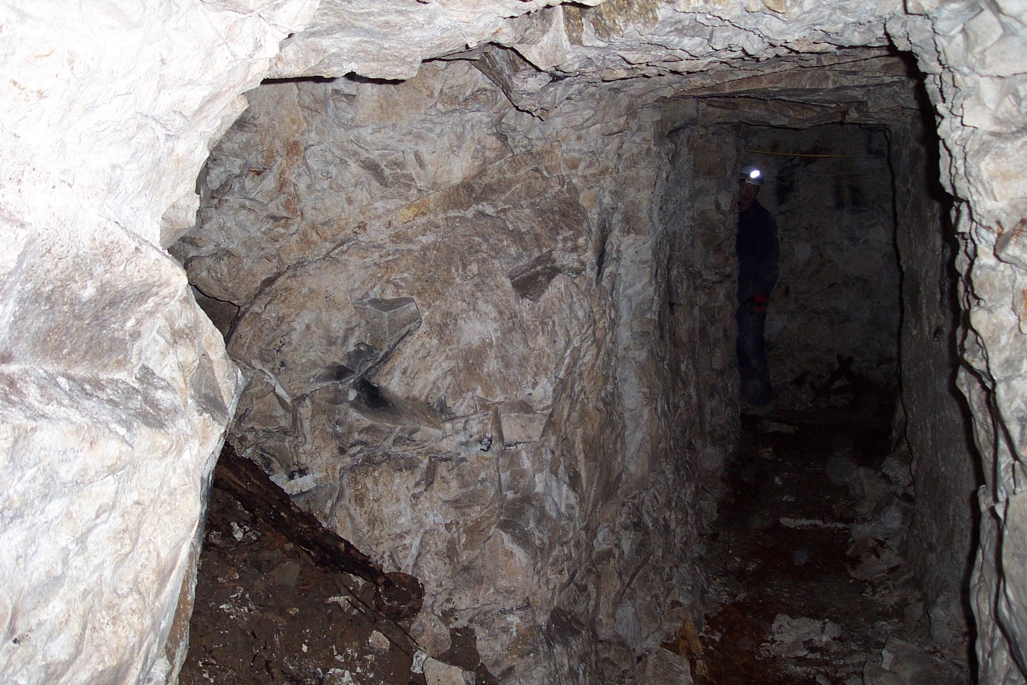
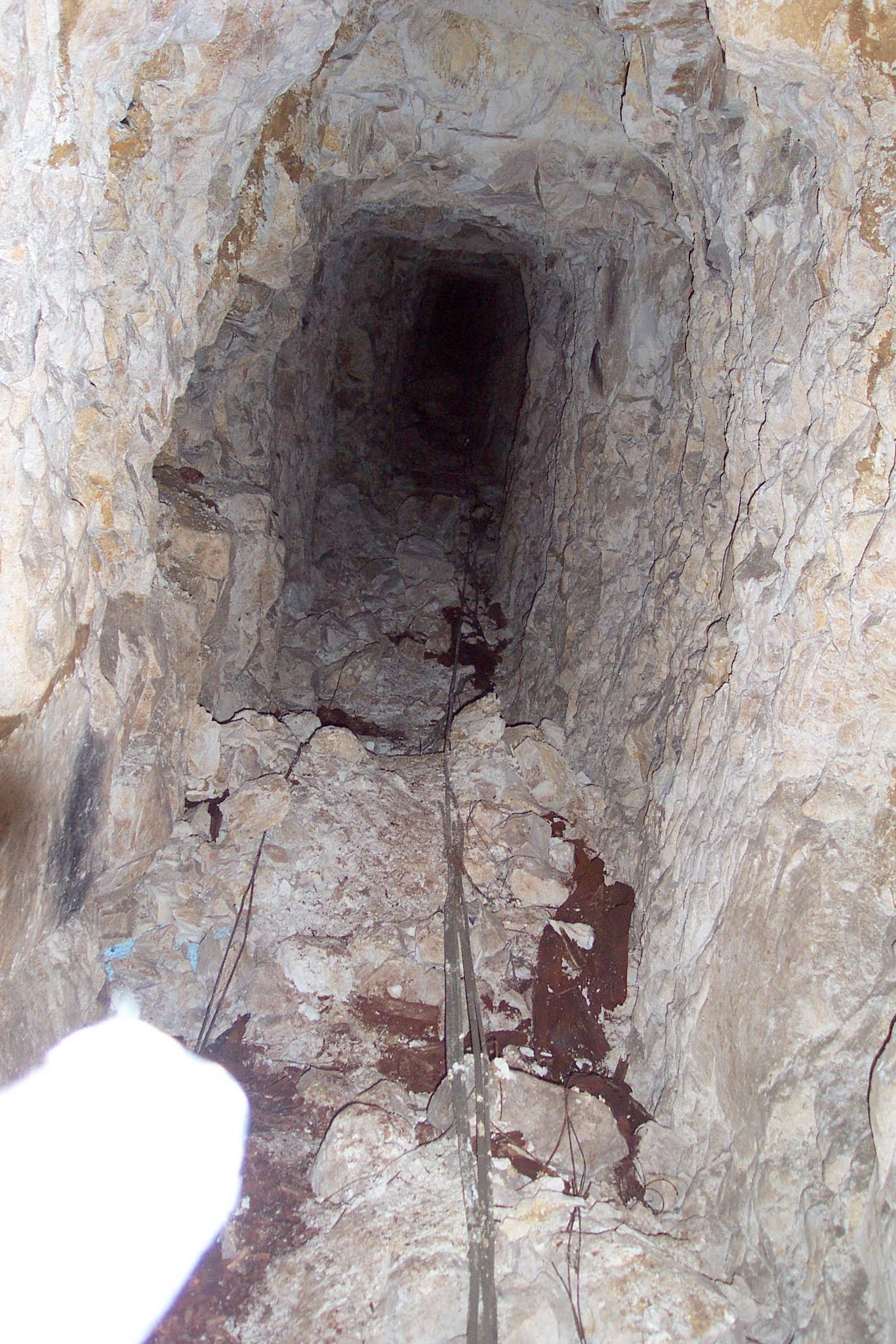
These photographs show the changing character of the surviving system: the access shaft, narrow hand-cut passages, obstructions and sections recorded during investigation.
The Durand Group investigation
Mike Dolamore’s report documents the May 2000 and January 2003 investigations, including the route, surviving features and contemporary survey evidence. Cave and Robinson add an earlier episode: in 1988, Royal Engineers entered part of the connected underground system through La Folie.
Goodman had no usable surface entrance when the Durand Group reached it. After comparing wartime plans, members approached the subway in May 2000 through P.73.J, a wartime mining lateral within the connected La Folie system. P.73.J was not another name for Goodman, but the approach to a connecting passage. At the junction, the P.73.J incline to the surface was blocked, so the route continued through the final link into Goodman itself.
The Group returned in January 2003. Cave and Robinson describe the subsequent excavation and laddering of a shaft about 8 metres deep, followed by clearance and the survey of 404 metres of passage—slightly more than a quarter of Goodman’s recorded total length. The accounts describe stages of the same modern investigation rather than competing discovery dates. Initial observations included blocked entrances, a store associated with a trench-mortar position absent from available plans, surviving cables and objects, extensive inscriptions, and clay entering the passage from above.
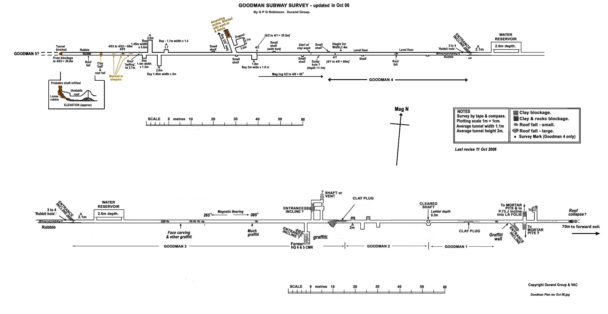
The route is best understood as a connected system rather than a single uniform tube. The 2006 survey records bays and shelves, roof falls, clay plugs, rubble, blocked inclines, reservoirs and changes in width and height. It gives an average width of about 1.1 metres and height of about 2 metres. Investigators also documented cabling, containers, ammunition and grenades in their archaeological settings; these finds help identify how the space functioned but do not make the site safe or publicly accessible.
Further investigations in 2003, 2004, 2006 and 2008 reached sections beyond obstructions, mapped chambers and surface connections, and continued the recording of graffiti. The work revealed the difference between a neat line on a military plan and a tunnel altered by use, backfilling and geological change. Substantial lengths and some mapped features remained inaccessible.
Surveying the surviving system
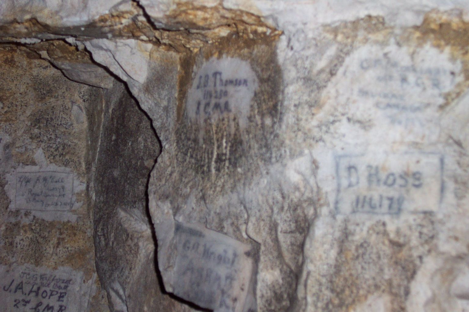
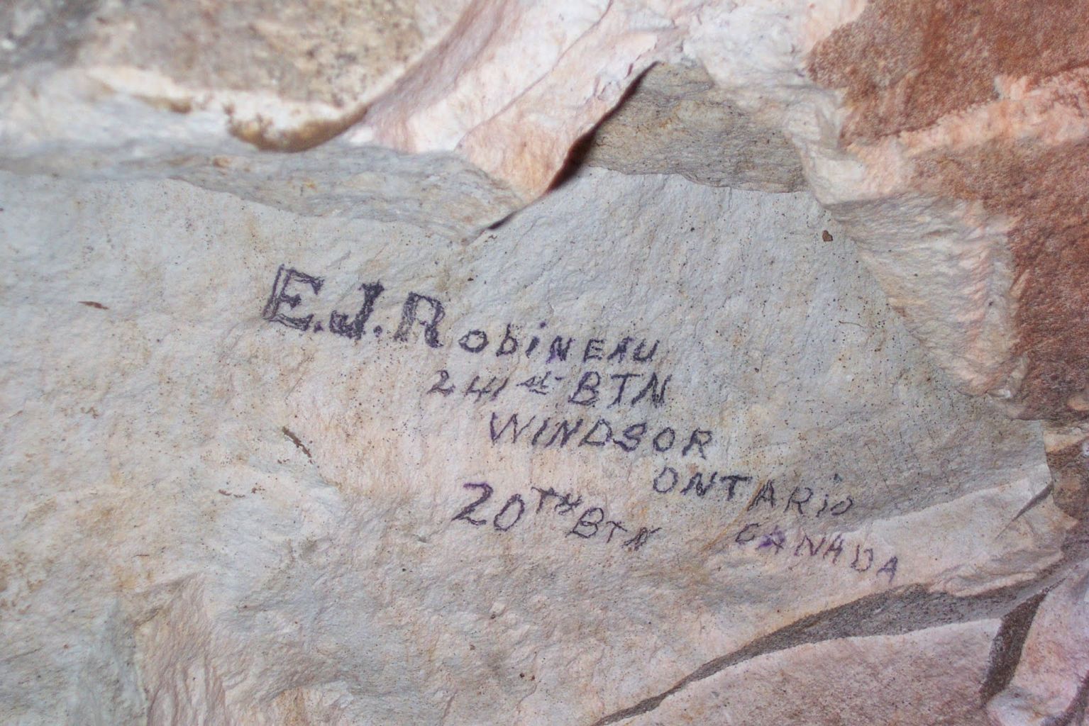
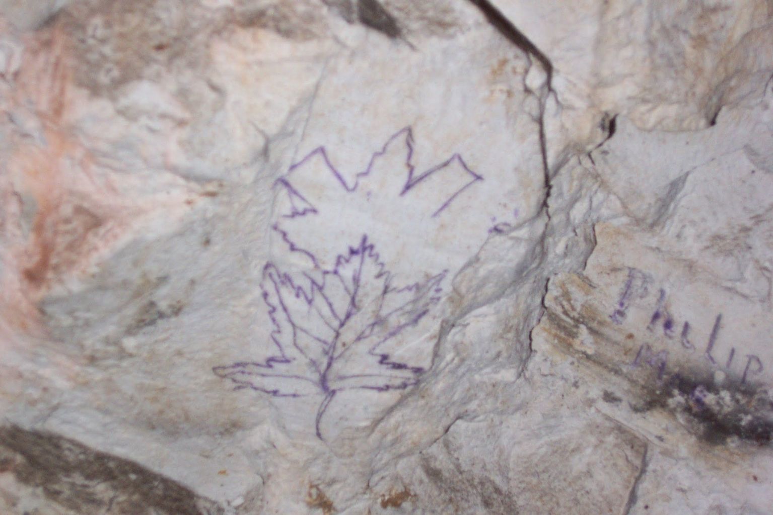
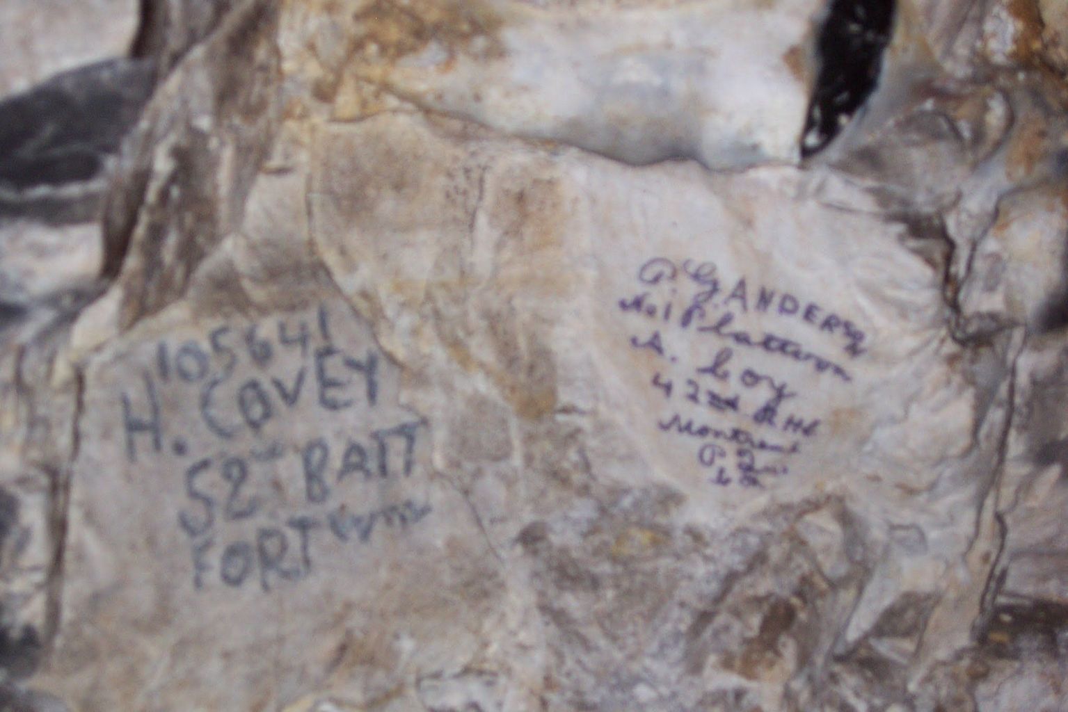
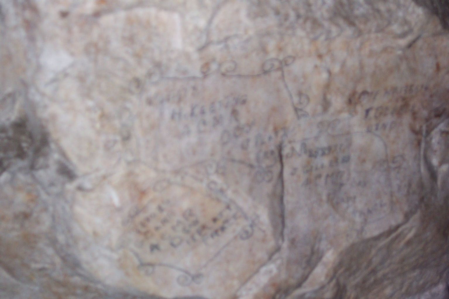
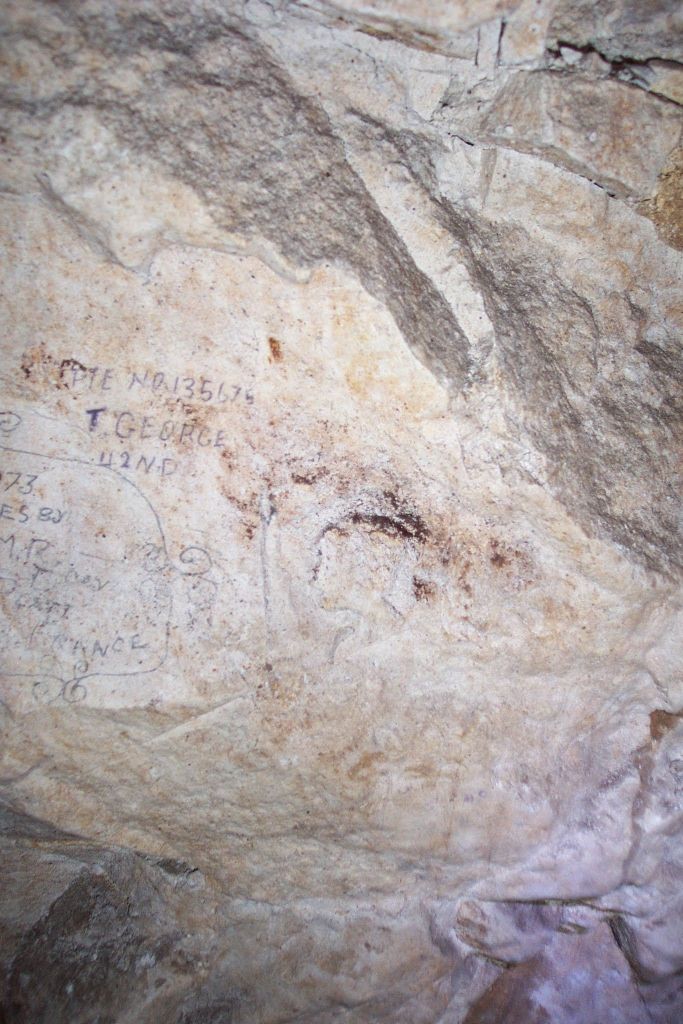
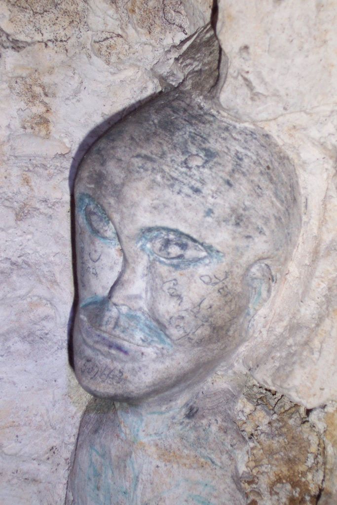
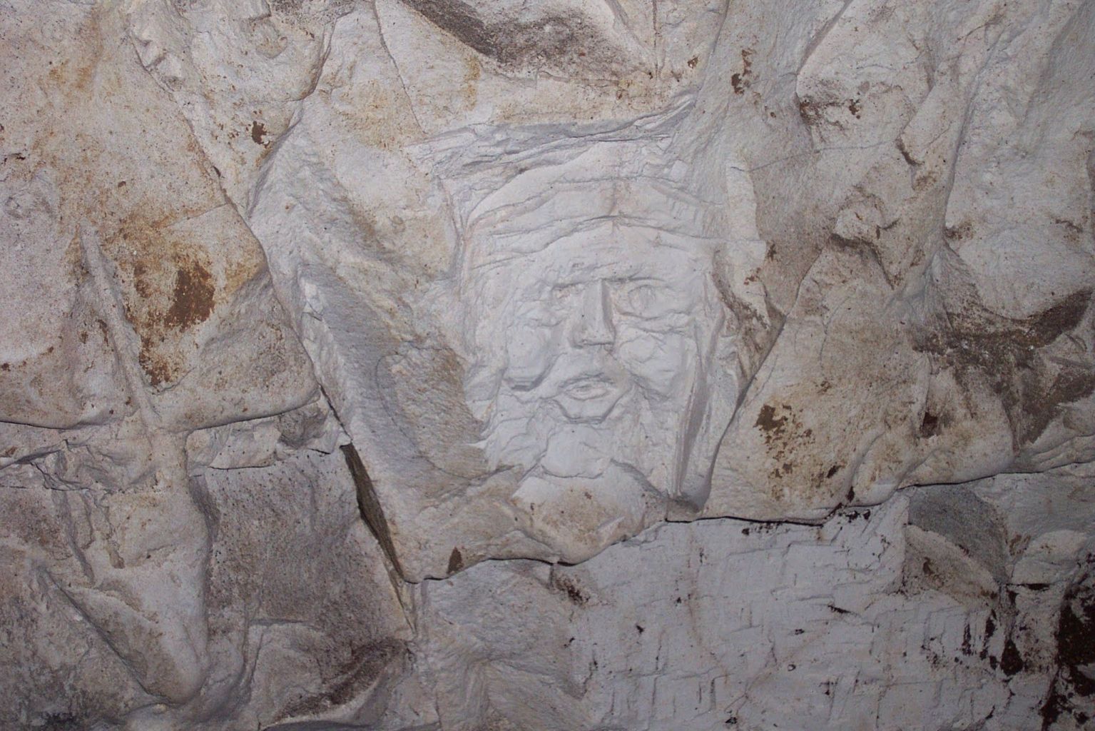
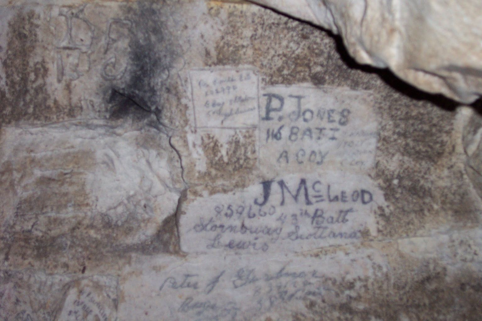
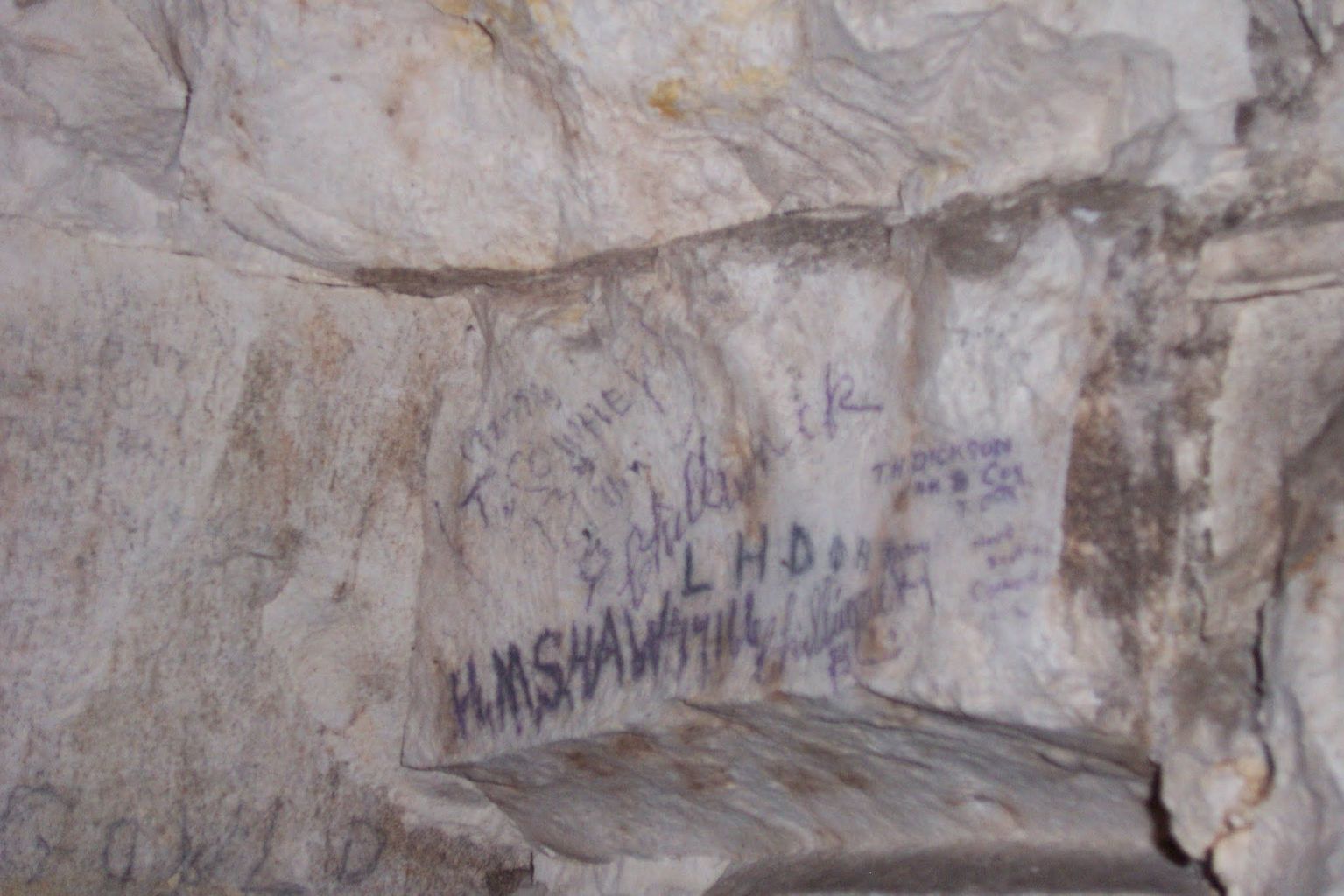
Goodman has the character of a wartime work site rather than a reconstructed visitor passage. Unlike the publicly interpreted section of Grange, its investigated galleries have not been reshaped as a visitor route, although some obstructions were cleared and reinforced during the Group’s work. The walls retain indelible-pencil inscriptions, incised names and drawings, and faces modelled or cut in relief, alongside cabling, fittings, chambers and other objects left within the system. The Durand Group recorded more than 250 names; markings associated with the 4th Canadian Mounted Rifles are especially prominent, alongside references to other Canadian Mounted Rifles units and to the 172nd Tunnelling Company.
Archaeologist Matthew Leonard, drawing on fieldwork in Goodman and the connected La Folie tunnels, compares its surviving fabric with the section of Grange prepared for visitors. He reads the inscriptions, confined spaces and surviving material culture as clues to how soldiers might have experienced the underground approach to battle. The physical evidence is direct; the sensations he reconstructs are an archaeological and anthropological interpretation, since events inside Goodman on 9 April are incompletely documented.
Those traces demand careful reading. A name and date establish that a person marked the wall, but may refer to an earlier enlistment or service event rather than the day on which the inscription was made. Some troops used the subway after the assault; not all surviving graffiti belongs to the night of 8–9 April. None of the more than 250 names recorded by the Group was dated 8–12 April 1917. Photography and plans preserve each mark in context so it can be compared with other inscriptions, war diaries and service records.
There are also limits to what is preserved and known. Postwar infilling closed entrances, later collapses blocked passages, and the Group did not reach every mapped feature. The original investigation did not confirm the form of all forward exits or inspect the full western route. The documented sections are substantial, but they are only part of Goodman, not a complete, continuous walk through the 1917 system.
Graffiti: individual traces in the chalk
The inscriptions form a fragile record of the men who passed through Goodman. The expanded gallery brings together names, unit references, Canadian place-names, maple-leaf emblems and drawings; each image can be enlarged for closer examination.
The geology beneath Vimy
The tunnel was cut in Upper Cretaceous chalk, a rock that permitted rapid excavation but did not behave uniformly. Thin beds, clay-rich horizons, harder layers and intersecting fractures all affect how the roof carries its weight and how water moves through it. Surface bombardment and later land use have also altered the ground above the wartime works.
In research completed in 2007, geologist Maureen C. White examined the chalk and underground excavations at the Canadian National Vimy Memorial. Her thesis, Geologic Controls on Instability in WWI Excavations: Canadian National Memorial Site, Vimy, France studies Goodman alongside the Grange and O Sector systems. It combines geological observations with mapping of joints, chalk layers, weathering and water-related alteration. White measured nineteen significant fractures in the Goodman sections she studied; eighteen contained silt infill, evidence of water and fine material moving along the joints. She identified two major places where clay and soil had entered through dissolution features and observed local roof falls that had enlarged the roof into bell-shaped cavities.
These findings explain why two chalk tunnels can age differently. Closely spaced or inclined joints allow pieces to detach progressively from a roof, a process called ravelling. Water moving along fractures can dissolve chalk and create a route for soil from above to enter the passage. White found more such instability in the investigated Goodman sections than in the Grange and deeper O Sector sections she compared. She tentatively placed Goodman in the clay-rich Lewes Nodular Chalk, but said that its exact stratigraphic position could not be established from the accessible exposures. Her observations describe the areas studied in 2006–07, not a blanket assessment of every metre today.
A related peer-reviewed geomechanics paper by D. Jean Hutchinson and colleagues (2008), co-authored by Phillip Robinson of the Durand Group, examined the broader Vimy memorial site. It combined historical excavation dimensions, chalk mapping and sampling with models of how depth, span, rock quality and weathering influence potential surface subsidence. The research addressed a conservation and public-safety question: which buried features might affect the surface as they deteriorate? It did not establish that all underground workings share the same level of risk.
White also describes a 2002–04 geophysical programme across the memorial site. The survey detected anomalies that were then assessed with drilling, but an anomaly could represent a backfilled trench, crater or geological variation as well as a void. The programme was site-wide, and its anomaly count should not be presented as a count of Goodman tunnels or collapses.
Change and preservation
Goodman’s condition has continued to change since the Group’s principal investigations. Earlier measurements and descriptions cannot be assumed to represent its present condition.
The subway is not a public visitor route. Preserving its record means documenting both the wartime features and the processes that may damage them. Photographs of inscriptions, surveys of accessible passages, comparisons with wartime plans and geological observations each capture a different part of the evidence. Together they show why Goodman matters: it preserves the infrastructure of a major Canadian assault, the marks of the people who passed through it, and a record of how an underground battlefield changes over time.
Sources and further reading
- S. G. Bennett, The 4th Canadian Mounted Rifles, 1914–1919 (1926). Postwar unit history directly locates battalion headquarters in Goodman Tunnel on 5–6 April and reports the firing of a mine at the Goodman Tunnel sap on 9 April.
- 2nd Canadian Mounted Rifles, Operation Order No. 44, 7 April 1917 and report on the Vimy attack, 9–12 April. Transcriptions link to scans of the original records; specify D Company’s route through Goodman, traffic arrangements, 4th CMR headquarters and guides for 5th CMR carrying parties.
- Brereton Greenhous, Stephen J. Harris and Jean Martin, Canada and the Battle of Vimy Ridge, 9–12 April 1917 (Department of National Defence, 2017 digital edition). Compares Goodman (1,722 metres) with Tottenham (1,408 metres) and Grange; the earlier discussion gives rounded lengths for Goodman and Grange.
- David Branagan, “The Australian Mining Corps in World War I” (1987). Draws on L. A. Cotton’s unpublished 1954 manuscript for dimensions of two Vimy Wombat trenches, including one near Chassery Crater.
- Damien Finlayson, “The Lightning Keepers: The Australian Alphabet Company in the Great War,” Stand To! No. 112 (June 2018). Identifies Goodman among the Vimy works electrically lit and maintained by the Alphabet Company and describes its provision of the Wombat boring equipment used at the subway’s forward end.
- Matt Leonard, “A sensorial No Man’s Land: corporeality and the Western Front during the First World War” (2019). Archaeological interpretation comparing Goodman’s surviving passages and inscriptions with the visitor section of Grange.
- Matthew Leonard, Beneath the Killing Fields: Exploring the Subterranean Landscapes of the Western Front (Pen & Sword Archaeology, 2016). Draws on fieldwork in Goodman to discuss construction, underground movement, material culture, graffiti and the sensory experience of subterranean warfare; interpretive claims are distinguished in the article from directly documented events.
- Durand Group, Goodman Subway overview. Identifies a Wombat charge at the forward end and describes the protective trench it created.
- 2nd CMR diary entries, 29 and 30 April 1917. Record an order to move to Goodman and the subsequent battalion movement, respectively.
- 1st Canadian Mounted Rifles war diary, April 1917 (transcription). Entry for 30 April names Goodman Tunnel; the 1 May entry names the Grange Tunnel quarry area, a discrepancy to check against the originals.
- E. P. S. Allen, The 116th Battalion in France (1921). Names Goodman Tunnel as a landmark on an advance party’s route on 10 April; does not demonstrate entry into the passage.
- 42nd Canadian Infantry Battalion, War Diary, 1915–1919 (CEF Study Group transcription of the contemporary diary). Entries for 20–23 April 1917 identify the battalion’s move into Goodman Tunnel on 21 April and subsequent move to Vimy village.
- The National Archives, WO 95/244/4, 172 Tunnelling Company Royal Engineers: Weekly mining reports, February 1916–December 1918. Original reports spanning Goodman’s construction; the catalogue entry identifies the record, while the detailed chronology above follows the extracts published by Dolamore.
- 4th Canadian Mounted Rifles, War Diaries: 1917 (regimental website overview). Summarizes the battalion’s April preparation and assault; the overview does not identify Goodman by name.
- Mike Dolamore, Report on the Preliminary Investigation of the Goodman Subway, Vimy National Memorial: May 2000 & January 2003 (Durand Group, 2003). Publicly linked from the Group’s publications page; includes the construction chronology and initial field observations.
- Maureen C. White, Geologic Controls on Instability in WWI Excavations: Canadian National Memorial Site, Vimy, France (Queen’s University MSc thesis, 2007). Goodman case study and conclusions on instability.
- D. J. Hutchinson et al., “Geomechanics stability assessment of World War I military excavations at the Canadian National Vimy Memorial Site, France,” International Journal of Rock Mechanics and Mining Sciences 45 (2008), 59–77.
- Nigel Cave and Phillip Robinson, The Underground War: Vimy Ridge to Arras (Pen & Sword, 2011; paperback 2015). Provides Goodman’s detailed construction and operational chronology, including the Goodman–Pylones counting convention, the three access points, 1988 and 2003 investigations, and the 172nd Tunnelling Company diary dimensions for the Wombat charges.
- Nigel Cave, Vimy Ridge (Battleground Europe). Battlefield context.
- Veterans Affairs Canada, Battle of Vimy Ridge.