T19–T21: a German fighting gallery beneath Vimy Ridge
In the forested part of the Canadian Vimy Memorial site, T19–T21 preserves a German system of fighting galleries beneath one of the most intensely mined stretches of the Western Front. Its wartime plans, chalk-cut passages, surviving engineering details and inscriptions allow the underground struggle to be read at the scale of an individual gallery. They also connect this place to the wider contest between German miners and the British tunnelling companies opposite La Folie.
1915–16
Mining galleries spread beneath the La Folie front as German and Allied engineers contested the ridg...
1916
Zollern and neighbouring Arnulf appear in German sector organisation opposite the British P and O mining...
24–25 January 1917
Dated inscriptions place German personnel in the T19–T21 galleries.
23 March 1917
Mining Company 293 assisted four mine explosions in Zollern I, creating the Longfellow craters.
9 April 1917
The Canadian assault captured the German front; British engineers subsequently inspected the galleri...
October 2004
The Durand Group recorded T19 construction, equipment and inscriptions.
January 2005
Further survey identified a concealed connection and defensive features.
2019
Later recording documented the linked system and T21 engineering features.
The mining front at La Folie
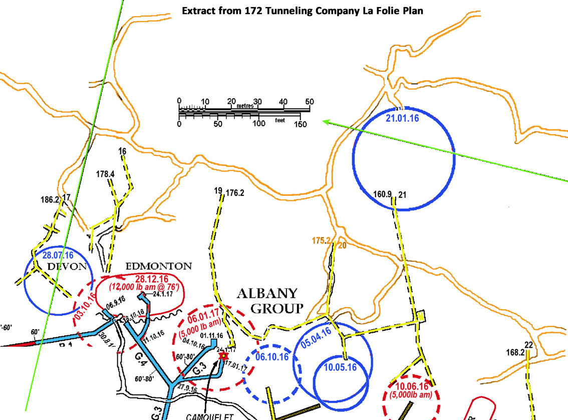
By 1916 the opposing armies had driven galleries beneath the ground around La Folie and Neuville-Saint-Vaast. British plans divided this frontage into lettered mining sectors. P Sector, at La Folie, was worked by the 172nd Tunnelling Company, Royal Engineers; the adjoining O Sector to the south was associated with the 175th Tunnelling Company. German plans used a different set of names. T19–T21 lay in the southern part of Zollern, near the boundary with Arnulf. Those labels describe managed stretches of a changing front, rather than the names of individual tunnels.
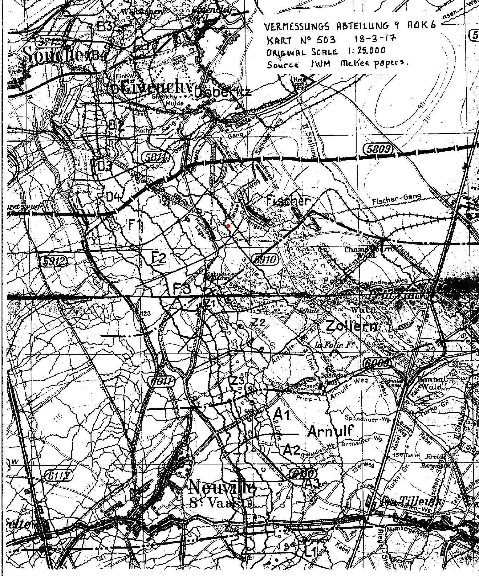
A German sector diagram subdivided Zollern into Z1, Z2 and Z3. Its position relative to the British La Folie workings is clearer when it is read alongside the British mining plan reproduced by Robinson and Cave and the surviving gallery survey. The opposing maps were compiled for different purposes and at different dates: they help place the system within the battlefield without treating every line as a completed or surviving passage.
The infantry and mining specialists had distinct roles. Reserve Infantry Regiment 262 is documented in Zollern during the March 1917 fighting, while Reserve Infantry Regiment 263 held the neighbouring Arnulf North frontage during the April battle. On the British side, the 172nd Tunnelling Company worked opposite Zollern. These alignments locate the underground contest; they do not, on their own, identify the party that cut any particular section of T19–T21.
British 172nd Tunnelling Company plan extract for the La Folie mining front. Coloured annotations identify workings and crater groups; this is a contextual plan, not a measured drawing of T19–T21.
From offensive mining to underground defence
The mining war changed as the opposing galleries multiplied. In 1916 both sides drove forward to attack enemy workings and protect their own. Charges could destroy a gallery without opening a large surface crater; this was a camouflet. Listening became as important as excavation, since a detected enemy gallery might be met by a defensive charge or by a new branch driven towards it.
German pioneer and mining formations served the wider ridge, while infantry units held the trenches above. Jack Sheldon’s account of the German side describes Pionier-Mineur-Kompagnie 293 (Pioneer Mining Company 293) assisting the preparation of four mines in Zollern I that were fired on 23 March 1917, producing the Longfellow craters. Men of Reserve Infantry Regiment 262 helped carry explosives. This identifies cooperation between infantry and specialist miners in the sector, though these charges were separate from T19–T21. The numbered company cannot be assigned to excavation of this system merely from its nearby work.
By the winter of 1916–17, British and German galleries were close enough that listening posts, guarded connections and concealed passages had immediate defensive value. British mining records and the German fabric should therefore be read together: a line on a plan records an intended or observed route, while the cut chalk, timber and deposits show what survives underground.
German military map of Vimy Ridge, 18 March 1917, showing the named Fischer, Zollern and Arnulf sectors. Original scale 1:25,000; source noted on the supplied copy as IWM McKee papers.
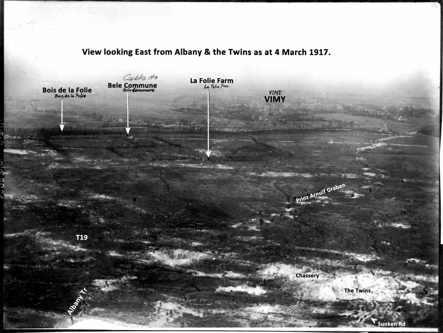
Oblique view looking east from the Albany and Twins area, 4 March 1917. The T19 annotation is approximate. Digitally prepared from the supplied annotated copy to omit an unrelated crater label.
Reading the T19–T21 galleries
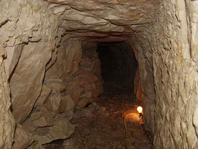
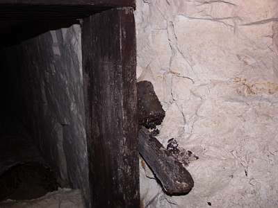
The wartime British plan depicts a connected German system reached by three numbered inclines or shafts, T19, T20 and T21. Its branches extended towards the British mining front. Later survey and surviving fabric show the character of those passages: chalk-cut galleries, timbered openings, changes of level and areas where movement or excavation was obstructed. A pump installation associated with T21 points to the practical problem of water underground; other surviving fittings and timber record how the galleries were maintained.
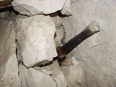
The map and the physical remains answer different questions. The plan records the network known to British engineers after capture, while the surviving chalk shows individual working faces, later blockages and construction details. In one branch an entrenching tool was left at the end of a short gallery. The branch is consistent with a listening or defensive purpose rather than a route for infantry movement on the scale of a subway.
The system’s relationship to the British galleries makes its short branches especially revealing. The opposing workings could be approached, heard and threatened from below ground even when the soldiers above could not see one another. The surviving layout gives this proximity a physical form.
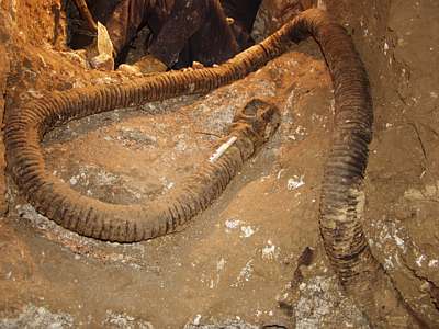
Corrugated hose recorded inside the T19–T21 system.
Chalk-cut passage recorded in the T19–T21 galleries.
January 1917: names, listening and defence
Inscriptions in the system record 24 and 25 January 1917 along one of the lower galleries. These dates place men in the passage during a phase of close listening and countermining.
A British chamber prepared for a camouflet—an underground charge intended to disable an opposing gallery—lay opposite a branch of the German system. The relationship shown by the plans gives the short branches and concealed connecting passage a military purpose: they allowed the Germans to listen towards the British workings while retaining a route through their own system. Two stick grenades found within reach near the chalk-blocked passage suggest preparation for a possible underground breach. They do not, by themselves, show that a breakthrough or hand-to-hand fight took place.
Details of this kind bring the documentary maps into focus. The dates fix activity to particular walls; the blocked link and tools show decisions made inside the gallery; and the grenade positions indicate how close the opposing underground fronts could feel to the men working there. A name or number scratched in chalk should be connected to a unit only when its reading, date and military deployment agree.
One of two German stick grenades recorded near the blocked passage in T19–T21.
A second German stick grenade recorded near the blocked passage in T19–T21.
The April 1917 battle and the British record
On 9 April 1917 the Canadian Corps attacked Vimy Ridge. The German front around Zollern and Arnulf was overrun as the offensive advanced. British engineers then inspected captured German workings. Their plan of T19–T21 and notes on the system record what could be traced after the battle, including the relationship between the numbered passages and the opposing British mining sector. Phillip Robinson and Nigel Cave reproduce and discuss these plans in The Underground War: Vimy Ridge to Arras.
That post-capture survey is particularly valuable when set beside the German chalk inscriptions. The January dates belong to activity while the Germans still held the galleries; the British drawing records the system as encountered after the April assault. Together they provide a sequence from construction and listening to capture and inspection, rather than a single undated picture of the tunnels.
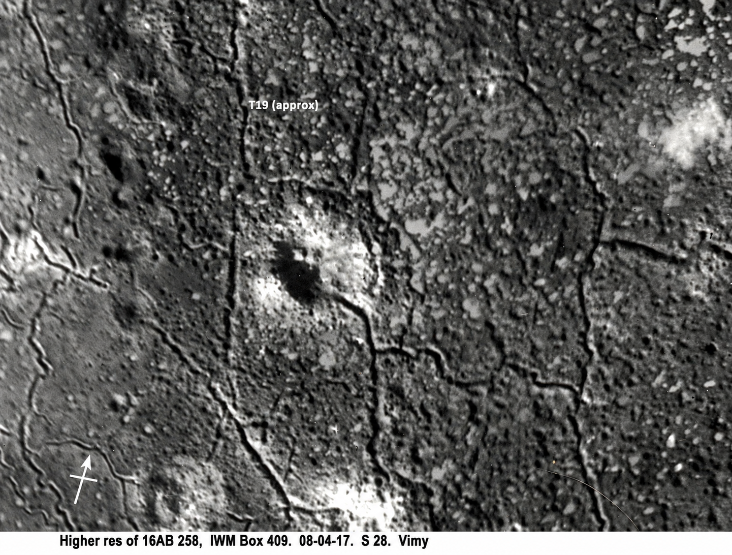
Vertical aerial photograph dated 8 April 1917, the day before the Canadian assault. The T19 annotation is approximate. Supplied copy cites IWM Box 409, 16AB 258, S28; digitally prepared to omit an unrelated crater heading.
Recording T19–T21
Durand Group investigations beginning in 2004 compared the wartime plans with the surviving galleries and recorded the construction, equipment and inscriptions. Subsequent work extended the survey across the linked system and documented the T21 pump room and associated engineering. The value of the site lies in these connections: a military plan can be tested against the chalk, while dated writing and objects bring the daily work of the underground front into view.
T19–T21 is a fighting gallery system, shaped by mining, listening and the threat of a breach. Its compact passages and defensive features tell a different story from the larger troop subways also preserved around Vimy. Read with contemporary German and British records, the surviving fabric adds the perspective of the men who worked beneath the forested ridge before its capture in April 1917.